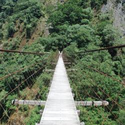
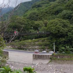
The Baishi Suspension Bridge was first built in the 10th year of Taisho (1921) and rebuilt in 1947. The bridge is about 145 meters long and 90 centimeters wide, crossing the main stream of Sakyacin Creek. Skayacin means white stone (Baishi) in the Atayal language. Sakyacin Creek originates from the west side of the north edge of Dabajian Mountain, and is one of the two major tributaries of the upper reaches of Dahan River. In recent years, due to the increase in the number of tourists, it has been renovated again in consideration of safety, and an explanatory board is set up beside the bridge.
Atayal
Baishi Suspension Bridge
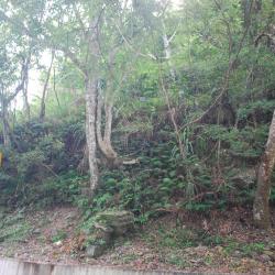
The north-west ridge saddle of Syakaro Mountain
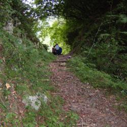
The northwest saddle of Syakaro Mountain is the crossing point of the entire trail. The Japanese excavated the saddle to facilitate passage, forming a door-like passage. The local Atayal people named it Belefun, which means "door".
Going eastward from the saddle for a few minutes and the ridgeline on the right leads to the entry of Syakaro Mountain. From there, walk for about 20 minutes and the northern saddle of the mountain will be on the left. It takes about 1.5 hours round trip to climb Syakaro Mountain. Due to the strategic location, Matsushita police post was set up there in Taisho 11 (1922), which is the highest police post along the Syakaro Trail.
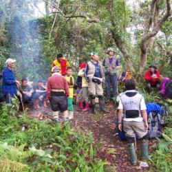
Syakaro National Trail - Shilu End
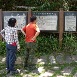
he Forestry Bureau has set up an explanatory board by the entrance (Shilu end) of the Syakaro National Trail in Wufeng Township, Hsinchu County. Syakaro Historic Trail, also known as Shilu Historic Trail, has two entry points, one in Qingquang, Wufeng Township, Hsinchu County, and the other end is in Xiuluan Village, Jianshi Township. The Syakaro incident happened twice in the sixth year and ninth year of Taisho (1917 & 1920). At that time, there was only one Aiyong border within the old Hsinchu Prefecture. Therefore, in mid-November of the 9th year of Taisho (1920), it was planned to dig a new Lifan road from Shangping to the dispatch station to suppress and monitor the Syakaro group.
At the end of March in the 11th year of Taisho (1922), the "Syakaro Trail" was completed. In April of the same year, a total of 19 new police posts were successively established along the trail. In the 13th year of Taisho (1924), the security stations at both ends of the trail were changed to police posts to improve the security of the entire road.
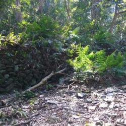
Shilu Hamlet
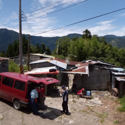
Shilu Hamlet is located on the south-facing long ridge of a small hill in the east of Mindu Mountain. In the early days, this area was rich in magnolia compressa, thus, the Atayal people called this place Skaru. Skaru refers to the magnolia compressa tree, which is widely distributed in the broad-leaved forests of middle and low altitudes in Taiwan. In the 2nd year of Taisho (1913), the Aiyong Supervision Office was set up in this area. It was named Syakaro, after the transliteration of Skaru, which got transliterated later as "Shilu". This image shows the current situation of the Shilu hamlet, and above the hamlet is the Syakaro police post from the Japanese occupation period, which was renamed the Shilu Police Station after the war.
Qingquan No. 1 Suspension Bridge
Qingquan No. 1 Suspension Bridge is located in Qingquan Hamlet, Taoshan Village, Wufeng Township, Hsinchu County. It is about 535 meters above sea level and crosses Shangping River. Qingquan No. 1 Suspension Bridge also connects to Qingquan Police Station. It is about 157 meters long, 25 meters high, and 1.4 meters wide, and is the highest suspension bridge in the Qingquan area. You can overlook the entire Qingquan area from the bridge. Where the bridge is standing was the original site for the Inoue Railway Bridge during Japanese rule. Both ends of the bridge still have sections of the Syakaro guard road remaining from those time. The Railway Bridge was damaged due to disrepair for a long period of time and in 1996 the current bridge was rebuilt on the same site.
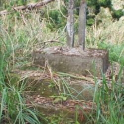
Taman River Police Post
The Taman River Police Post is located on the mountain opposite the southern side of the Dahan Bridge parking lot in Fuxing District of Taoyuan City. When the construction of the Northern Cross-island Highway began in 1963, many railway bridges that were built during the Japanese occupation were demolished and reconstructed because most of the routes overlapped with the Jiaobanshan Sanxing Historic Trail. The Taman River Suspension Bridge, that was next to Taman River Police Post, was also rebuilt into the Dahan Bridge, which overlooks the narrow valley of Taman River and the Baling area.
Today, in the woods on the mountain opposite the parking lot, the remains of the stacked stones from Taman River Police Post can still be found.
Deji Reservoir
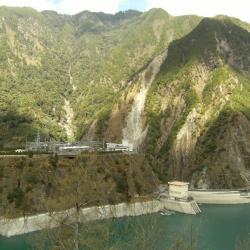
The Deji Reservoir is located on the upper reaches of Dajia River in Heping District, Taichung City, with steep slopes and many passes. At the end of the Japanese occupation, the Governor-General in Taiwan planned the development of the Dajia River. The plan was to build a weir in the upper reaches of Dajia River to store water for generating electricity, agricultural irrigation and industrial water use. However, the plan was interrupted due to the defeat of Japan. In the post-war period, the Nationalist Government followed the plan of the Governor-General, and the power development plan was still based in Dajian, with six power plants including Dajian, Qingshan, Guguan, Tianlun, Maan, and Shigang. In 1973, Deji Dam started to store water, forming a big lake in the shape of a goose egg. In the following year, the plant officially generated electricity.
Shayun’s Bell
Shayun’s Bell Tower is located in Liuxingshe in Nanao Township, Yilan County. The Atayal traditional name for the place is Lyoxing, which means bird’s nest fern that grew there. Due to the geographical location, it restricted the only passage to the Lanyang Plains from the Klesan mountainous area. It is also the main pass to the east coast. Since the Qing Dynasty, it has always been the country’s most important battlefield. In fact, in the middle of the Japanese rule, the Government-General in Taiwan vigorously promoted the emperor’s movement and began to plan and operate the story of Shayun’s Bell. The Liuxingshe was the origin of the story, and the ruins of the bell stand can still be seen today.
Maobian Police Post
The Maobian Police Post is located in the saddle of Mouhen in Nan'ao Township, Yilan County. It was built in 1919 for the year when the Paihau Historic Trail was also excavated. There is also a Tongshan branch route that reaches Hanxi Village in the north and connects to the main route near Leyoxenshe. The main route is about 87.2 km in length and the branch route is about 44.2 km, both pass through the traditional territories of the Atayal tribe of the Nan’ao group.
During the Japanese occupation, Taiwan’s Governor-General used the Piahau Historic Trail as the path for migrating the Atayal people, forcing them to move out of their village. In the early post-war period, the National Government also forced the tribes to move to the plains.
Futaishan Guard Road Entry
The entrance of Futaishan Guard Road is located in the Heliu River Basin in Nan’ao Township, Yilan County. To get there, walk north from Nanzi Police Post towards Wutashe, passing the three-way intersection in front of Nan'ao Nanxi, and then climb up the ridgeline in the south-west direction. After boarding the ridgeline, you will arrive at a small platform, which is the entrance of the Futaishan Guard Road, and the Atayal named it Biuho. This section of the trail passes through the south side of the Futaishan and connects with Gegezi Guard Road. Where they intersect was the former site of the Heliu Police Post.
Today, the Atayal people still use this path especially when they planted shiitake mushrooms in the 1970s.