Atayal

Tongshan Police Post
銅山駐在所的砌石疊牆

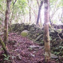
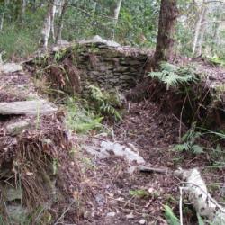
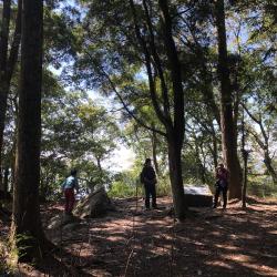
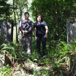
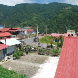
Tongshan Police Post is located in the south-west of Tongshan in Nan'ao Township, Yilan County. It sits at an altitude of about 1,620 meters. In fact, the Piahau Historic Trail, which runs through Nan’ao Township and Datong Township in Yilan County, was built in 1919. There is also a Tongshan branch route that reaches Hanxi Village in the north and connects to the main route near Leyoxenshe. The main route is about 87.2 km in length and the branch route is about 44.2 km, both pass through the traditional territories of the Atayal tribe of the Nan’ao group.

During the Japanese occupation, Taiwan’s Governor-General used the Piahau Historic Trail as the path for migrating the Atayal people, forcing them to move out of their village. In the early post-war period, the National Government also forced the tribes to move to the plains.

Doras Hunting Hut
Doras獵寮位在Yax Bula鞍部至哥各茲社之間的稜線北側上

Doras hunting hut is located on the north side of the ridge line between Yax Bula Saddle and Gegezishe in Nan'ao Township, Yilan County. It has an open terrain and a good view due to the high elevation. It is owned by the elderly Doras of Jingyang Village. He was the last elder of the Kubabuoshe to be moved down from the mountain. However, according to the field survey record, this place was rebuilt  during the Japanese occupation by the Government-General in Taiwan. It can be identified from the stone stacked at the bottom of the working hut that it was not the traditional technique of the Atayal people. In addition, according to historian Liao Yingjie's research, this place may be the Gegezi Dispatching Station, and it was once the Gegezi Meteorological Observatory.

Hagaparis'she
哈卡巴里斯社築有大範圍石牆以防禦山豬

200 years ago, the ancestor Gunpai Noekkan  led 9 households of 36 people to settle here at the Hagaparis Hamlet in Nan’ao Township, Yilan County. They traveled from the north of Lishan Mountain to Moyao in Heping River Basin cutting through Nanhu Dashan and settled in Hagawan-she. The son of Noekkan carried on, leading the tribe to migrate again to build a community in Hagaparis. According to the records of the Japanese anthropologist, Mori Chosuke, the Hagaparis community had only 17 households. Due to its remote location, the Governor-General in Taiwan did not open a guard road here but had once stationed a police post. In the early days of the Japanese occupation, the people of Hagaparis Hamlet moved to Hanxi Village around 1915, and then moved to Nan'ao Plain in 1964 to live with the people of Wuta Village.


Piahaushe
從次考干溪遠眺比亞毫社

Piahaushe in Nan’ao Township, Yilan County, is located on the river terrace on the right bank of the upper reaches of Hepingbei Creek. It is located at the confluence of the Cikaogan River. It sits at an altitude of about 1,000 meters. The traditional Atayal name for it is Biho, which is based on the name of the tribal leader, Biho Naui. During the Japanese occupation, it was named Baiyaushe, which stem from the Japanese pronunciation of “Piyahau”. In the post-war period, it was transliterated into Piahau. After the tribes migrated to the plains of Nan’ao, the place was commonly called Bihou.

Jingyangshe
金洋社的遺址

Jinyangshe is located on a south-sloping hillside on the left bank of Hepingbei Creek in Nan’ao Township, Yilan County.  It is about 1,200 meters above sea level. Due to the terrain, it is divided into the Knyan Hamlet on the west side of the valley and the Yuwu Hamlet on the east. The Atayal traditional name of the place is Nekenyan, which means forgotten because it is said that in the past, the tribesmen forgot their things there. Regarding the reclamation history of the Jingyangshe, the ancestor Takun Bato led the tribe from Pinsəbəkan through the Nanhu Dashan and the Biyahaoshe to settle in Kngungn in the 1790s. Later, his son Ponya led the tribe to move to Jingyangshe.

During the Japanese occupation, the Jingyangshe, Biyahoshe, and Kubaboshe were regarded as big communes due to their large population and power.


Wantian Battery Ruins
日治時期設置的丸田砲臺地基

The Wantian Battery, in Tai'an Township of Miaoli County, was set up for the Government-General in Taiwan to monitor the northern Atayal group. The battery was erected on the ridge line or highest point of the mountain overlooking tribal villages in order to intimidate indigenous people.

In the early days of Japanese rule, the governor of Taiwan, Sakuma Samata organized a large-scale crusade to manage the indigenes. In 1911, he suppressed the northern group of Atayal tribe with superior force. Police Officer, Maruda Kiyoshi, was killed during this fight and therefore, the battery was named after him.

Today, the remains of the Wantian Battery are hidden in the forest of Cryptomeria. The stone road that leads to the battery from Erbensong Police Post was mainly used to transport food and firearms supplies.


Inago Police Post
調查人員於Inago社駐在所門前合影(調查人員於イナコ駐在所遺址門前合影)

The Inago Police Post is located on the southern bank of Zhuoshui River, about 3 kilometers west of the Wanda Hamlet in Ren’ai Township, Nantou County. The police post was set up by the Government-General in Taiwan in the original Songlin Hamlet during the Japanese occupation.

In fact, before the Wushe incident occurred in 1930, Taiwan’s Government-General once moved some Truku people collectively to a place 5 kilometers west of the Wanda Reservoir. However, as infectious disease broke out 74 people from 14 households returned to their original homes. In the post-war period, the National Government completed the construction of the road from Wanda to Puli in facilitating transportation. Since then, the people from Songlin Hamlet moved to the current location.

Qubing Site
曲冰遺址的解說碑文

Qubing ruin site is located in Ren'ai Township, Nantou County. It got its name from its curving stream and icy water. It was discovered by archaeological excavations in 1981, and thereby exposing the nearby Qubing hamlet. Based on the unearthed foundation stones and stone walls, it is speculated that the area may have had a row of stone houses. Among the relics found, there are stone arrowheads, stone adzes, net pendants, stone axes, pottery pieces, which prove that the early economic activities of the local residents were farming and fishing. The site spanned from the Puli Shuiwa Cave site to the Damalin site, with an estimated time frame between 1700 and 3600 years ago. In addition, from the large number of stone tools unearthed at the site it is speculated that the residents may have adapted to life in the mountains.


Songlin Hamlet
遠眺松林部落和松林橋

Songlin Hamlet is located on the platform on the south bank of Zhuoshui River in Ren’ai Township, Nantou County, about 3 km west of the Wanda Hamlet. It is named after the many pine trees there. In fact, before the Wushe incident occurred in 1930, Taiwan’s Government-General once moved some Truku people collectively to a place 5 km west of the Wanda Reservoir. However, as infectious disease broke out 74 people from 14 households returned to their original homes. In the post-war period, the National Government completed the construction of the road from Wanda to Puli in facilitating transportation. Since then, the people from Songlin Hamlet moved to the current location.


Ching’ai Hamlet
親愛部落一隅

Ching’ai Hamlet is located on the terrace on the south bank of Zhuoshui River in Ren’ai Township, Nantou County. It is inhabited by the Atayal tribe of the Wanda group from Wanda Hamlet . It is geographically bounded by Xiulin Township and Wanrong Township in Hualien County in the east, Xinyi Township in the south, Wujie Hamlet in the southwest, and connected to Nanfeng, Datong, Chunyang, and Jingying hamlets in the north.

In the post-war period, since the Ching’ai Hamlet did not participate in the Wushe incident in 1930, the National Government adopted the meaning of "kin" and "love" and named it Ching’ai (beloved).