Atayal

Road Signs at Mountaineering Entrance
哈盆越嶺道登山口木牌指示牌

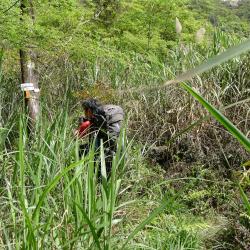
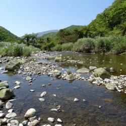
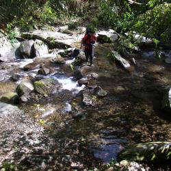
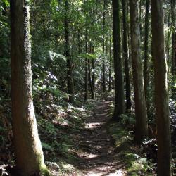
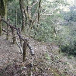
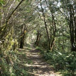
Hapen Historic Trail starts from Fushanli, Wulai District, New Taipei City in the west, and ends in Lunpi Village, Datong Township, Yilan County in the east. It was formerly known as the "Shenkeng to Yilan Crossing Aiyong Boarder", built in built in Meiji 38 (1905). In Showa 6 (1931),  the Police Department of the Taiwan Governor's Office rebuilt the road to relocate the indigenous people of the Ka’aowan group from Takasan and Gaoyilan communities. The road continued to be used after the war until now.

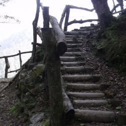
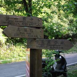
The wooden sign at the entrance indicates the distance from the trailhead to Fushan Elementary School (2.4 kilometers, about 53 minutes walk), and Hapen Campground (9 kilometers, 203 minutes walk).

County Boundary
調查人員於縣界勘查

The Hapen Historic Trail starts from Fushan, and goes all the way around the right bank of Nanshi River. After crossing several tributaries, it arrives at the confluence of Hapen River and Nanshi River. Climb up the ridge between the two streams to reach the east saddle of Peak 934, and then continue to climb to the county boundary between New Taipei City and Yilan County, which is also the highest point of the historic trail, the saddle between Hongchai Mountain and Zhongling Mountain. Then pass Zhongling Police Post and finally arriving at Lunpi.

The county boundary is about 1,050 meters above sea level, and takes about 80 minutes to reach Zhongling Mountain.

Upstream of Nanshi River
南勢溪上溯一景

The Hapen Historic Trail, which runs obliquely through Wulai District, New Taipei City, and Datong Township, Yilan County, goes along the right bank of the upper reaches of Nanshi River and around the mountain. The path crosses the tributaries of Nanshi River many times. Once reached the Hapen Camp, continue walking along Nanshi River for an hour until reaching the confluence of the tributaries. Then cut the ridge line, and go around to the saddle between Hongchai Mountain and Zhongling Mountain, and finally arriving at Lunpi.

Polu Creek
哈盆越嶺古道鄰近4.5K~5K溪流-波露溪

The Hapen Historic Trail, which runs obliquely through Wulai District, New Taipei City, and Datong Township, Yilan County, goes along the right bank of the upper reaches of Nanshi River and around the mountain. The path crosses the tributaries of Nanshi River many times. There are three main locations where you need to wade across the river before arriving at Hapen Camp. The first river crossing is at around 3K of the trail. Polu Creek is also one of the tributaries of the upper reaches of Nanshi River. The stream is clear and shallow, but the roadbed near the stream is lost and very steep. Although there are ropes to assist, you still need to be very cautious.

Cedar Forest
哈盆越嶺古道途經柳杉林區道路

The Hapen Historic Trail, which runs obliquely through Wulai District, New Taipei City, and Datong Township, Yilan County, goes along the right bank of the upper reaches of Nanshi River and around the mountain. The path crosses the tributaries of Nanshi River many times. The road conditions are flat, the shade is dense, and the natural landscape is primitive, which is quite suitable for ecological observation, mountaineering and hiking and other activities.


Gaorao Road
高繞路一景

The starting point of the Fuba Cross-ridge Historic Trail is in Fushanli, Wulai District, New Taipei City, and the finishing point is in Baling, Taoyuan City. It was one of the important transportation passage between New Taipei City Wulai District and Taoyuan Fuxing District druring the Japanese rule. In recent years, it has been planned and built by the Forestry Bureau as a section of the "Chiatianshan National Trail System". The entire path runs through the Lalashan the Chitianshan Natural Reserves. There are many giant red cypress trees along the route, which is also an important habitat environment for wildlife. After entering the Fuba Cross-ridge Historic Trail from the mountaineering entrance of the Sacred Trees District of Lalashan, walk for about 10 minutes, you will encounter a collapsed wall. Since this section of the trail has collapsed, the Forestry Bureau erected wooden stairs to bypass the collapsed section. This detour, Gaorao Road, can be passed in about 5 minutes.


Detouring Wooden Stairs
林務局架設高繞木梯,協助徒步者繞過崩壁

The starting point of the Fuba Cross-ridge Historic Trail is in Fushanli, Wulai District, New Taipei City, and the finishing point is in Baling, Taoyuan City. It was one of the important transportation passage between New Taipei City Wulai District and Taoyuan Fuxing District druring the Japanese rule. In recent years, it has been planned and built by the Forestry Bureau as a section of the "Chiatianshan National Trail System". The entire path runs through the Lalashan the Chitianshan Natural Reserves. There are many giant red cypress trees along the route, which is also an important habitat environment for wildlife. After entering the Fuba Cross-ridge Historic Trail from the mountaineering entrance of the Sacred Trees District of Lalashan, walk for about 10 minutes, you will encounter a collapsed wall. Since this section of the trail has collapsed, the Forestry Bureau erected wooden stairs to bypass the collapsed section. This detour, Gaorao Road, can be passed in about 5 minutes.


Baling Bridge
遠眺巴陵橋一景

The predecessor of the Northern Cross-island Highway was Jiaobanshan Sanxing Guard Road during the Japanese colonial period. In October of the third year of Taisho (1914), the Japanese built the Balong Suspension Bridge at 47 kilometers away from today's Northern Cross-island Highway. Fuba Cross-ridge Historic Trail connects with Jiaobanshan Sanxing Road here. During the construction of the Northern Cross-island Highway in the 1960s, the Balong Bridge was demolished and rebuilt as "Baling Bridge".

Gigantic Fallen Tree
拉拉山神木區到檜山駐在所之間,可見巨大倒木隧道

There are many sacred trees along the way from the sacred tree area of ​​Lalashan to the Guishan Police Post, and there are also many huge fallen trees. Since large fallen trees are not easy to be removed, it is often seen that the giant trees lying on the road are sawn open to form a passage. The huge fallen log in this image is located near 15K of the trail.

Trail near the County Boundary
縣界附近的古道狀況

The Fuba Cross-ridge Historic Trail is also a trail for climbing Lalashan and Guishan. If you have spare energy, you can make a detour and climb to the top of these mountains along the way. The climbing entrance of Lalashan is located near the county boundary, and takes around 1 hour one way. The climbing entrance of Guishan is located at the Guishan Police Post, and the climbing time is about 25 minutes.