Atayal

Baigou Police Post
力行產業道路通往瑞岩的岔路口民宅即為白狗駐在所舊址

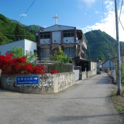
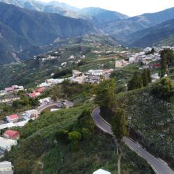
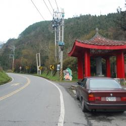
Baigou Police Post, located in Ren'ai Township of Nantou County, used to stand at the fork of the industrial road leading to Ruiyan hamlet. It is 1,349 meters above sea level.

During the Japanese occupation, the Government-General in Taiwan built the Pyanan Historic Trail in 1918 for the purpose of supply transportation and management of indigenous people. The trail is 120 km in length.

In the post-war period, the trail section from Siyuan Pass to Datong in Yilan was replaced by the Central Cross-island Highway, and the section from Meimu to Cuiluan was later opened as part of the Lixing industrial road.


Hongxiang Village
設立於1958年的紅香真耶穌教會

The Hongxiang Hamlet is located in the foothills of Baigu Dashan in Ren’ai Township, Nantou County. It is 1,170 meters above sea level. The traditional Atayal name of the hamlet is Makanaji. The land is flat and fertile, and most of them have been converted into paddy fields.

In the early days of the Japanese occupation, the tribesmen first moved to the upper reaches of the Makanaji Stream and took refuge when the Government-General in Taiwan sent military police into the hamlet. However, they were forced to relocate to a spot 1.3 km north of the former site of Maisiduobang for better monitoring and management by the Japanese. Later in 1923, they moved to the current location due to the barren land.

Xinwangyang Village
新望洋部落的街景

Xinwangyang Hamlet, also known as Mariba or Mareba, is located in Ren'ai Township of Nantou County, on the 29 km point of Lixing Industrial Road.

The people of Xinwangyang Hamlet originally lived on the hillside of the Beigang River below the current site, with the traditional name “Mek-Moyau”. However, during the Japanese occupation, due to the fact that they lived under the sloping terrain, some people thought that the environment was bad and so they moved to the area near Xinwangyang Cemetery.

In the post-war period, due to landslides and concerns for the safety of living there, the village collectively moved again to a place with relatively stable land in the southwest and named it Xinwangyang.

Nowadays, most of the tribal people are engaged in non-tropical and high-mountain agricultural work, which is an important source of local income.

Mareppa Police Post
新望洋公墓內的水泥建物即為マレッパ駐在所遺址

Mareppa Police Post is located inside the Xinwangyang Cemetery in Ren'ai Township, Nantou County, on the 29 km point of the Lixing Industrial Road, at an altitude of about 1,500 meters.

Xinwangyang Cemetery was originally the Wangyang village, also known as Mariba or Mareba. The people got relocated to settle here during the Japanese occupation. In the post-war period, due to landslides and stress about the safety of residence, the village was collectively moved to a place with relatively stable ground in the southwest and named Xinwangyang.

Nowadays, most of the tribal people are engaged in non-tropical and high-mountain agricultural work, which is an important source of local income.

Maricowan Police Post
右邊第一棟民宅即為マリコワン駐在所的位置

The Marikowan Police Post is located inside the Marikowan Hamlet in Ren’ai Township of Nantou County.

During the Qing period, there were originally four communities: Mklihan, Mkbubul, Mktata, and Mkbabo. However, during the early days of the Japanese occupation, the Government-General in Taiwan sent personnel to the hamlet and demanded the people to hand over firearms. The tribesmen stubbornly resisted, and so police forces were sent to suppress the people as well as burning down the Mklihan community.

In the post-war period, the National Government merged the four tribes into one Cuiluan community (Qalang Bubun). After the completion of the industrial road, some people moved to the roadside to form the Marikowan Hamlet.


Lishan Hamlet
卑亞南古道封面照

The Lishan Hamlet is located on the 82.5 km point on Provincial Highway 7A in Heping District of Taichung City, on the hillside on the south bank of the upper reaches of Dajia River. It is 1,780 meters above sea level.

This hamlet used to be the official Salamao サラマオcommunity that was established by the Government-General in Taiwan when Atayal people from the Kishiai community on the left bank of Dajia River and the Pelumoan ペルモアン community from the right bank of Dajia River were collectively moved here. 

During this period, paddy field farming and non-tropical agriculture was actively introduced. Lishan Hamlet was originally located near the old Nichinan police post until mid-1960 when the Cross-island Highway was opened to traffic and the local residents moved to Songbai Village, a Veterans Village set up by the Retirement Society. Gradually, this area became a little settlement.

Taibaojiu Police Post
從高空俯瞰太保久駐在所遺址,現已搭建水塔

The Taibaojiu Police Post is located above Provincial Highway 7A in Heping District of Taichung City, near the Songmao Hamlet, on the flat area of mountain ridge between the Dajia River and the Hehuan River, and is about 2,300 meters above sea level.

This police post was set up by the Government-General in Taiwan during the Japanese occupation, and named it Taibaojiu. Due to the Japanese pronunciation, it was referred to as Tabok, which local residents often used this name to refer to the hamlet. In the post-war period, the police post was moved to the current site next to the highway. Most of this area has been developed into orchards.


Huanshan Hamlet
環山派出所位於環山部落上方,臺7甲線省道旁

Huanshan Hamlet is located in Heping District of Taichung City, at the 61km point on the Provincial Highway 7A and is about 1,600 meters above sea level. The hamlet was established in 1913, when a group of Atayal people migrated here from the Mashitobaon community (マシトバオン社) in Ren’ai Township, Nantou County.  The hamlet got its name from its geological location. As it is surrounded by high mountains such as Nanhu Mountains and Xueshan range, the name “Huanshan” means surrounded by mountains. Its previous name was Shikayau community (シカヤウ社).

During the Japanese occupation, the Governor-General in Taiwan planned to relocate the people from Huanshan hamlet closer to the flat land for the sake of management. However, this plan had failed and so they began to plant non-tropical fruit trees. This continued on into the post-war period. To this day, tribal people still use high-mountain agriculture as a business, but are greatly affected by import competition and traffic interruption.

Zhiliang Police Sation
志良派出所的建物外觀

The current Zhiliang Police Station is located about 3 km north-east on Huanshan in Heping District of Taichung City. It is the former Zhiliangjie Police Post that was set up by the Governor-General in Taiwan on the Pyanan Historic Trail during the Japanese occupation.

This trail was originally the path that Atayal people travel between north and south. However, for the purpose of transportation and management control, the Governor-General has resolutely built roads especially for managing and relocating the Atayal group to other villages (aka Indigene Management Route). Afterwards, the Nitto Research Institute of Domestic Oil Production tried to use the fallen wood roots of the cedar in the Zhilioangjie area to distill turpentine oil. However, due to limited profits, the production was suspended the following year. The present Zhiliang area has been included in the Big Lishan High Mountain Agriculture area.

Siyuan Pass
國民政府設立的飲水思源碑亭

Siyuan Pass is located on the 45km point of Provincial Highway 7A in Datong Township of Yilan County, 1,948 meters above sea level, near the watershed between Lanyang Stream and Dajia Stream, which is also the lowest saddle point where Nanhu Dashan Mountain Branch and Xueshan Mountain Range meet. It is often foggy and misty.

During the Japanese occupation, the Government-General in Taiwan began to build the Pyanan Historic Trail in 1918 for the purpose of transportation and management control. It stretched from Zhuoshui in the north to Wushe in the south. The total length of the trail is about 120 km. After the war, the National Government built industrial roads and the Central Cross-island Highway, which replaced the Pyanan Historic Trail.

Since the Pyanan saddle was the water source for both Lanyang and the Dajia Stream, the area was named Yingshui Siyuan, which conveys the meaning of "When you drink from the stream, you remember the source". Therefore, the pavilion was set up to commemorate the water source.