Pyanan

Shengguang Police Station
勝光派出所

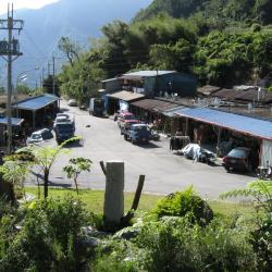
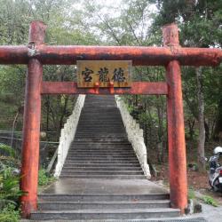
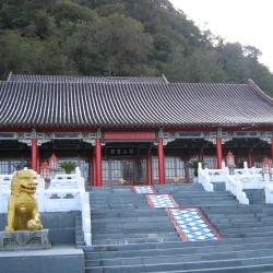
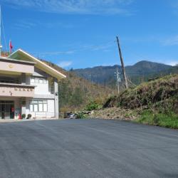
Shengguang Police Station is located 49.5 kilometers away from Central Cross-island Highway Yilan branch line. During the Japanese occupation, in order to facilitate transportation and manage the indigines, the Pyanan Historis Trail was built in the 7th year of Taisho (1918). The route starts from today’s Datong Township, Yilan County and extended to Wushe in Nantou County, with a total length of 120 kilometers. The trail was completed in the 10th year of Taisho (1921). 

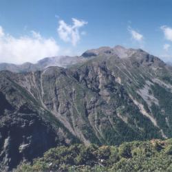
The biggest feature of this road is that it almost presents a "north-south" road system. Most of the Lifan roads are east-west, which makes this trail one of the six north-south roads. The Pyanan Historic Trail passes through the Atayal territory, forming a longitude and latitude with the east-west Lifan road, interweaving into a traffic network, and playing a very important role in the history of mountain transportation during the Japanese occupation. After the war, this historic trail was replaced by the Yilan branch of the Central Cross-island Highway and the Lixing Industrial Road.

Xibao
西寶國小旁的西寶聚落一景。

Xibao is located 161 kilometers away from the Zhongheng Highway. It is a large river terrace. Anthropologists have discovered pottery and stone spinning wheels on the Xibao terrace, which may have been left by humans in the late Neolithic period. About 250 to 300 years ago, after the Truku people settled in the Liwu River valley, they established the Xibao community here. After the Japanese implemented the Lifan policy in 1915, they were forced to move away. After World War II, some returned to the tribe. When the Zhongheng highway began to be excavated, vegetables and fruits were grown on the terraces of Xibao River due to the inconvenient transportation of vegetables in mountainous areas, and Xibao Farm was established. After the highway was opened, the Retirement Association arranged for the veterans to settle here. There is Xibao Elementary School on the terrace. It was originally a school for the children of the Xibao Farm workers, and later it was changed to Forest Primary School. It is the only forest primary school in the country and the only primary school inside the national park.


Walking Trail on the Main Peak of Hehuan Mountain
日治時期,日本政府為討伐太魯閣族人,曾先後組成探險隊進行五次的地形探勘,當時的台灣總督佐久間左馬太曾於大正元年(1912)9月底,隨合歡山探險隊登上合歡主峰山頂,親自觀測周圍的地形環境。現在在合歡山主峰山腰,公路的上方,隱約可見一條與公路平行的小路,這就是太魯閣戰役時日軍所開出的軍用道路,路跡仍清晰,可走上一小段,體會一下日軍當年的討伐之路。

The main peak of Hehuan Mountain is 3,417 meters above sea level, which is the watershed between Liwu River and Zhuoshui River. The mountaineering entry is located at 30.8 km from Taiwan Provincial Highway 14. Since a radar station was built on the Hehuan Main Peak in the early years, the Hehuan Main Peak Trail is actually a road for military vehicles. After the troops withdrew in 2000, the National Park  reorganized this area and transformed old foundations (other than telecommunication base station) into a viewing platform. From the top of the mountain you can see Hehuan Peak, Qilai Peak, Nenggao Mountain, Nanhu Mountain, Central Sharp Mountain, and Yushan Mountain at a glance.

The Tomb of Mona Rudo
莫那魯道之墓

On October 27, the 5th year of the Showa era (1930), the Japanese held a sports event here. The staff of the Camphor company, the Japanese police officers and officials who were stationed in the headquarters of Nengao County and neighboring areas gathered here. The garrisons were weak in manpower and were easy to attack and rob weapons and ammunition from. Therefore, the six Sediq tribes chose to revolt on this day, but they were outnumbered and suffered heavy casualties. It is known as the "Wushe Incident" in history. After the incident, Mona Rudo, the leader of the Seediq tribe, shot himself in the dense forest above the cliff above the Mahepo Grottoes. It was not until Showa 8 (1933) that his body was discovered by two hunters from the Sakura community. Nenggao County Police in Nantou Office bound Mona Rudo’s remains with iron wires and put them on public display at the Wude Hall in Puli. Afterward, they were sent to the anatomy room of the Governor’s School of Medicine to be made into bone specimens and then sent to the Department of Anthropology at Taipei Imperial University for classroom research. In 1973, Gao Guang-hua, then mayor of Ren'ai Township (the posthumous son of Jiro Hanaoka who committed suicide in the Wushe incident), and representatives of the clan brought Mona Rudo's remains from the Specimen Exhibition Hall of the Department of Archeology and Anthropology, National Taiwan University, back to Wushe for burial.

Mona Rudo Memorial Park
莫那魯道紀念公園

On October 27, the 5th year of the Showa era (1930), the Japanese held a sports event here. The staff of the Camphor company, the Japanese police officers and officials who were stationed in the headquarters of Nengao County and neighboring areas gathered here. The garrisons were weak in manpower and were easy to attack and rob weapons and ammunition from. Therefore, the six Sediq tribes chose to revolt on this day, but they were outnumbered and suffered heavy casualties. It is known as the "Wushe Incident" in history. After the incident, Mona Rudo, the leader of the Seediq tribe, shot himself in the dense forest above the cliff above the Mahepo Grottoes. It was not until Showa 8 (1933) that his body was discovered by two hunters from the Sakura community. Nenggao County Police in Nantou Office bound Mona Rudo’s remains with iron wires and put them on public display at the Wude Hall in Puli. Afterward, they were sent to the anatomy room of the Governor’s School of Medicine to be made into bone specimens and then sent to the Department of Anthropology at Taipei Imperial University for classroom research. In 1973, Gao Guang-hua, then mayor of Ren'ai Township (the posthumous son of Jiro Hanaoka who committed suicide in the Wushe incident), and representatives of the clan brought Mona Rudo's remains from the Specimen Exhibition Hall of the Department of Archeology and Anthropology, National Taiwan University, back to Wushe for burial.

Second Office of Taipower Wanda Power Station
台電萬大發電廠第二辦公室

The second office of the Wanda Power Station of the Taiwan Power Company was originally the Wushe Public School during the Japanese Occupation and the site of the Wushe incident. In the 5th year of Taisho (1916), Japanese people set up Wushe Public School in Wushe area to provide education and placement for Japanese children in Wushe area. On October 27, the 5th year of the Showa era (1930), the Japanese held a sports event here. The staff of the Camphor companyand, the Japanese police officers and officials who were stationed in the headquarters of Nengao County and neighboring areas gathered here. The garrisons were weak in manpower, and was easy to attack and rob weapons and ammunition. Therefore, the six Sediq tribes chose to revolt on this day. After the incident, the Japanese police piled the 138 dead bodies on the playground of the Wushe Public School, and ordered the police to cut firewood and cremate the bodies. It took three days and three nights to complete the cremation.

Wugang Shrine
)霧ケ岡社入口的鳥居,霧ケ岡社戰後被拆除,入口的鳥居上方短柱也是戰後被加上去的。

The Wugang Shrine ruins is located in Jiesho Lane next to the Wushe fire station. Enter the alley and walk for about one or two minutes you will see a red torii gate and stone steps leading to Delong Temple. This torii is the remains of Wugang Shrine. On both sides of the stone-steps there is an abandoned stone lantern, also left from Wugang Shrine. The opening of Wugang Shrine was on December 16, Showa 7 (1932), and the ritual day is October 28th each year. After the war, the shrine was changed to offer sacrifices to Kaitai Shengwang and Fude Zhengshen. In 1958, the government promoted Confucian education and renamed it "Confucius Temple". In 1960, it was renamed "Delong Temple". From the square in front of Delong Temple, you can overlook Wushe Street and Wanda Reservoir. 

Lishan Hotel
梨山賓館

Built in 1965, Lishan Hotel is located in the center of Lishan district. It was the earliest hotel built in the area, also one of the main hotels where President Chiang Kai-shek hosted foreign guests and stayed when he visited Taiwan. Designed by the same architect as Taipei Yuanshan and Kaohsiung Yuanshan, which  are known as the three major palace hotels in Taiwan, the red exterior architectural features has become a landmark of Central Cross-island.  The hotel began to operate in 1971 and was run by the National Military Retired Officers and Soldiers Guidance Committee of the Executive Yuan. It ceased operation after the 921 earthquake and Typhoon Minduli in 2000, and since it has not been maintained for more than a decade, it has lost its original glamour. In 2004, the hotel was taken over by the Shenshan National Scenic Management Offce, and was entrusted to be operated and managed by Lishan Hotel Co., Ltd. The hotel was rebuilt and reopened in December 2012.

Songmao Hamlet
空拍松茂部落,影像左下方分布於公路兩側的聚落為松茂部落,順著公路往前延伸至遠處的聚落為梨山,右側蜿蜒的溪谷為大甲溪。

The Songmao Hamlet is located 3 kilometers to the northeast of Lishan, on section four of Zhongxing Road, Lishanli, Heping District, Taichung City to be exact. It is located on the shoulder-shaped flat edge between Dajia River and its tributary Hehuan River, with an altitude of about 2,300 meters. During the Japanese occupation period, there was a Taibajiu police post in the area, so it was named "Taibaojiu"; Taibaojiu was also spelled "タボク" (Taboku) in Japanese, so the residents often referred to the community as "Tabok". After the war, the residents moved to the current site on the side of the road. The origin of the name Songmao is unknown, but it may be related to the variety of Songmao pear.

Xueshan
從雪山北峰向南眺望雪山稜線,遠方最高山頭就是雪山。

Xueshan is located at the junction of Heping District, Taichung City and Tai'an Township, Miaoli County. It is 3,886 meters above sea level and is the second highest peak in Taiwan. In July of the 4th year of Taisho (1915), Saitsu Kyuhei, the survey team of the Fan Affairs Bureau, and his party, crossed the southern saddle of Pyanan(now Siyuan Yakou) from the southern part of Beiyanshe (now Nanshan Village) to Zhijiayangshe (now Huanshan hamlet), followed by Zhijiayang Dashan ridgeline to complete the first ascent and measurement of the main peak of the snow-capped mountain. Since then, this route has become the most convenient way to climb the sub-alpine mountain (the name of Xueshan during the Japanese occupation). In the 4th year of the Showa era (1929), the governor of Taichung prefecture built the "Chigao Lodge" in the southeastern part of Xueshan, which was the only lodge in the area that accommodates hundred people. After the opening of the Xueshan Mountain Route in 1970, it replaced the Zhijiayang Line as the main route for climbing Xueshan because it was relatively gentle and easy to walk.