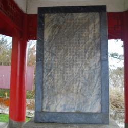
Inside the Siyuan Yakou pavilion, there is a "Central Cross-island Highway Yilan Branch Project Monument", which records the beginning and end of the road construction project. On the back of the stele, there are four words "Ying Shui Si Yuan" (meaning: drink water and remember the water source, be thankful) inscribed by General Zhou Zhirou, the then chairman of the Taiwan Provincial Government in August 1961. This is the origin of the place name "Siyuan Yakou". The Yilan branch line of Central Corss-island Highway began construction in January 1955 and completed in March 1959, with a total length of 111 kilometers. The predecessor of this road was the Pyanan Historic Trail during the Japanese rulw. In order to facilitate traffic and manage the indigines, the Japanese began to build the trail in the 7th year of Taisho (1918), which extended from today’s Leshui Village in Yilan County, passing through Mao'an, Siji, Nanshan, Siyuan Yakou in Taichung City, Huanshan, Lishan, Mailiguan in Nantou County, Marleba, Hongxiang, Ruiyan to Wushe, with a total length of about 120 kilometers. It was completed in the 10th year of Taisho (1921).
Pyanan
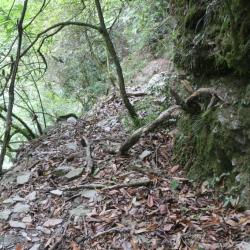
During the Japanese colonial period, in order to facilitate transportation and manage the indines, the Pyanan Historic Trail began to be built in March of the 7th year of Taisho (1918). The route goes through Huanshan, Lishan, Heping District, Taichung City, Cuiluan, Wangyang, Hongxiang, Ruiyan, and Wushe, Renai Township, Nantou County, with a total length of about 120 kilometers. It was completed in March 1921. This route was originally an aperture for the communication between the north and the south of the Atayal people. After excavation, it also became an important road for the "group migration" of the Atayal people. At present, this historic trail has been replaced by the Yilan branch line of the Central Cross-island Highway and the Lixing Industrial Road, leaving only two sections of the trail that do not overlap with the highway. One is the section from Yorkejiaoxi to Siyuan Yakou, and the other is from Lishan Anbu to Fushoushan farm.
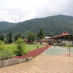
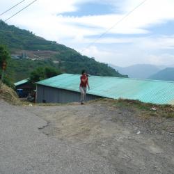
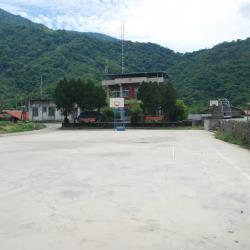
Nanshan Elementary School is located in Nanshan village, at an altitude of almost 1,200 meters. It is an indigenous school with Atayal culture. The predecessor of Nanshan Elementary School was the "Pyanan Indigenous Children's Education Center" during the Japanese occupation period. It was established in May of the 9th year of the Taisho era (1920). In November of the same year it was open for school. In September of the 10th year of the Taisho era (1921), it was changed to "A-type Indigenous Children's Education Center", and the additional school building was completed in December of the same year. In May 1946, it was taken over by the National Government and changed to "Beinan Branch of Siji National School in Taiping Township, Taipei County". In August 1962, it became independent as "Nanshan National School in Datong Township, Yilan County". In August 1968, the nine-year national education was implemented, and the school was renamed "Nanshan National Elementary School". In 1991, the reconstruction of classrooms, dormitories and playgrounds was completed.
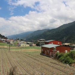
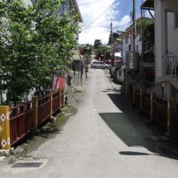
The Nanshan Tribe is located at 28K of the Taiwan Provincial Highway 7 of the Central Cross-island Highway Yilan Branch Line, at an altitude of 1,200 meters. It is a river terrace on the left bank of the upper reaches of the Lanyang River. It was originally called pyanan, meaning cooking, because in the past, the Atayal people often rest and cook here. In 1959, the Yilan branch of the Central Cross-island Highway was built. At that time, Premier Jiang Jingguo of Executive Yuan passed by here and felt that the name of Pyanan was indecent, so he took the word Nan and changed the name of the village to Nanshan Village. Nanshan Village is divided into upper and lower hamlets. Kanaban is the lower hamlet, and is located about 300 meters north of the Nanshan Police Station. It is the original location of Pyanan Hamlet and as it locates belo the terrace, it is called the lower hamlet. Koxao is the upper hamlet. In 1913, the Japanese forces penetrated into the Nanshan area and set up a station at the current site of the Nanshan police station. In order to disperse the power of the indigines, the leader Losin-nobo moved half of the community members to live near the station and called it Koxao because of its nose-like landform.
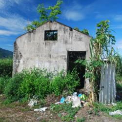
Meimu Police Post, in Ren'ai Township of Nantou County, is located below the Lixing Industrial Road and next to the Meimu Camphor Bureau. It has now been converted into a tea factory.
The Lixing Industrial Road was completed in 1968. The road begins from Wushe in the south and ends in Lishan in the north, connecting to the Central Cross-island Highway. The section from Meimu to Cuiluan was originally part of the Pyanan Historic Trail during the Japanese Occupation period.
Today, the hillsides along the Lixing Industrial Road are rich in non-tropical fruits, but the geology of the area where the road passes is fragile. There are often landslides, hence the road conditions are not good.
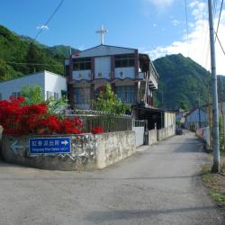
The old Ruiyan police station, in Ren’ai Township of Nantou County, is located in the northeastern foothills where Beigang River and Kagao River meet.
The Ruiyan Hamlet was formed by the merger of the Mesiduobang community and the Tieli Lao community. Since Japanese rule, it has experienced multiple group migration policies. In the post-war period, the National Government also changed the name of the hamlet and merged. It was until the Jiji earthquake in 1999 that the Ruiyan Hamlet was relocated again in 2011 due to severe stratum damage. The new location of the hamlet is on the right bank of Beigang River, northwest of the original village. However, there are still 32 households that have not moved due to insufficient land.
Baigou Police Post, located in Ren'ai Township of Nantou County, used to stand at the fork of the industrial road leading to Ruiyan hamlet. It is 1,349 meters above sea level.
During the Japanese occupation, the Government-General in Taiwan built the Pyanan Historic Trail in 1918 for the purpose of supply transportation and management of indigenous people. The trail is 120 km in length.
In the post-war period, the trail section from Siyuan Pass to Datong in Yilan was replaced by the Central Cross-island Highway, and the section from Meimu to Cuiluan was later opened as part of the Lixing industrial road.
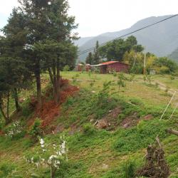
The Hongxiang Hamlet is located in the foothills of Baigu Dashan in Ren’ai Township, Nantou County. It is 1,170 meters above sea level. The traditional Atayal name of the hamlet is Makanaji. The land is flat and fertile, and most of them have been converted into paddy fields.
In the early days of the Japanese occupation, the tribesmen first moved to the upper reaches of the Makanaji Stream and took refuge when the Government-General in Taiwan sent military police into the hamlet. However, they were forced to relocate to a spot 1.3 km north of the former site of Maisiduobang for better monitoring and management by the Japanese. Later in 1923, they moved to the current location due to the barren land.
Xinwangyang Hamlet, also known as Mariba or Mareba, is located in Ren'ai Township of Nantou County, on the 29 km point of Lixing Industrial Road.
The people of Xinwangyang Hamlet originally lived on the hillside of the Beigang River below the current site, with the traditional name “Mek-Moyau”. However, during the Japanese occupation, due to the fact that they lived under the sloping terrain, some people thought that the environment was bad and so they moved to the area near Xinwangyang Cemetery.
In the post-war period, due to landslides and concerns for the safety of living there, the village collectively moved again to a place with relatively stable land in the southwest and named it Xinwangyang.
Nowadays, most of the tribal people are engaged in non-tropical and high-mountain agricultural work, which is an important source of local income.
Mareppa Police Post is located inside the Xinwangyang Cemetery in Ren'ai Township, Nantou County, on the 29 km point of the Lixing Industrial Road, at an altitude of about 1,500 meters.
Xinwangyang Cemetery was originally the Wangyang village, also known as Mariba or Mareba. The people got relocated to settle here during the Japanese occupation. In the post-war period, due to landslides and stress about the safety of residence, the village was collectively moved to a place with relatively stable ground in the southwest and named Xinwangyang.
Nowadays, most of the tribal people are engaged in non-tropical and high-mountain agricultural work, which is an important source of local income.