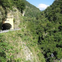
Wenshan Hot Spring is located between Tianxiang and Xibao on the Central Cross-Island Highway. It is the only natural Hot Spring in Taroko National Park where water flows out from the crack of a marble rock on Dasha riverbed. It was discovered by Captain Fukami Buheiji during the Taroko War in 1914, and named it Fukami Hot Spring (Chinese character Shen-Shui, meaning deepwater). In the post-war period, the National Government changed its name to Wenshan Hot Spring. The trail on the right side of the south entrance of the Taishan Tunnel used to lead down to the hot spring. However, after a rock fell and injured some tourists in 2005, the trail has been closed since.
Taroko War
Wenshan Hot Spring
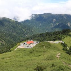
Guanyuan Police Post
The Guanyuan Police Post is located above Guanyuan on the Central Cross-Island Highway, about 2,580 meters above sea level. When the Taroko War broke out, the army sent by the Government-General in Taiwan attacked the Turuku tribe from the east side of Hehuanshan. Guanyuan was the first stop, and when the then Governor of Taiwan, Sakuma Samata, heard that the Turuku tribe had fought here, he named the place after the ancient battleground during the Japanese Sengoku Period, “Sekigahara” (Guanyuan in Chinese character). As a result, the route of Hehuan Traversing Historic Trail was changed in the middle of the Japanese occupation, and the police post was called Guanyuan in honor of the Governor.
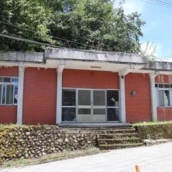
In the post-war period, the Central Cross-Island Highway was opened, passing through the small hamlet below Guanyuan Police Post, also known as Guanyuan. The hamlet has a lodge, Hehuan police station, and Guanyuan gas station.
Hehuan Traversing Historic Trail
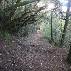
When the Taroko War broke out in 1914, the then Governor of Taiwan, Sakuma Samata, wanted to use a strong military and police force to defeat the Turuku tribe along the Liwu River. Therefore, Nantou Minister, Ishibashi Tooru, personally led the road excavation team, and opened the road from Puli to Tianxiang. After the war, the road continued to be opened from Puli to Taroko Gorge entrance, which was the original path of the Hehuan Traversing Historic Trail. Later, due to the collective migration of tribes and the steep slope of the original route, the route was modified and completed in 1935.
In the post-war period, the Central Cross-Island Highway was opened and replaced the Hehuan Traversing Historic Trail. Coupled with the erosion from typhoons, there are only a few complete road sections that can be walked on today.
Hehuan Police Post
The Hehuan Police Post is located above the Provincial Highway 14, between Dayuling and Xiaofengkou, at an altitude of 2,782 meters. When the Taroko War broke out in 1914, the then Governor of Taiwan, Sakuma Samata, wanted to use a strong military and police force to defeat the Turuku tribe along the Liwu River. Therefore, Nantou Minister, Ishibashi Tooru, personally led the road excavation team, and opened the road from Puli to Tianxiang. After the war, the road continued to be opened from Puli to Taroko Gorge entrance, which was the original path of the Hehuan Traversing Historic Trail. Later, due to the collective migration of tribes and the steep slope of the original route, the route was modified and completed in 1935. This route was a popular hiking trail at that time.
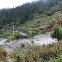
Wuling
Wuling is located between the main peak and the east peak of Hehuanshan, on the 31.5 km point of the Provincial Highway 14. It is 3,275 meters above sea level, the highest point of Taiwan Highway, and has a panoramic view of the surrounding mountains.
During the Japanese occupation, Wuling was called the Hehuanshan Saddle. When the Taroko War broke out in 1914, the then Governor of Taiwan, Sakuma Samata, led troops from Wushe and crossed the saddle to reach the northwestern region of eastern Hehuanshan, and set up a crusade command there. Therefore, Wuling was also called Sakuma Pass at the time. During the Japanese occupation, hikers climbed the main peak of Hehuanshan from here. In the post-war period, due to the excavation of the Central Cross-Island Highway, it was renamed Wuling.
Zhuifen Police Post
Zhuifen Police Post of Ren’ai Township, Nantou County is located opposite the current Cuifeng Police Station, which is a popular observatory that overlooks the mountains. During the Japanese Occupation period, Zhuifeng was called Oiwake, which means the divergence point of the road, and just like the name, it was the boundary point acknowledged by the Governor-General in Taiwan and the indigenous tribes. When the Taroko War broke out in 1914, the army would assemble at Zhuifeng Police Post before heading to Hehuanshan as there was a large supply station.