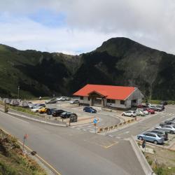
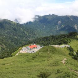
Wuling is located between the main peak and the east peak of Hehuanshan, on the 31.5 km point of the Provincial Highway 14. It is 3,275 meters above sea level, the highest point of Taiwan Highway, and has a panoramic view of the surrounding mountains.
During the Japanese occupation, Wuling was called the Hehuanshan Saddle. When the Taroko War broke out in 1914, the then Governor of Taiwan, Sakuma Samata, led troops from Wushe and crossed the saddle to reach the northwestern region of eastern Hehuanshan, and set up a crusade command there. Therefore, Wuling was also called Sakuma Pass at the time. During the Japanese occupation, hikers climbed the main peak of Hehuanshan from here. In the post-war period, due to the excavation of the Central Cross-Island Highway, it was renamed Wuling.