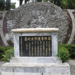
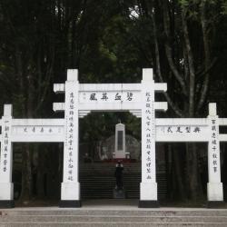
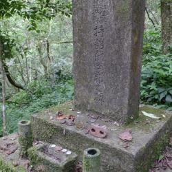
On October 27, the 5th year of the Showa era (1930), the Japanese held a sports event here. The staff of the Camphor company, the Japanese police officers and officials who were stationed in the headquarters of Nengao County and neighboring areas gathered here. The garrisons were weak in manpower and were easy to attack and rob weapons and ammunition from. Therefore, the six Sediq tribes chose to revolt on this day, but they were outnumbered and suffered heavy casualties. It is known as the "Wushe Incident" in history. After the incident, Mona Rudo, the leader of the Seediq tribe, shot himself in the dense forest above the cliff above the Mahepo Grottoes. It was not until Showa 8 (1933) that his body was discovered by two hunters from the Sakura community. Nenggao County Police in Nantou Office bound Mona Rudo’s remains with iron wires and put them on public display at the Wude Hall in Puli. Afterward, they were sent to the anatomy room of the Governor’s School of Medicine to be made into bone specimens and then sent to the Department of Anthropology at Taipei Imperial University for classroom research. In 1973, Gao Guang-hua, then mayor of Ren'ai Township (the posthumous son of Jiro Hanaoka who committed suicide in the Wushe incident), and representatives of the clan brought Mona Rudo's remains from the Specimen Exhibition Hall of the Department of Archeology and Anthropology, National Taiwan University, back to Wushe for burial.