Bunun

Worship Platform at Kaili Police Post
位在楓駐在所下方的參拜臺

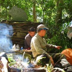
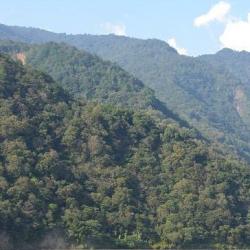
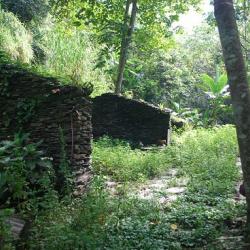
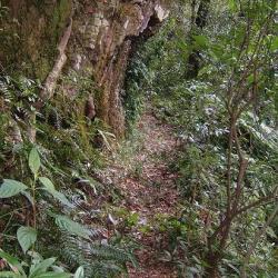
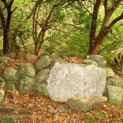
The worship platform is located on the river terrace of the Luye River, below the Kaili Police Post in Yanping Township, Taitung County. The time when the foundation was built is unknown. 

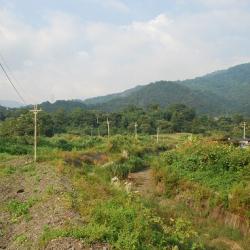
The Kaili Police Post was built by the Governor-General in Taiwan to improve the efficiency of monitoring Bunun people in the Pasnanavan area in 1924. The number of police officers stationed increased as police posts at Onzen, Siusui (Qingshui), Songshan, Kaili, Kakaiyu, Tavilin were successively set up on the left bank of the Beisilan River. The Songshan Police Post was withdrawn in 1930, and the control area of Siusui (Qingshui) Police Post was adjusted to cover the area between Onzen Police Post and Kaili Police Post. 


Halipusungshe
調查人員於Halipusung社合影留念

Halipusungshe is located in Yanping Township, Taitung County. It was where the Pasnanavan Incident occurred at the end of the Japanese occupation.

The incident was caused by the Haisul family who originally lived in Halipusungshe. However, due to the indigene relocation project, the Haisul family and other tribesmen were collectively moved to the west side of Luanshan in 1940. The tribesmen could not adjust to the new environment and fell ill at the new location. Feeling angry, they moved back to Halipusungshe the following year and attacked the Siusui (Qingshui) Police Post at night. Three Amis police officers, Inspector Sugawara and his family were killed that night. The next morning, Haisul and tribesmen continued to attack the Kaili Police Post and Kakaiyu Police Post. After the incident, the Governor-General in Taiwan searched for almost a month to find the Haisul family hiding in a temporary hut in Mount Piniyumayan. After persuasion, the Haisul family made an apology at the Asahi Police Post.

East section of Pasnanavan Historic Trail
部落族人仍常使用的山壁古道

The Pasnanavan Historic Trail, which crosses the Liugui District of Kaohsiung City and Yanping Township in Taitung County, was built in 1924. It starts from Liugui in the west and reaches Taoyuan in the east. The total length of the trail is about 126 km. 

In the past, the entry to the Trail was mostly from the west. Although the Government-General in Taiwan found the passage long and difficult to get in and out, this trail was built nevertheless.

Currently the section of this trail that starts from Liugui to Tengzhi is open as the Tengzhi Forest Road, and some parts of the eastern section are accessible through industrial roads. However, there are sections that have collapsed, which makes it impossible to pass.


Dashuiku Police Post
大水窟駐在所的石牆與大水窟山屋的木構建材,遺址有引水鐵管

The Dashuiku Police Post is located on the flat shoulder on the east side of Mount Nandashuiku, at an altitude of 3,150 meters.  It was established in 1920 and was the highest police post on the Batongguan Traversing Historic Trail during the Japanese occupation. November to April is the period when the mountains are covered with snow. Therefore, life at the Dashuiku Police Post faced various difficulties, such as the sudden temperature drop that caused the drinking water to freeze and daily water needed to be collected from Maiasang Police Post, which is several kilometers away. There were even times when all staff needed to be evacuated to Maiasang Police Post due to freezing weather. In the 1980s, the Yushan National Park Management Office built the Dashuiku mountain hut next to the former site of Dashuiku Police Post, but it was destroyed by a typhoon in 1999.


Ganzhuowanshe (Old Zhuoshe Hamlet)
河階臺地即為卓社群的舊部落干卓萬社

Ganzhuwanshe is located on the river terrace on the right bank of Zhuoshui River in the upper reaches of Wujie in Ren’ai Township, Nantou County, where the No.1 Fazhi Suspension Bridge is at today. It is at an altitude of 780 meters, and was an old hamlet of the Bunun from the Zhuoshe group. During the Japanese occupation, the Wanda Kashe Historic Trail passed by the old hamlet and in 1913, the Government-General in Taiwan set up the Ganzhuowan Police Post above the hamlet.


No.1 Fazhi Suspension Bridge
位於萬豐部落下方的法治一號吊橋遺址

The No. 1 Fazhi Suspension Bridge in Ren'ai Township, Nantou County is located in the basin surrounded by the peaks of the Central Mountain Range, below Wanfeng hamlet. Today, only the concrete structure of the bridge remains. In fact, this place was the original home of the Bunun people from the Ganzhuwanshe. Other communities that lived there during the Qing period included Lulunshe, Bakuras'she, and Totsukonshe.


Bakuras Hamlet
巴庫拉斯社現存的石板屋

Bakuras Hamlet is located in Xinyi Township, Nantou County with an elevation of about 550 meters. It was mainly formed by the relocation of the Bunun of the Kashe group from Wenwen hamlet and the Jialimo'an hamlet. During the Japanese occupation, the Government-General in Taiwan set up a police post and an education center here, but under the implementation of the group relocation policy, tribal people moved to Dili, Shuanglong and Tan’nan one after another in 1936. Today, from Dili Village along Provincial Highway No. 16 to the elevated platform in front of Heping, there is a fork on the left to reach Bakuras Hamlet. The former site of the police post has now become the Bakurasu Farm. The farm operator has also restored the two slate houses that were in the ruin site.

Jiemeiyuan Incident
姐妹原一景,古道由此穿過

Jiemeiyuan (Jiemei Plain) is located in Ren’ai Township, Nantou County. It was the site where the Jiemeiyuan incident occurred in 1903, which was a war between Bunun and Sediq. 

This war came about after the incident in 1902, when the Government-General in Taiwan imposed an economic blockade on the indigenous peoples and completely cut off the Sediq people of the Dektaya group’s access to trade in Puli. Then using the Pingpu and Bunun people to lure the Sediq people to trade in Jiemeiyuan. The Bunun people of the Ganzhuwan group used food and wine to disarm the Sediq people and then made an order to launch an attack. This resulted in the killing of the Sediq tribe. The impact of this incident was far-reaching. First it affected the Sediq ethnic group's submission to Japan, and then it enacted the Wushe incident.


Zhuoshe Monument
卓社紀念碑即為良久社蕃童教育所的遺址

The Zhuoshe Monument in Xinyi Township, Nantou County, is located on the former site of the Education Center for Indigenous Children in Liangjiushe, which was set up by the Government-General of Taiwan during the Japanese occupation. Later in 2003, the Bunun people set up a stone monument at the flagpole stand of the Education Center with the inscribed words "Monument erected in commemoration of the people of Zhuoshe who sought their roots and ancestral home”. The trail is made up of two trails, the Wanda Wushe and Wanda Kashe, which passes through the traditional territories of the Sediq and Bunun. In fact, the Wushe Kashe Historic Trail was the first Lifan road (Indigene management route) to be studied, because there are important Qubing archaeological sites along the way, and it is possible to understand the footprints of prehistoric populations, which has considerable academic value and indicator significance.

Historic Trail located near Liangjiushe
位在良久社附近的古道現況

The Wushe Kashe Historic Trail runs through Ren’ai Township and Xinyi Township in Nantou County, with a total length of about 60 km. The trail starts from Wushe in the north and ends in old Bakras Hamlet in the south. It is made up of two routes, the Wanda Wushe trail and Wanda Kashe trail, which pass through the traditional territories of the Sediq and Bunun. In fact, the Wushe Kashe Historic Trail was the first Lifan road (Indigene management route) to be studied, because there are important Qubing archaeological sites along the way, and it is possible to understand the footprints of prehistoric populations, which has considerable academic value and indicator significance.