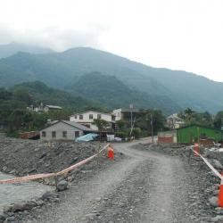
The Fuxing hamlet (Uaasik) is located in Fuxingli, Taoyuan District, Kaohsiung City. In the Bunun language, it is called Uaasik, which means a place that grows palms because there are many wild mountain palms here. The locals are more accustomed to using the Japanese translation of Bibiuw (bibiyoshe or Bibiwushe). The people originally lived scattered among the mountains and forests. During the Japanese colonial period, the Japanese implemented the policy of managing the indigenous peoples and forced the relocation of the tribe to concentrate on the left bank of the Laonong River, which is the platform about 2 kilometers east of the confluence of the Laonong River and the Lakesi River. At the end of the Japanese occupation, malaria broke out in the villages,causing the people to migrate, and the population dropped sharply. It was not until after the liberation that the malaria epidemic slowed down that the population gradually returned. At present, people mainly live near the present Fuxing Police Station. Since this hamlet is further away from the Southern Cross-island Highway, the settlements are scattered and small in scale.
Bunun
During the Japanese colonial period, January 31, 1926 was when the officials entered the Shou area and announced new police posts to be stationed in the area under the jurisdiction of the Lilong Branch Office. Between Pasnanavan and the Kaohsiung state border, there are police officers stationed in Tachibana, Shou, Tokipan, Asahi, and Izumo, which belong to the third and fourth divisions of the third surveillance area of the Lilong Branch Office. At that time, the Japanese have roughly established a defense border along the Pasikau River, running east-west across the Pasnanavan area of the Central Mountain Range.
The Wushe Kashe Historic Trail from the Japanese rule leads to Wanfeng from Wujie. The exits are in Wushe of Renai Township and Bakuras hamlet, an old tribe in Dili Village, Xinyi Township, respectively. The trail along the Zhuoshui River has gone through a rebuild and the trail from north of Wanfeng village to Wushe has been replaced by the current highway. Currently, there are sections of the trail remaining near Inago and the route from Wujie to Bakuras hamlet.
Due to the 1999 Jiji earthquake, the Morakot typhoon, and several heavy rainfalls the trail is broken into pieces. What is now left is some remains of suspension bridges, pillars, and fragments of the trail. At present, there are still relics of the trail on the Wujie Dam and the rock walls beside the dam.
The Wushe Kashe Historic Trail that was built during the Japanese colonial period was actually composed of two sections of ancient routes, namely "Wanda Kashe trail" and "Wanda Wushe trail". The Wushe Kashe Historic Trail was the first Lifan road (Indigene management route) to be studied. The trail passes through the traditional territories of the Sediq and Bunun, and has important Qubing archaeological sites along the way. It was the earliest path of the ancestors and therefore, the ruins, settlements, and trails have considerable academic value and indicator significance.
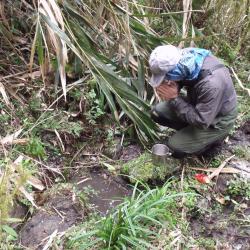
The water source of Bazaishan is located between Bazaishan and Xinglujun mountain. It is about 1,800 meters above sea level on the ridge line. It emerges directly from the ground. It is one of the very important water sources on the eastern section of the Guanmen Historic Trail. Starting from the industrial road at the foot of Bazaishan, it takes about a day on foot to reach this spring. There are no other water sources on the way, therefore, this water source is particularly precious. The Bunun people believe that the spring is bestowed by the ancestors, so when they use the spring water, they will thank the ancestors first, pray and worship beside the spring.
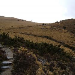
The far ridgeline in the picture is Dashuiku, which is located in south of Mount Dashuiku, south of Mount Jianshan, and north of Mount Jianshan and North-faced Mountain, on the main ridge of the Central Mountain Range.
Nearby is a bamboo grassland with a good outlook and a natural pond. The Qing soldiers were once stationed here in the Qing period and named the camp Shuiku. Today, the pottery fragments left by the life of the people at that time can be found on site. Furthermore, this area was the prefectural boundary for Taichung and Hualien during the Japanese occupation period, and a checkpoint was set up. Currently, there are still traces of the stacked stone foundation. There are also semi-circular iron pipes on site, which were left from the Japanese occupation period when the water source of the Dashuiku was drawn from the pond in the north.
The Minami Police Post is located between the Zhizhushan Police Post and the prefectural boundary, with an altitude of about 3,225 meters. Unlike today, where one could pass through the police post, at that time, the traversing trail bypassed the outer wall of the post.
This image shows the stacked stone wall and rammed earth wall left on the Minami Police Post. The scope of the police post is approximately trapezoidal, about 40 meters long and about 35 meters wide, while the beveled stone wall is about 44 meters. There are remains of porcelain fragments, wine bottles and other containers to be seen on site.
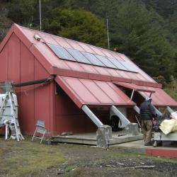
Belonging to the Yushan National Park, the Central Gold Mine Hut is located in Xinyi Township, Nantou County, at an altitude of 2823 meters and about 4 kilometers away from Xiugu plain. The hut is made of steel, two levels with 20 beds, solar panels for providing night lighting, simple toilets next to it, and is equipped with picnic tables and chairs, etc. The water source came from the clear stream next to the fork road from the hut to the Dujuan campsite. The Central Gold Mine Hut was built on the foundation of the former Xiuguluan police post from the Japanese occupation period. It got its name from Mount Xiuguluan, and was known for gold mining during the Japanese occupation.
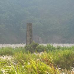
Dashuiku has been a traffic hub since the Qing Dynasty. The Batongguan Historic Trail from the Qing period was completed in the first year of Guangxu (1875). Since then, a camp was set up on the east side of the Dashuiku pond, and today there are remaining ceramic fragments on site that after being studied by archaeologists, they are products of Fujian Dehua kilns during the Xianfeng and Tongzhi reigns of the Qing Dynasty. The Batongguan Traversing Trail was completed in the 10th year of Taisho (1921). The Japanese set up the prefectural boundary on the roadside on the southwest side of the Dashuiku pond, at an altitude of about 3240 meters, and built a pavilion above it for travelers to rest.
In the 1970s, the Forestry Bureau built a tin and iron mountaineering hut in the south of the pond, but it was destroyed by strong winds and snow. Yushan National Park Management Office built a mountain house with solar power supply, rainwater collection tank and simple toilet on the original site, which can accommodate 24 people.