Bunun

Marshland in the east section of Guanmen Historic Trail
拔仔山往那實達社方向路段的石階群

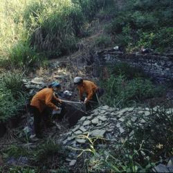
The Guanmen Historic Trail, which straddles Jiji Township of Nantou County and Ruisui Township of Hualien County, began construction in 1886 and completed in the following year. The trail starts from Jiji in the west and reaches Fuyuan in the east, about 105 km in length. It was the last excavated road during the Qing period but was not frequently used by the officials then.

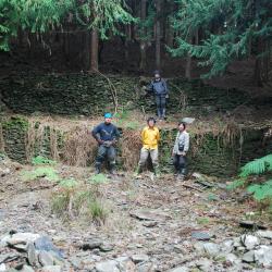
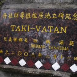
During the Japanese occupation, the trail was used by the Government-General in Taiwan to force the Kashe group and Danshe group of the Bunun tribe to move to a concentrated village.

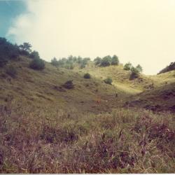
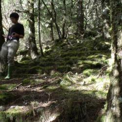
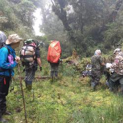
Nowadays, there is a marshland in the east section of the Guanmen Historic Trail, which is located below the ridge line of Bazaishan. Due to the humid and rainy climate here, many sections of the road are quite muddy. Although the terrain is wide, flat and covered with short grass, the bottom is full of mud and is easy to sink in when walking on it.

Slate house in Haba'ang Hamlet
哈巴昂社遺址中規模最大的石板屋

Haba’ang Hamlet is located on the right bank of the Haba’ang River in the upper reaches of the east Danda River in Xinyi Township, Nantou County. It is about 1,600 meters above sea level, at the end of the ridge line extending from the west edge of Mount Guanmen. It belongs to the Danshe group of the Bunun tribe.

During the Japanese Occupation period, influenza occurred, leading to the death of many tribal people.

Today, due to the afforestation by the Forestry Bureau, there is almost no weed growing there. In addition, due to the remote location and little traffic, the ruins have been well-preserved. There are about 10 slate houses scattered on a wide platform. The neatly stacked stone walls and earthen pots are located by the door of many houses. Unfortunately, many of them have been damaged.


The Monument of Seeking the Root of Tielusang Hamlet
位於帖鹿桑社的丹社群尋根祖居地紀念碑

The Monument of Seeking the Root of Tielusang Hamlet is located on a slope opposite the confluence of Danda River in the west and east in Xinyi Township, Nantou County, at an altitude of about 2,080 meters.

Tielusang Hamlet can be reached by going down from the afforestation road near the sixth checkpoint on Danda Forest Road. However, roads are damaged from typhoons and earthquakes, and the site is in poor condition. Continuing down from Tielusang Hamlet, about 1,280m above sea level, there is a fork road, which is the Guanmen Historic Trail. Located in the Tielusang Hamlet. The monument was erected in 2003 and was inscribed by Tian Bingyuan, the then mayor of Xinyi Township.

Danda Hot Spring
位於丹大東溪和卡阿郎溪匯流河口的丹大溫泉

Danda Hot Spring is located at the confluence estuary of east Danda River and Ka’alang River in Xinyi Township, Nantou County. It is in the south of Kanmuzu Hamlet, at the end of Moung Guanmen west ridge, and is about 1,100 meters above sea level.

Above the hot spring there is a campsite left from the Qing period, called Hot Spring Camp. There used to be a railway bridge that crossed the stream above Danda Hot Spring, but no longer exists today. The Guanshan Historic Trail is also broken and cannot be passed. Nowadays, to get to Danda Hot Spring, walk down from the sixth or seventh checkpoint on Danda Forest Road. 


Guanmen Pond
周圍是大片平緩箭竹草坡的關門水池

Guanmen Pond is located in Xinyi Township, Nantou County, beside Guanmen Mountain on the third section of the Central Mountain Range. It is an important water source on the third section of the Central Mountain Range. The surrounding large flat land of arrow bamboos was the former site of the Mount Guanmen Camp. In addition, there are wooden pillar holes on the small hill next to the Guanmen Pond. Next to the pillar holes there is also a small hole, which is the hole for the gate.


The stone steps on the southeast edge of Luntaiwen
佈滿青苔的石階群,保存良好

The stone steps on Mount Luntaiwen are located on the steep ridge line of Mount Guanmen and Mount Luntaiwen in the east section of the Guanmen Historic Trail.

To get to Mount Luntaiwen, start from Bazai village and head up to Bazaishan, then go around Xinlujunshan and Mahouwanshan. After that, go up along the southeastern edge of Mount Luntaiwen, and the historic trail from Bazaishan to Mount Luntaiwen is roughly on the ridge line. As the arrow bamboos are very sparse here, it is possible to clearly see the moss-covered stone steps. In addition, the location is remote and inaccessible, and so the stone steps are well preserved.

Mixikewan Hamlet
從高處俯瞰密西可灣社遺址,上方為人造林

Mixikewan Hamlet is located on the left bank of the Mixikewan River, a branch of the west Danda River in Xinyi Township, Nantou County. It is about 1,300 meters above sea level, and was a hamlet formed from the migration of people from the Kategelan Hamlet.

During the Japanese occupation, influenza broke out and resulted in the death toll as high as 73 people in the hamlet.

Nowadays, to get to the Mixikenwan Hamlet, enter from the afforestation road of the sixth checkpoint on Danda Forest Road, pass the Tielusang Hamlet and Danda Hamlet, continue south to the confluence estuary of west Danda River and Mixikewan River, and then climb from the estuary to the platform of the river terrace. There are three slate houses on the uppermost terrace, which is the lower part of the Mixikewan Hamlet.

Haba'ang Hamlet
哈巴昂社遺址的屋牆和陶甕

Haba’ang Hamlet is located on the right bank of the Haba’ang River in the upper reaches of the east Danda River in Xinyi Township, Nantou County. The hamlet is about 1,600 meters above sea level, at the end of the ridge line extending from the west edge of Mount Guanmen. It belongs to the Danshe group of the Bunun tribe.

During the Japanese occupation, influenza occurred which led to the death of the tribal people.

Today, due to the afforestation by the Forestry Bureau, there is almost no weed growing in the area. In addition, the remote location that resulted in few visitors was able to preserve the ruins. There are about 10 slate houses scattered on a wide platform. There are neatly stacked stone walls, and earthen pots at the door of many houses. Unfortunately, many of them have been damaged.


Ka'alang Hamlet
卡阿郎社遺址旁的造林工寮

Ka’alang Hamlet is located on the right bank of the Wuming stream in the upper reaches of the east Danda River in Xinyi Township, Nantou County. It is about 1,600 meters above sea level and was a hamlet formed from the migration from Danda Hamlet.

Nowadays, to get to Ka’alang Hamlet, enter from the afforestation road near the seventh checkpoint on Danda Forest Road, go around the Ka’alang ridge and then go down to arrive at the destination. Currently there are eight slate houses remaining at the site, distributed on the steep slope. Fragments of pottery shards and porcelain bowls from the Japanese occupation period can still be found scattered inside the house.

Kanmuzu Hamlet
勘姆卒社遺址內的石板屋

Kanmuzu Hamlet is located on the east side of the ridge saddle at the confluence of the east Danda River and Kanmuzu River in Xinyi Township, Nantou County. It is about 1,600 meters above sea level, and was a hamlet formed from the migration from the Danda hamlet.

There is Kanmuzu Hot Spring next to the hamlet. During the Japanese occupation, the Government-General in Taiwan used to have a police post here.

Nowadays, if you want to go to Kanmuzu Hamlet, you can enter from the afforestation road near the Seventh checkpoint on Danda Forest Road and walk down the fire prevention alleyway along the ridge line. However, the ridge line is quite long, and the path is not clear. The slate houses in the hamlet are distributed on the ridge line.