Bunun

Former Site of the Prefectural Boundary
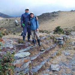
調查人員於州廳界遺址的臺階上合影

The former site of the Prefectural Boundary is located on the Batongguan Traversing Historic Trail of the Japanese Occupation period. It is mainly located on the southwestern side of the Dashuiku Pond at an altitude of about 3,240 meters.  It is a stone foundation with four 4.3 meters wide steps.  The stairs were the dividing line between Taichu State (now Taichung City) and Karenkou Prefecture (now Hualien County) during the Japanese occupation. In the past, the Governor-General in Taiwan once built a pavilion on the foundation to provide a resting place for travelers, and erected a wooden boundary marker in front of it. After the war, the Forestry Bureau built an iron hut in the 1970s that was later destroyed by strong winds and snow.

Today, the Yushan National Park Management Office rebuilt a hut with solar power and a rainwater tank on the original site.


Songshan Police Post
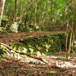
松山駐在所後方的古道路段

The Songshan Police Post in Yanping Township, Taitung County, was established in 1924. It was built by the Governor-General in Taiwan to improve the efficiency of monitoring Bunun people in the Pasnanavan area. The number of police officers stationed increased as police posts at Onzen, Siusui (Qingshui), Songshan, Kaili, Kakaiyu, Tavilin were successively set up on the left bank of the Beisilan River. The Songshan Police Post was withdrawn in 1930, and the control area of Siusui (Qingshui) Police Post was adjusted to cover the area between Onzen Police Post and Kaili Police Post. 


Taitung Cycas Nature Reserve
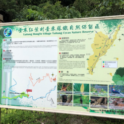
臺東蘇鐵自然保留區的立牌

Taitung cycas was misclassified as Taiwan cycas due to identification problems in the early days. It is an ancient living fossil. However, the precious wild cycas often get deforested and stolen, resulting in a sharp decline in the number. The wild Taitung cycas near Hongye Village in Yanping Township, Taitung County has the widest distribution area and the highest growth. In order to prevent Taitung cycas from being stolen and to maintain the existing species, the Forestry Bureau designated the area on both sides of Luye River as a cycas protection area in 1980, which is 7 km long from east to west and covers an area of ​​290.46 hectares. In 1986, it was announced as the Taitung Cycas Nature Reserve, which treats Taitung cycas as a rare plant and is strictly protected.


Mingye Bridge and Wuling Bridge
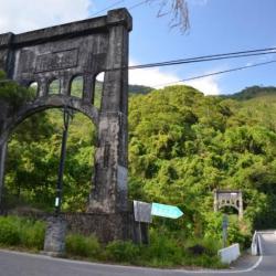
日治時期修築的明野橋為吊橋形式,右側為戰後興建的武陵橋

Mingye Bridge and Wuling Bridge in Yanping Township, Taitung County are located on the alluvial fan of Luliao Creek. The traditional Bunun name for the place is Bokurau, which means plain.

Mingye Bridge was a suspension bridge built during the Japanese occupation. The completion time is unknown. Wuling bridge was built after the war to connect Wuling Village and Xinfeng community. Since the environment in the Wuling area meets the requirements of the Governor-General in Taiwan for relocating indigenes, a vast amount of money was invested in the construction of facilities, and it has become the most successful collective migrating area in Taitung. In 1938, it also accommodated the relocation plan of the Bunun people from Kakalan and Masudala groups of Pasnanavan.


Bunker Ruins
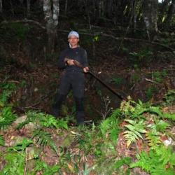
調查人員所立之處即為楓駐在所旁的碉堡遺址

The bunker ruins in Yanping Township, Taitung County, is a circular fortress with a diameter of 4 meters. It is located next to the Kaili Police Post and was used as a defense against the enemy. Today, only the foundation remains.

The Kaili Police Post was built by the Governor-General in Taiwan to improve the efficiency of monitoring Bunun people in the Pasnanavan area in 1924. The number of police officers stationed increased as police posts at Onzen, Siusui (Qingshui), Songshan, Kaili, Kakaiyu, Tavilin were successively set up on the left bank of the Beisilan River. The Songshan Police Post was withdrawn in 1930, and the control area of Siusui (Qingshui) Police Post was adjusted to cover the area between Onzen Police Post and Kaili Police Post. 


Zhongye Hamlet
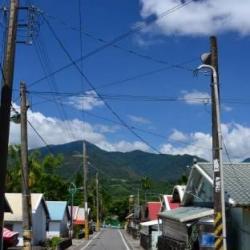
中野部落的街景

The Zhongye Hamlet is located on the west side of Luanshan in Yanping Township, Taitung County. The hamlet was formed when the Bunun group of the Pasnanavanshe was forced to move away by the Governor-General in Taiwan during the Japanese occupation in 1938. At that time, the foothills on the west side of Luanshan were planned to be an important area for the indigenous groups to migrate to. In 1941, people from Pasnanavanshe were collectively moved to three hamlets in the north, central, and south,  and they were called Ueno (Shangye), Nakano (Zhongye), and Geya (Xiaye). Police posts were also built in those three hamlets. Nakano (Zhongye) hamlet was later renamed to Luanshan Community in order to beautify its name.

Suspension Bridge Ruins
在清水至松山的古道上,通往對面的吊橋橋墩遺跡

The suspension bridge ruins in Yanping Township, Taitung County is located on the Pasnanavan Historic Trail from Siusui (Qingshui) to Songshan. The purpose of the bridge was mainly to cross over to the tribe on the opposite riverbank. However, the suspension bridge’s iron cable has been damaged and only the bridge piers are left. The tribe elders think that it was destroyed by the Haisul family when the Pasnanavan incident occurred in 1941.

The incident was caused by the Haisul family who originally lived in Halipusungshe. However, due to the indigene relocation project, the Haisul family and other tribesmen were collectively moved to the west side of Luanshan in 1940. The tribesmen could not adjust to the new environment and fell ill at the new location. Feeling angry, they moved back to Halipusungshe the following year and attacked the Siusui (Qingshui) Police Post at night. Three Amis police officers, Inspector Sugawara and his family were killed that night. The next morning, Haisul and tribesmen continued to attack the Kaili Police Post and Kakaiyu Police Post.

Longmen Gorge
開鑿於龍門峽谷岩壁上方的古道

The Pasnanavan Historic Trail, which crosses the Liugui District of Kaohsiung City and Yanping Township in Taitung County, was built in 1924. It starts from Liugui in the west and reaches Taoyuan in the east. The total length of the trail is about 126 km. In the past, the entry to the Trail was mostly from the west. Although the Governor-General in Taiwan found the passage long and difficult to get in and out, this trail was built nevertheless.

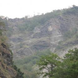
Today, the sections of the historic trail that was excavated above the rock walls of Longmen Gorge are steep, and both ends of the trail have collapsed, making it difficult to get there.

Kaili Police Post
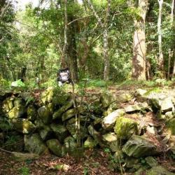
楓駐在所的地基駁坎

The Kaili Police Post is located on the river terrace of the Luye River in Yanping Township, Taitung County. It was built in 1924 by the Governor-General in Taiwan to improve the efficiency of monitoring Bunun people in the Pasnanavan area. The number of police officers stationed increased as police posts at Onzen, Siusui (Qingshui), Songshan, Kaili, Kakaiyu, Tavilin were successively set up on the left bank of the Beisilan River. Of which, the Songshan Police Post was withdrawn in 1930, and the control area of Siusui (Qingshui) Police Post was adjusted to cover the area between Onzen Police Post and Kaili Police Post. 


Siusui (Qingshui) Police Post
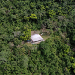
從空中俯瞰過去清水駐在所的位址

The Pasnanavan Historic Trail, which crosses the Liugui District of Kaohsiung City and Yanping Township in Taitung County, was built in 1924. It starts from Liugui in the west and reaches Taoyuan in the east. The total length of the trail is about 126 km. In the past, the entry to the Trail was mostly from the west. Although the Governor-General in Taiwan found the passage long and difficult to get in and out, this trail was built nevertheless.

The Siusui (Qingshui) Police Post was built by the Governor-General in Taiwan to improve the efficiency of monitoring Bunun people in the Pasnanavan area in 1924. The number of police officers stationed increased as police posts at Onzen, Siusui (Qingshui), Songshan, Kaili, Kakaiyu, Tavilin were successively set up on the left bank of the Beisilan River.