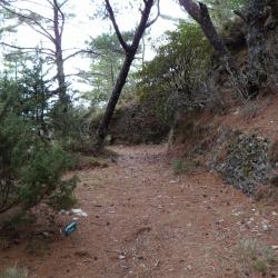
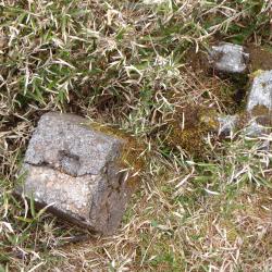
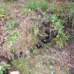
The Zhizhushan Police Post (Dujuan Camp) is located between the Xiuguluan Police Post and the South Police Post, about 3,150 meters above sea level. The police post was named after the flower Rhododendron that was abundant in the area. Hence, some call the police post the Rhododendron camp (Dujuan Camp). The Batongguan Traversing Historic Trail from the Japanese occupation period was located about 30 meters below the post, and so it is not the current mountaineering road that passes the post. During the Japanese occupation period, there were iron wires between the traversing historic trail and the post, which illustrates how indigenous peoples were prevented from entering the area at that time. Today, many living utensils from the past, such as wine bottles, can be found around the station.
布農族
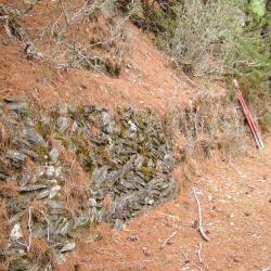
This image shows the current state of the barrier behind what used to be the Zhizhushan police post, about 1.2 meters high and 18 meters long.
The front door and the back door of the police post have rammed earth walls with layered stones and the ground is covered with pine needles.
The Banaik Refuge Mountain Shelter is located about 100 meters away from the Barnaik police post that was built during the Japanese occupation period. Due to the insignificance of its geographical location, the Banaik police post was abolished at the end of the Japanese occupation period. The origin of the location’s name is unknown.
The Batongguan trail of the Qing period begins from the Batongguan campsite of the Qing period, crossing the upper reaches of the Laonong River, along the southern edge of the front peak of the Batongguan to the northern edge of Mount Zhizhu, where it intersected with the traversing historic trail from the Japanese occupation period. Continue climbing along the edge and you will reach the Dujuan saddle.
The Bunun people call this place BaBahrasno, which means "river" because on the southern side of the Batongguan plain, there was a small tributary of the Yanong River passing through it. When the "Central Road" was built during the Qing Dynasty, this place was used ot be called Pantonukua, which is the Cou language for Yushan. This was later transliterated to Batongguan, and the path is being use to this day.
Due to the dangerous terrain and that Batongguan has a good outlook, there were police officers stationed there with trenches, observation decks, and shooting ranges during the Japanese occupation period. There was a wrestling field in front of the station. Every autumn a wrestling competition is held between the police posts, and there are two rows of rammed earth walls about 1.2 meters high. Batongguan plain was a place where the historic trail of Japan and of Qing Dynasty intersects.
Batongguan plain was a place where the historic trail of Japan and of Qing Dynasty intersects. The Bunun people call this place BaBahrasno, which means "river" because on the south side of the Batongguan plain, there was a small tributary of the Yanong River passing through it. When the "Central Road" was built in the Qing Dynasty, Pantonukua, which is the Cou language for referring Yushan, was used to call this place, and the transliteration was Batongguan. The Japanese continue to use it to this day.
During the Japanese Occupation period, the Batongguan police post was not located on the same foundation as the Batongguan Campsite in the Qing Dynasty period, but about 120 meters north of the Qing campsite.
Due to the dangerous terrain and that Batongguan has a good outlook, there were police officers stationed there with trenches, observation decks, and shooting ranges during the Japanese occupation period. There was a wrestling field in front of the station. Every autumn a wrestling competition is held between the police posts, and there are two rows of rammed earth walls about 1.2 meters high.
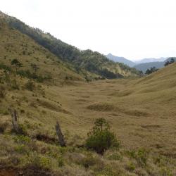
The Bunun people call Guangao Hahaguo, which means "low concave land" because it is a flat and broad saddle between Mount Batongguan and Mount Guangao. Guangao is connected to Dongpu in the north, the tribes along Daxi County in the northeast, and Batongguan in the south. During the Japanese occupation period, the two routes of "Central Line Road" and "Batongguan Traversing Historic Trail" intersect at Guangao, making it an important geographic location for military and for transportation purposes.
According to the data of Showa 11 (1936), there was 13 staff in the Guangao police post, and there were well-equipped houses and sentries.
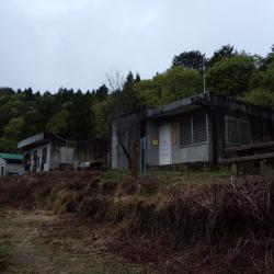
The Guangao Workstation is located below Guangaoping, some 66 kilometers away from Luanda Forest Management Office on Junda Forest Road. While it was first established for logging businesses and that trucks could travel the whole 83 kilometers long Junda Forest Road, today logging is forbidden and the passable passage is only 32 kilometers long as subsequent sections have not been repaired.
The Guangao Workstation, which originally belonged to the forestry system, has become the Guangao Conservation Research Station of the Yushan National Park Management Office.
The ridgeline behind the Guangao Conservation Research Station is Guangaoping, which is called Hahaguo by the Bunun people, which means "low concave land", because it is a flat and broad saddle between Mount Batongguan and Mount Guangao.
In August 2009, Typhoon Morakot caused a serious collapse in the western section of the Batongguan Traversing Historic Trail. There were 4 collapsed spots on the road between Guangao and Batongguan. The Guangao workstation sank due to the collapse, and the building structure has been tilted and cracked. Hence, it is no longer suitable for mountaineers to stay over. On September 15, 2010, Yushan National Park Management Office announced that it is prohibited to use.
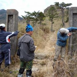
Duiguan police post is about 10.3 kilometers from the Dongpu Mountain Pass, at an altitude of around 2,100 meters. It is a flat ground with a wide field of vision. The Bunun people call this area Taikan, which means "the corner of the road", and the Japanese transliterated it into Chinese characters. Below the Duiguan police post is a magnificient canyon terrain of the Chenyoulan Valley. While the upper stream valley is flat and vast, which is an important geographical demarcation point for Duiguan. The Yushan National Park Management Office has placed an explanation board here, introducing the several police posts stationed along the Batongguan Traversing Historic Trail during the Japanese occupation period, one of which is Duiguan which is used as an important resting stop for hikers.