Guangao Police Post

Attractions along Batongguan Traversing Historic Trail

The Bunun people call Guangao Hahaguo, which means "low concave land" because it is a flat and broad saddle between Mount Batongguan and Mount Guangao. Guangao is connected to Dongpu in the north, the tribes along Daxi County in the northeast, and Batongguan in the south. During the Japanese occupation period, the two routes of "Central Line Road" and "Batongguan Traversing Historic Trail" intersect at Guangao, making it an important geographic location for military and for transportation purposes.

According to the data of Showa 11 (1936), there was 13 staff in the Guangao police post, and there were well-equipped houses and sentries.

  • - / -
  • - - -
  • -
  • - -/-
  • -
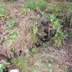
This image shows the platform under which the Guangao police post was stationed, and the relics such as wine bottles and teapots of the Japanese occupation can be found there.
This image shows what is today’s the helipad of Guangaoping. It used to be where the Guangao Police Post was stationed during the Japanese occupation.
古道地圖
沿途景點所在位置
沿途景點所在縣市
南投縣
沿途景點所在鄉鎮
信義鄉