Hamlet

Yabis
影像為雅比斯部落

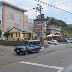
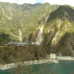
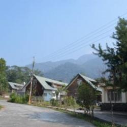
The hamlet is on the east side of the Nanshi hamlet, on the high ancient river terrace on the right bank of the Dajia River. The terrain is high and flat, and prehistoric stone tools can be collected from the surface of farmland. The residents came from Songhe hamlet after the 72 floods in 2004. In addition to the Atayal, the residents also include Hokkien, Hakka, Amis, and other ethnic groups. 

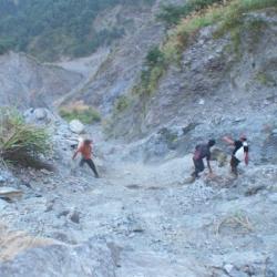
The Typhoons Mindulle and Aere in July and August 2004 hit Songhe hamlet, causing all 78 households to collapse. The county government and the office urgently placed the affected households in the Indigenous Arts Center. Because some areas of the Songhe Hamlet were listed as dangerous areas and could not be rebuilt, the government allocated 0.9 hectares of the land of the Indigenous Arts Center and had the Red Cross build 40 houses to resettle the Songhe victims.
 

Heping
影像為今臺中市和平區。

The original name of Heping is "Shaolaiping", which is a narrow river terrace on the right bank of Dajia River. The name came about after the "Shaolaishe" community moved here. Shaolaishe originally lived scattered in the northwestern part of Dongmao Mountain and the foothills on the west bank of Dongmao River. Later, due to a lack of cultivated land, the people moved to Misara. 

In the 39th year of Meiji, due to the ruling requirement, people were moved to the current place of residence. At the beginning of the move, there were 6 households with 23 people; In the 5th year of Showa (1930), two communities (Baimao and Baimao Aleng) were merged Nansei community. After the war, the Heping Township Office was moved here from Boai, and the name "Heping" gradually replaced the old Xiaolaiping. Heping is the administrative center of the district, where most of the agencies in the district are concentrated, such as the township representative assembly, police station, fire brigade, household registration office, peasant association, junior high school, library, and so on.
 

Old Hamlet of Shou Police Post
影像為壽駐在所舊部落殘留的舊鐵鍋,因長年曝曬於戶外,經風吹日晒,已氧化成碎片。

During the Japanese colonial period, January 31, 1926 was when the officials entered the Shou area and announced new police posts to be stationed in the area under the jurisdiction of the Lilong Branch Office.  Between Pasnanavan and the Kaohsiung state border, there are police officers stationed in Tachibana, Shou, Tokipan, Asahi, and Izumo, which belong to the third and fourth divisions of the third surveillance area of ​​the Lilong Branch Office. At that time, the Japanese have roughly established a defense border along the Pasikau River, running east-west across the Pasnanavan area of ​​the Central Mountain Range.

Wanfeng
位於萬豐部落下方的法治一號吊橋遺址

The Wushe Kashe Historic Trail from the Japanese rule leads to Wanfeng from Wujie. The exits are in Wushe of Renai Township and Bakuras hamlet, an old tribe in Dili Village, Xinyi Township, respectively. The trail along the Zhuoshui River has gone through a rebuild and the trail from north of Wanfeng village to Wushe has been replaced by the current highway. Currently, there are sections of the trail remaining near Inago and the route from Wujie to Bakuras hamlet.

Due to the 1999 Jiji earthquake, the Morakot typhoon, and several heavy rainfalls the trail is broken into pieces. What is now left is some remains of suspension bridges, pillars, and fragments of the trail. At present, there are still relics of the trail on the Wujie Dam and the rock walls beside the dam.
 

Liangjiu Falls
影像為位於良久社下方的良久瀑布,霧社、卡社古道於其上方通過

The Wushe Kashe Historic Trail that was built during the Japanese colonial period was actually composed of two sections of ancient routes, namely "Wanda Kashe trail" and "Wanda Wushe trail". The Wushe Kashe Historic Trail was the first Lifan road (Indigene management route) to be studied. The trail passes through the traditional territories of the Sediq and Bunun, and has important Qubing archaeological sites along the way. It was the earliest path of the ancestors and therefore, the ruins, settlements, and trails have considerable academic value and indicator significance.

Kngungu-she
影像為各姆姆社駐在所,日治時期曾在此設立駐在所,金洋社至各姆姆社亦有標準的警備道路,此社於昭和元年(1926)12月,共31戶115人併入金洋社中,各姆姆社自此廢社

Kngungu is an ancient tribe of Klesan. According to the oral tradition of its migration, each tribe left the ancient tribe of habun Kolo and went east to Piahaushe. This settlement was later established as a permanent hamlet by the Mabaala people and continued until the 1930s. While the Kana-Xaqual people crossed Piahaushe, went alond the north Heping River towards the east and settled in Moyao, Kngungu and other places. 

Later, they moved away from the land of Kngungu to the north (upward along the mountain ridge) around 1,000 kilometers above sea level and gradually established settlements Jinyangshe, Kigayangshe, Kubabo, Kelumuo’anshe, Hagawan, Hagaparis, Tabera, Lahau and Klgyah. The Kana-Xaqual people exhibit a continuous linear community diffusion, making them an important ancient tribe for the spread of the Squliq language.
 

Ryohen-she
照片中央無樹林地區即為流興社,週邊較淺色為林務局於 1970 年代所種之楓香樹。

Ryohen-she is located on the slope facing east, the ridge line between Buxiaowan River and Ryohen (Kong Sawsi) River, a tributary of  north Heping River, at an altitude of about 1,000 meters. The area is open, sunny, and suitable for living. The residents believe that their ancestor Bato Naui set out from pinsəbəkan together with Wasau Payas, crossed the Nanhu Mountain and arrived at habun kolo, where Bato stopped and settled. Wasau Payas and his tribe carried on moving eastward to kngungn (south of old Jinyangshe, Linxi Platform), where Wasau died. The tribe later moved to Tbunan, a platform by the river terrace on the right bank of the Buxiaowan River estuary.  

Decades later, due to the increase in population, the tribe migrated to three different places, namely Ryohen-she, which was lead by the then leader Takun Bakotsi. They went up along the Ryohen River to the mountainside to establish the settlement. The other group traveled northward for about one kilometer to establish Gogotsu-she, while the third group, led by Meraaran, established the Rəkinos-she near Gogotsu-she.

Kubabo Landslip
影像為調查人員越過庫巴博大崩壁

"Bbu" means "a place with a good view from the platform on the mountain" in the Atayal language. From the name, it is clear how the terrain of this hamlet is like. The hamlet is located at the intersection of the left bank of the north Heping River and the Mohen River, at an altitude of about 1,200 meters. The Japanese Occupation Security Road passes below the hamlet, leading to Liuxingshe in the east and Jinyangshe in the west. There is an Education Center for indigenous children and a fort in Kubaboshe. At present, the school playground, the command platform, and the drainage ditch can still be seen in the hamlet. 
In the early days, traditional Atayla house was used as the official’s office. Later in the first year of the Showa era (1926), the Japanese built the Kubabo police post  using cypress wood. However, there are no traces of the wooden structure of the building any more, only huge  stacked stone foundations remain.

Deji Reservoir
臺電公司大甲溪發電廠德基分廠,前方水壩為德基壩

The Deji Reservoir is located on the upper reaches of Dajia River in Heping District, Taichung City, with steep slopes and many passes. At the end of the Japanese occupation, the Governor-General in Taiwan planned the development of the Dajia River. The plan was to build a weir in the upper reaches of Dajia River to store water for generating electricity, agricultural irrigation and industrial water use. However, the plan was interrupted due to the defeat of Japan. In the post-war period, the Nationalist Government followed the plan of the Governor-General, and the power development plan was still based in Dajian, with six power plants including Dajian, Qingshan, Guguan, Tianlun, Maan, and Shigang. In 1973, Deji Dam started to store water, forming a big lake in the shape of a goose egg. In the following year, the plant officially generated electricity.

Shayun’s Bell
莎韻之鐘鐘樓遺址

Shayun’s Bell Tower is located in Liuxingshe in Nanao Township, Yilan County. The Atayal traditional name for the place is Lyoxing, which means bird’s nest fern that grew there. Due to the geographical location, it restricted the only passage to the Lanyang Plains from the Klesan mountainous area.  It is also the main pass to the east coast. Since the Qing Dynasty, it has always been the country’s most important battlefield. In fact, in the middle of the Japanese rule, the Government-General in Taiwan vigorously promoted the emperor’s movement and began to plan and operate the story of Shayun’s Bell. The Liuxingshe was the origin of the story, and the ruins of the bell stand can still be seen today.