Hamlet

Maobian Police Post
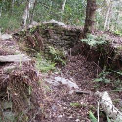
茂邊駐在所的遺址

The Maobian Police Post is located in the saddle of Mouhen in Nan'ao Township, Yilan County. It was built in 1919 for the year when the Paihau Historic Trail was also excavated. There is also a Tongshan branch route that reaches Hanxi Village in the north and connects to the main route near Leyoxenshe. The main route is about 87.2 km in length and the branch route is about 44.2 km, both pass through the traditional territories of the Atayal tribe of the Nan’ao group.

During the Japanese occupation, Taiwan’s Governor-General used the Piahau Historic Trail as the path for migrating the Atayal people, forcing them to move out of their village. In the early post-war period, the National Government also forced the tribes to move to the plains.
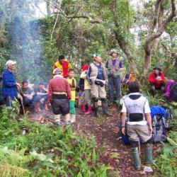
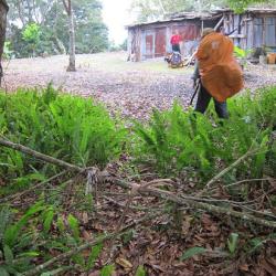
Futaishan Guard Road Entry
富太山警備道入口平臺,族人稱其為Biuho

The entrance of Futaishan Guard Road is located in the Heliu River Basin in Nan’ao Township, Yilan County. To get there, walk north from Nanzi Police Post towards Wutashe, passing the three-way intersection in front of Nan'ao Nanxi, and then climb up the ridgeline in the south-west direction. After boarding the ridgeline, you will arrive at a small platform, which is the entrance of the Futaishan Guard Road, and the Atayal named it Biuho. This section of the trail passes through the south side of the Futaishan and connects with Gegezi Guard Road. Where they intersect was the former site of the Heliu Police Post.

Today, the Atayal people still use this path especially when they planted shiitake mushrooms in the 1970s.

Tongshan Police Post
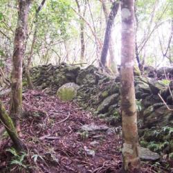
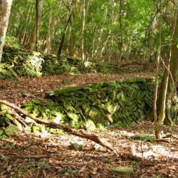
銅山駐在所的砌石疊牆

Tongshan Police Post is located in the south-west of Tongshan in Nan'ao Township, Yilan County. It sits at an altitude of about 1,620 meters. In fact, the Piahau Historic Trail, which runs through Nan’ao Township and Datong Township in Yilan County, was built in 1919. There is also a Tongshan branch route that reaches Hanxi Village in the north and connects to the main route near Leyoxenshe. The main route is about 87.2 km in length and the branch route is about 44.2 km, both pass through the traditional territories of the Atayal tribe of the Nan’ao group.

During the Japanese occupation, Taiwan’s Governor-General used the Piahau Historic Trail as the path for migrating the Atayal people, forcing them to move out of their village. In the early post-war period, the National Government also forced the tribes to move to the plains.
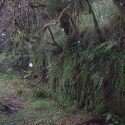
Doras Hunting Hut
Doras獵寮位在Yax Bula鞍部至哥各茲社之間的稜線北側上

Doras hunting hut is located on the north side of the ridge line between Yax Bula Saddle and Gegezishe in Nan'ao Township, Yilan County. It has an open terrain and a good view due to the high elevation. It is owned by the elderly Doras of Jingyang Village. He was the last elder of the Kubabuoshe to be moved down from the mountain. However, according to the field survey record, this place was rebuilt  during the Japanese occupation by the Government-General in Taiwan. It can be identified from the stone stacked at the bottom of the working hut that it was not the traditional technique of the Atayal people. In addition, according to historian Liao Yingjie's research, this place may be the Gegezi Dispatching Station, and it was once the Gegezi Meteorological Observatory.

Hagaparis'she
哈卡巴里斯社築有大範圍石牆以防禦山豬

200 years ago, the ancestor Gunpai Noekkan  led 9 households of 36 people to settle here at the Hagaparis Hamlet in Nan’ao Township, Yilan County. They traveled from the north of Lishan Mountain to Moyao in Heping River Basin cutting through Nanhu Dashan and settled in Hagawan-she. The son of Noekkan carried on, leading the tribe to migrate again to build a community in Hagaparis. According to the records of the Japanese anthropologist, Mori Chosuke, the Hagaparis community had only 17 households. Due to its remote location, the Governor-General in Taiwan did not open a guard road here but had once stationed a police post. In the early days of the Japanese occupation, the people of Hagaparis Hamlet moved to Hanxi Village around 1915, and then moved to Nan'ao Plain in 1964 to live with the people of Wuta Village.


Piahaushe
從次考干溪遠眺比亞毫社

Piahaushe in Nan’ao Township, Yilan County, is located on the river terrace on the right bank of the upper reaches of Hepingbei Creek. It is located at the confluence of the Cikaogan River. It sits at an altitude of about 1,000 meters. The traditional Atayal name for it is Biho, which is based on the name of the tribal leader, Biho Naui. During the Japanese occupation, it was named Baiyaushe, which stem from the Japanese pronunciation of “Piyahau”. In the post-war period, it was transliterated into Piahau. After the tribes migrated to the plains of Nan’ao, the place was commonly called Bihou.

Jingyangshe
金洋社的遺址

Jinyangshe is located on a south-sloping hillside on the left bank of Hepingbei Creek in Nan’ao Township, Yilan County.  It is about 1,200 meters above sea level. Due to the terrain, it is divided into the Knyan Hamlet on the west side of the valley and the Yuwu Hamlet on the east. The Atayal traditional name of the place is Nekenyan, which means forgotten because it is said that in the past, the tribesmen forgot their things there. Regarding the reclamation history of the Jingyangshe, the ancestor Takun Bato led the tribe from Pinsəbəkan through the Nanhu Dashan and the Biyahaoshe to settle in Kngungn in the 1790s. Later, his son Ponya led the tribe to move to Jingyangshe.

During the Japanese occupation, the Jingyangshe, Biyahoshe, and Kubaboshe were regarded as big communes due to their large population and power.


Songshan Police Post
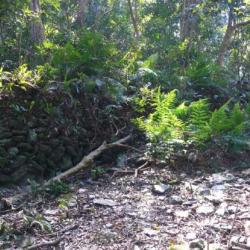
松山駐在所後方的古道路段

The Songshan Police Post in Yanping Township, Taitung County, was established in 1924. It was built by the Governor-General in Taiwan to improve the efficiency of monitoring Bunun people in the Pasnanavan area. The number of police officers stationed increased as police posts at Onzen, Siusui (Qingshui), Songshan, Kaili, Kakaiyu, Tavilin were successively set up on the left bank of the Beisilan River. The Songshan Police Post was withdrawn in 1930, and the control area of Siusui (Qingshui) Police Post was adjusted to cover the area between Onzen Police Post and Kaili Police Post. 


Taitung Cycas Nature Reserve
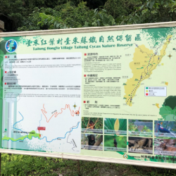
臺東蘇鐵自然保留區的立牌

Taitung cycas was misclassified as Taiwan cycas due to identification problems in the early days. It is an ancient living fossil. However, the precious wild cycas often get deforested and stolen, resulting in a sharp decline in the number. The wild Taitung cycas near Hongye Village in Yanping Township, Taitung County has the widest distribution area and the highest growth. In order to prevent Taitung cycas from being stolen and to maintain the existing species, the Forestry Bureau designated the area on both sides of Luye River as a cycas protection area in 1980, which is 7 km long from east to west and covers an area of ​​290.46 hectares. In 1986, it was announced as the Taitung Cycas Nature Reserve, which treats Taitung cycas as a rare plant and is strictly protected.


Mingye Bridge and Wuling Bridge
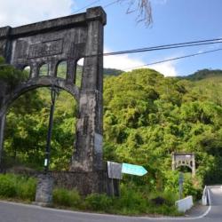
日治時期修築的明野橋為吊橋形式,右側為戰後興建的武陵橋

Mingye Bridge and Wuling Bridge in Yanping Township, Taitung County are located on the alluvial fan of Luliao Creek. The traditional Bunun name for the place is Bokurau, which means plain.

Mingye Bridge was a suspension bridge built during the Japanese occupation. The completion time is unknown. Wuling bridge was built after the war to connect Wuling Village and Xinfeng community. Since the environment in the Wuling area meets the requirements of the Governor-General in Taiwan for relocating indigenes, a vast amount of money was invested in the construction of facilities, and it has become the most successful collective migrating area in Taitung. In 1938, it also accommodated the relocation plan of the Bunun people from Kakalan and Masudala groups of Pasnanavan.