Indigene Management Route

Qiugang Cliff
從空中俯瞰萩岡斷崖

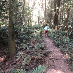
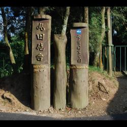
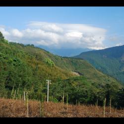
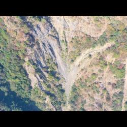
The Qiugang Cliff is located between Erbensong and Qiugang on the Beikeng Creek Historic Trail. It is about 3 kilometers away from the Erbensong hiking entrance, with a total length of 300 meters of gravel road. The road is divided into two parts. First, the long-distance cliff is composed of gravel slopes, about 200 meters in length, and it can be seen that the Beikeng River and Nankeng River converge to form the Da’an River. The second part is the formation of cliffs.

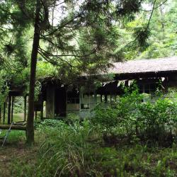
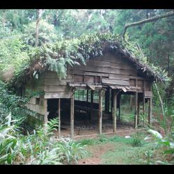
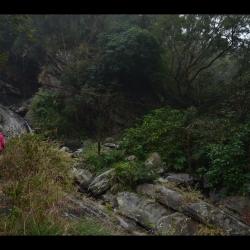
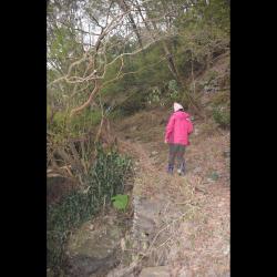
Around 2003, the historic trail section of Erbensong was recovered by the Xuepa National Park. However, due to natural disasters, the entire section is still closed. The Qiugang Cliff, known as the top ten scenic spots of Beikeng Creek Historic Trail, is  also hard to get close to.

Erbengsong Trench Ruins
二本松駐在所通往丸田砲臺的古道路段

The Erbensong trench ruins in Tai'an Township of Miaoli County is located on the river terrace platform on the southern slope of the Erbensong Police Post, about 1,350 meters above sea level. It was designed to facilitate the Wantian Battery in combat and to prevent from indigenes attacks. There is a piled stone road built next to the Erbensong trench, which is the road that connected Wantian Battery to Erbensong Police Post during the Japanese occupation. The road was mainly used for transporting grains and firearm supplies, so that the Government-General in Taiwan could monitor the northern Atayal group through the firepower of the battery.

Today, the remains of the trench are about 550 meters long, and the Sheipa National Park has renovated it into a hiking trail, surrounded by artificial forests.


Song’an Police Station
2003年松安派出所尚未拆除的水泥建築

The Song’an Police Station, in Tai’an Township of Miaoli County, was originally the Erbensong Police Post during the Japanese occupation, built in 1911. In Japanese, Erbensong refers to a place with two pine trees. The traditional Atayal name for the place is Pihun, which means door. Both have the meaning of entering Beikeng Creek.

The Erbensong Police Post was set up with the purpose of monitoring the northern group of the Atayal tribe in the Da’an River Basin during the Japanese rule. However, there have been fierce attacks by the Atayal tribe. In the post-war period, the National Government changed its names to Erbensong Police Station and Song'an Police Station.

When the Jiji earthquake occurred in 1999, police officers were moved to Meiyuan Police Station, which has now been converted into Erbensong Visitor Center.

Beikeng Police Post (Front)
Tayal,泰雅族,理蕃設施,駐在所

The Beikeng Police Post, in Tai’an Township of Miaoli County, was established in 1923. It is located on the 14.6 km point of the Beikeng Creek Historic Trail and is about 1,640 meters above sea level. The traditional Atayal name for the place is Simayen, which means floor-like lawn.

The Beikeng Police Post was originally the administrative center of the Beikeng Creek Historic Trail. There was an education center, Wude Hall, medical facility, places for trades, guns and ammunition depot and so on, of which the buildings still remain on the trail today.

To get there, enter from the Simaxian Forest Road in the Xuejian Recreation Area, climb up the Simaxian Forest Road to an altitude of about 2,000 meters, and then descend about 360 meters to arrive at the station.


Beikeng Police Post (Side)
北坑駐在所遺址上的木造工寮,為戰後林務局所設置的

The Beikeng Police Post, in Tai’an Township of Miaoli County, was established in 1923. It is located on the 14.6 km point of the Beikeng Creek Historic Trail and is about 1,640 meters above sea level. The traditional Atayal name for the place is Simayen, which means floor-like lawn.

The Beikeng Police Post was originally the administrative center of the Beikeng Creek Historic Trail. There was an education center, Wude Hall, medical facility, places for trades, guns and ammunition depot and so on, of which the buildings still remain on the trail today.

To get there, enter from the Simaxian Forest Road in the Xuejian Recreation Area, climb up the Simaxian Forest Road to an altitude of about 2,000 meters, and then descend about 360 meters to arrive at the station.

Wantian Battery Entrance
丸田砲臺步道的入口處

The Wantian Battery Trail entrance, in Tai’an Township of Miaoli County, is located on the 15 km point of Simaxian Forest Road and is about 1,310 meters above sea level. The trail was set up to monitor the northern Atayal group during the Japanese occupation. The battery was erected on the ridge line or high point of the mountain overlooking tribal villages in order to intimidate indigenous people.

In the early days of Japanese rule, the Governor of Taiwan, Sakuma Samata organized a large-scale crusade to manage the indigenes. In 1911, he suppressed the northern group of Atayal tribe with superior force. Police Officer, Maruda Kiyoshi, was killed during this fight and therefore, the battery was named after him. Today, the remains of the Wantian Battery are hidden in the forest of Cryptomeria.


Overlooking Wantian Battery
從天狗部落遠眺東方稜線上的丸田砲臺

The Wantian Battery in Tai’an Township of Miaoli County is located on the river terrace south-facing from Erbensong Police Post. It is about 1,310 meters above sea level, and was set up to monitor the northern Atayal group during the Japanese occupation. The battery was erected on the ridge line or high point of the mountain overlooking tribal villages in order to frighten indigenous people.

In the early days of Japanese rule, the Governor of Taiwan, Sakuma Samata organized a large-scale crusade to manage the indigenes. In 1911, he suppressed the northern group of Atayal tribe with superior force. Police Officer Maruda Kiyoshi was killed during this fight and therefore, the battery was named after him. Today, the remains of the Wantian Battery are hidden in the forest of Cryptomeria.

Suspension Bridge next to Old Haocha Water Source
舊好茶部落水源地旁的吊橋遺跡

The remains of the suspension bridge next to the water source of the old Haocha Village is about 1,000 meters above sea level. Although the bridge has been destroyed, you can still see the main iron cable of the suspension bridge that spans across the stream. Heading down the mountain along Wutai Haocha Historic Trail you will reach Sandimen. To this day, at the trail entrance next to the water source of the abandoned Old Haocha Elementary School, there is still a complete stone-stacked road. However, there is only about 1 km of walkable historic trail remaining, and the rest have collapsed.

Jiuhaocha (Old Haocha) Elementary School
漆面脫落的舊好茶國小教室黑板

The Old Haocha Elementary School, located in Wutai Township, Pingtung County, is currently abandoned. The ceiling of the building collapsed, leaving only the walls, beams, pillars, and overgrown grass. During the Japanese occupation, the Government-General in Taiwan set up a police post and educational institution on the edge of the Old Haocha Village in the east with the aim to transfer tribal power through the entry of state power, and to become the main authority to manage the village. Also, to stabilize tribal governance through national education and teaching village children Japanese.  In the post-war period, the National Government established independent villages based on each police post, and the original educational institute was restructured into the Haocha Public School.

Historic Trail next to Old Haocha Water Source
舊好茶部落水源地旁的古道

Wutai Haocha Historic Trail entrance is located next to the water source of the Old Haocha Elementary School and is about 1,000 meters above sea level. Most parts of the trail have collapsed, leaving only about 1 km of the historic trail left for passage. Currently there is a suspension bridge ruin and the stone-stacked road is complete. The original starting point of the Wutai Haocha Historic Trail was located in Zhenxing Village, Yanpu Township, Pingtung County, and passes through Sandimen, Wutai and Old Haocha successively. It has a total length of about 27.9 km. During the Japanese occupation, the trail was designed for connecting villages. Today, the section that starts from Sandimen has been widened and became the Provincial Highway 24 leading to Wutai.