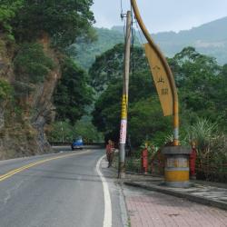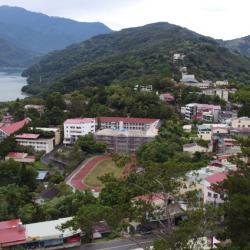
Wushe, located in Ren'ai Township, Nantou County, sits above the terrace on the west bank of the upper Meixi creek at an altitude of 1,148 meters. It is the intersection of three historic trails: Nenggao Traversing Historic Trail, Hehuan Traversing Historic Trail and Pyanan Historic Trail. It is also the hub of the Aiyong Boundary and has been vigorously constructed by the Governor-General in Taiwan, with administrative agencies, trade companies, hotels, and so on.
In the past, Wushe was not inhabited locally. The Zhuo group of the Bunun tribe called it Ish-Tibuo, which means the northern tribe. During the Qing period, the Han people used Hoklo language to transliterate it to Zhiwushe. Later, it got referred to as Wushe. In the post-war period, the National Government established the township office on Yingtai next to Wushe main street. Today, the residents are mostly Han Chinese.