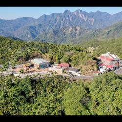
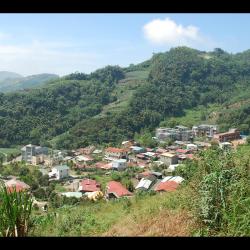
Located at the junction of Alishan Township in Chiayi County and Xinyi Township in Nantou County, Zizhong is at the valley pass between the Alishan Mountain Range and the Yushan Mountain Range. During the Japanese occupation, this place was called Eryu (Kodama), mainly in memory of Taiwan Governor Kodama Gentaro. But after the war, the name was changed to Zizhong in memory of Zhang Zizhong, an anti-Japanese General during World War II. In 1931, the Government-General in Taiwan completed the construction of the Shuishan Line of the Alishan Forest Railway, which went from Zhaoping to Eryu (Zizhong), also known as the Eryu (Kodama) Line.
Tsou
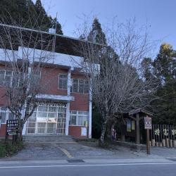
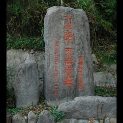
Tfuya Historic Trail (Old railway of the Shanshui Line)
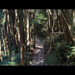
Located in Alishan Township of Chiayi County, the Tfuya Historic Trail (Old Railway of the Shuishan Line) is a branch line of the Dongpu Line of the Alishan Forest Railway in the past. The railway was completed in 1931, leading from Zhaoping to Eryu (Zizhong), and thereafter extending to Xingaokou. It is a railway built by the Government-General in Taiwan to develop the forest resources of Alishan during the Japanese occupation. Where the old Shuishan line meets Zizhong, there was a railway line branching out to the southwest. That is the current section of the Tfuya Historic Trail. However, the railway was abandoned in 1977. In 2001, the Chiayi Forestry Administration reorganized a part of the railway and made it the Tfuya Trail for tourists recreational hike.
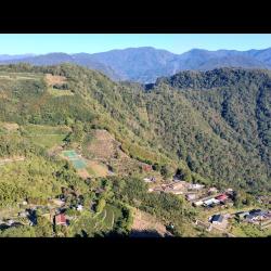
Tfuya Hamlet
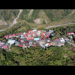
Tefuya Hamlet in Dabang Village, Alishan Township in Chiayi County. It is located on the high river terrace on the left bank of the Zengwen River. It is about 1,050 meters above sea level. It is an important passage for the Tsou people to go to Yushan area for hunting. As Tfuye hamlet is situated closer to the source of the Zengwen River, the traditional name is Tsumuna, which means water source. However, relevant documents from the Qing period noted that this place was called Zhumulaoshe or Duwuliaoshe. It was also recorded as Zhimulaoshe or Tunmushe in the early days of Japanese occupation. Both terms were transliterated from the pronunciation of tu-bu-la in Hoklo language. It was not until after the war that the term was transliterated into Tfuya in Chinese.
Tsatsaya Hamlet
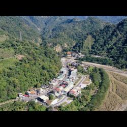
The Tsatsaya Hamlet is located in Shanmei village, Alishan Township in Chiayi County. It is located below the junction of Alishan Highway and Shanmei Industrial Road. It was a small community of the bigger Dabang group of the Tsou tribe. The traditional name is Tsatsaya, but was called “Laitoushe” by the Han people at that time, because the hamlet is located near Laitou (Longmei) of Fanlu Township. Today, the hamlet is known by Zhizhiya, which is the transliterated name of Tsatsaya. In the early days of Japanese occupation, the Tsatsaya hamlet had six households with 52 people, and in the early post-war period, there were nine households with 48 people. Also, since they were located near the Alishan Forest Railway, they had earlier contacts with the outside world.
Gongtian Village
Gongtian Village, located in Fanlu Township, Chiayi County, is bounded by Zhuqi Township and Alishan Township from the north to the east. People of the Liu family named this place Gongtian (literally means public field) because this piece of land was jointly cultivated. Gongtian then gradually became a regional general term. During the Japanese occupation, this place belonged to Gongtian Dazi and a police post was set up. In the post-war period, the administrative area was re-structured. The main settlement remained to be Gongtian and thus, the old administrative area name, Gongtian Village, was used.
Chukou Village
Chukou Village of Fanlu Township, Chiayi County, was the last flatland settlement to be established in the Alishan area. It is located at the valley entrance where the Bazhang River flows from the mountains to the flat land. There are two bridges, Tianchang and Dijiu, on the upstream and downstream of the river respectively. This is also where the Chukou fault is located. The Bazhang River that sits in between two mountain walls forms a cliff with a huge drop. It is as steep as two bulls fighting head-to-head, hence the name.
At the end of the Qing period, this place was developed into Chukou Street, which was a trading hub for mountain products. In the early days of the Japanese occupation, there was a railway for transporting goods leading to Chiayi South Gate via Dingzhongxia Street (Dingliu). At that time, there were 36 households and 134 people in Chukou village. At the end of the Japanese occupation period, there were only 18 households left.
Wailaiji (Outer Laiji) Village
The Wailaiji Hamlet is located on a terrace where the Tashan River merges into the mainstream in Laiji Hamlet in Alishan Township, Chiayi County. It is about 1 km north of the Neilaiji Hamlet and the traditional name is Bon, which means outside pump. During the Qing period, Wailaiji Hamlet was a new community of the Liuliuzi clang, and because it was located in the north of the old site, it was named Wailaiji (Outer Laiji). In the early days of Japanese Occupation, the Government-General in Taiwan built a police post and an education center indigenous children because this area had relatively large flat land.
Neilaiji (Inner Laiji) Village
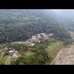
Neilaiji Hamlet is located in the alluvial land on the right bank of the Alishan River, in Laiji Village, Alishan Township, Chiayi County. The traditional name is Bnguu or Pnguu, which means low basin. It is also known as the old Laiji Hamlet. During the Qing period, the people of Neilaiji Hamlet moved from Tfuya to Lalauya and lived there for about 20 years. Then they crossed the Shitzulu and temporarily settled in traditional territories such as Chumana, Meongo, and Fnafnau. Finally, they moved to the current Neilaiji during the Japanese occupation. Relevant documents from the Governor-General in Taiwan noted that the migration road between Shitzulu and Laiji Hamlets was repaired in the middle of the Japanese occupation.
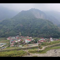
Lalauya Hamlet
Located in Alishan Township, Chiayi County, Lalauya (or Leyeh) Hamet is located about 2 km away from Shizhao Section of Alishan Highway. It is a small community derived from Tfuya village. Due to the ravages and natural disasters in the past, the tribes moved here. The name Leyeh is the transliteration of the traditional Tsou name, Lalauya.
In the early days of the Japanese Occupation, the tribe had 5 households with 70 people. In the early post-war period, the number increased to 26 households with 111 people. With the opening of the Alishan Highway that connected the county roads and township roads, it made traveling more convenient for the Tsou people. Especially since 2003, the Alishan township office, household registration office and police station have all moved to nearby areas. Lalauya has become the administrative center of the whole township.
Shitzulu (Laiji Trail)
Shitzulu (Laiji Trail) is located between Shizi village and Dabang village in Alishan Township, Chiayi County. It is about 1,530 meters above sea level and was used to be a passage between Tfuya village and Laiji village of the Tsou. The name Shitzulu means crossroad because during the Japanese occupation, this area was marked as a crossroad on the mountain line. At that time, when the Alishan Forest Railway was built by the Governor-General in Taiwan, it was also the residence of the railway workers. After the completion of the railway, the Shitzulu Station was built. Later, due to the development of the camphor industry, they settled in camphor workers and formed a Han settlement.
Today, the Shitzulu Station settlement is only about 50 meters away from the Alishan Highway, which is the closest place between the railway and the highway.