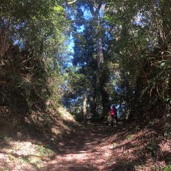
The Tfuya Historic Trail, which straddles the junction of Alishan Township in Chiayi County and Xinyi Township in Nantou County, mainly leads from Tfuya to Zizhong. It was a path that the Tsou people used for hunting, wedding, and visiting families in the past. In addition, it can be connected to Tataga and all the way to the Yushan area, which is an important passage for connecting Alishan and Yushan. In the middle of the Japanese occupation period, the Government-General in Taiwan rebuilt the old trail adjacent to Zizhong into an old railway on the Shuishan Line, which was used to transport timber. The railway was abandoned in 1977 and in 2001, the 6.32 km long trail that goes from Tfuya to Zizhong was refurbished, preserving the original railway pavement, which is the Tfuya Historic Trail known today.
Tfuya
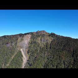
Tashan is one of the Alishan mountain ranges. The mountain ranges from east to west. The rock formations are arranged horizontally and stacked on top of each other like a tower. The main peak of Tashan Mountain is 2,663 meters above sea level. It is the holy mountain of the Tsou tribe.
The traditional Tsou name is Hocubu, which has a meaning of the goblins’ nest and home to the spirits. Tsou people believe that the spirits live on Tashan after death, and that the good spirits live on Big Tashan, while the evil spirits live on small Tashan. Small Tashan is 2,484 meters above sea level, and its traditional name is Maeno, which means peak.
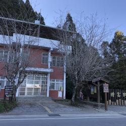
Located at the junction of Alishan Township in Chiayi County and Xinyi Township in Nantou County, Zizhong is at the valley pass between the Alishan Mountain Range and the Yushan Mountain Range. During the Japanese occupation, this place was called Eryu (Kodama), mainly in memory of Taiwan Governor Kodama Gentaro. But after the war, the name was changed to Zizhong in memory of Zhang Zizhong, an anti-Japanese General during World War II. In 1931, the Government-General in Taiwan completed the construction of the Shuishan Line of the Alishan Forest Railway, which went from Zhaoping to Eryu (Zizhong), also known as the Eryu (Kodama) Line.
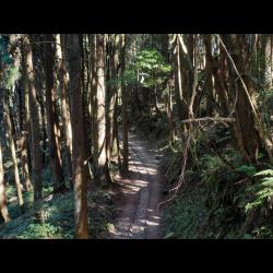
Located in Alishan Township of Chiayi County, the Tfuya Historic Trail (Old Railway of the Shuishan Line) is a branch line of the Dongpu Line of the Alishan Forest Railway in the past. The railway was completed in 1931, leading from Zhaoping to Eryu (Zizhong), and thereafter extending to Xingaokou. It is a railway built by the Government-General in Taiwan to develop the forest resources of Alishan during the Japanese occupation. Where the old Shuishan line meets Zizhong, there was a railway line branching out to the southwest. That is the current section of the Tfuya Historic Trail. However, the railway was abandoned in 1977. In 2001, the Chiayi Forestry Administration reorganized a part of the railway and made it the Tfuya Trail for tourists recreational hike.
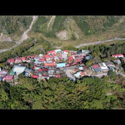
Tefuya Hamlet in Dabang Village, Alishan Township in Chiayi County. It is located on the high river terrace on the left bank of the Zengwen River. It is about 1,050 meters above sea level. It is an important passage for the Tsou people to go to Yushan area for hunting. As Tfuye hamlet is situated closer to the source of the Zengwen River, the traditional name is Tsumuna, which means water source. However, relevant documents from the Qing period noted that this place was called Zhumulaoshe or Duwuliaoshe. It was also recorded as Zhimulaoshe or Tunmushe in the early days of Japanese occupation. Both terms were transliterated from the pronunciation of tu-bu-la in Hoklo language. It was not until after the war that the term was transliterated into Tfuya in Chinese.