The migration process of the Chinuosi-she that got passed down orally is almost identical to that of the Gogotsu-she, and the relationship between the two communities is very close. Chinuosi-she was established during the time of the chief Meraaran. At that time, they were living with Gogotsu-she on the Tbunan platform on the right bank of the Bouxiao Wanxi estuary. After a while, Meraaran found that the Chinuosi-she was suitable for settlement and moved here. However, the tribe has difficulty in obtaining water because Chinuosi situated in the middle of the mountain, facing the north Heping River with a steep cliff in the southwest. Therefore, they began migrating to the south Nan’ao River, around 4 kilometers east of sendan police post in 1915. In 1920, many people died due to influenza and malaria and in 1923, Chinuosi-she relocated to the right bank of south Nan’ao River, around 1.3 kilometers south of sendan police post, and renamed Xuantanshe, with a total of 52 people of 16. households. As the land was too sloping and difficult to cultivate, the cmmunity relocated again to a platform 1 km northeast of the sendan police post in 1931, and finally moved to the current Jinyang Village.
klesan
The ancestors of the Gogotsu-she came from the upper reaches of Dajia River. They passed through habun sublus and Nanhu Mountain, and finally settled in a place called bbu (meaning flat top) in the upper reaches of north Heping River. They have also lived in Piahaushe and after that, went down along the north Heping River and lived on the Tbunan platform on the right bank of the Boxiaowan River estuary. Due to the increasing population and lack of arable land, the people later migrated to Gogotsu-she. Since 1913, members of the Gogotsu-she have successively moved to Sifanglin and upper Dong’aoshe in Hanxi Village (north of Dong’ao Police Station). Originally it was called lower Gogotsu-she, with a total of 59 people of 11 households. In 1922, it was renamed the Upper Dong’aoshe.
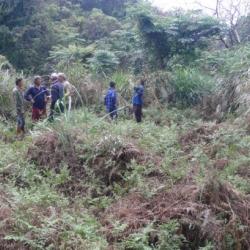
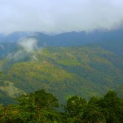
"Bbu" means "a place with a good view from the platform on the mountain" in the Atayal language. From the name, it is clear how the terrain of this hamlet is like. The hamlet is located at the intersection of the left bank of the north Heping River and the Mohen River, at an altitude of about 1,200 meters. The Japanese Occupation Security Road passes below the hamlet, leading to Liuxingshe in the east and Jinyangshe in the west. There is an Education Center for indigenous children and a fort in Kubaboshe. At present, the school playground, the command platform, and the drainage ditch can still be seen in the hamlet.
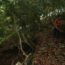
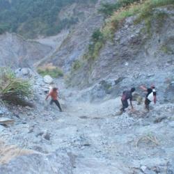
In the early days, traditional Atayla house was used as the official’s office. Later in the first year of the Showa era (1926), the Japanese built the Kubabo police post using cypress wood. However, there are no traces of the wooden structure of the building any more, only huge stacked stone foundations remain.
Kngungu is an ancient tribe of Klesan. According to the oral tradition of its migration, each tribe left the ancient tribe of habun Kolo and went east to Piahaushe. This settlement was later established as a permanent hamlet by the Mabaala people and continued until the 1930s. While the Kana-Xaqual people crossed Piahaushe, went alond the north Heping River towards the east and settled in Moyao, Kngungu and other places.
Later, they moved away from the land of Kngungu to the north (upward along the mountain ridge) around 1,000 kilometers above sea level and gradually established settlements Jinyangshe, Kigayangshe, Kubabo, Kelumuo’anshe, Hagawan, Hagaparis, Tabera, Lahau and Klgyah. The Kana-Xaqual people exhibit a continuous linear community diffusion, making them an important ancient tribe for the spread of the Squliq language.
Ryohen-she is located on the slope facing east, the ridge line between Buxiaowan River and Ryohen (Kong Sawsi) River, a tributary of north Heping River, at an altitude of about 1,000 meters. The area is open, sunny, and suitable for living. The residents believe that their ancestor Bato Naui set out from pinsəbəkan together with Wasau Payas, crossed the Nanhu Mountain and arrived at habun kolo, where Bato stopped and settled. Wasau Payas and his tribe carried on moving eastward to kngungn (south of old Jinyangshe, Linxi Platform), where Wasau died. The tribe later moved to Tbunan, a platform by the river terrace on the right bank of the Buxiaowan River estuary.
Decades later, due to the increase in population, the tribe migrated to three different places, namely Ryohen-she, which was lead by the then leader Takun Bakotsi. They went up along the Ryohen River to the mountainside to establish the settlement. The other group traveled northward for about one kilometer to establish Gogotsu-she, while the third group, led by Meraaran, established the Rəkinos-she near Gogotsu-she.
"Bbu" means "a place with a good view from the platform on the mountain" in the Atayal language. From the name, it is clear how the terrain of this hamlet is like. The hamlet is located at the intersection of the left bank of the north Heping River and the Mohen River, at an altitude of about 1,200 meters. The Japanese Occupation Security Road passes below the hamlet, leading to Liuxingshe in the east and Jinyangshe in the west. There is an Education Center for indigenous children and a fort in Kubaboshe. At present, the school playground, the command platform, and the drainage ditch can still be seen in the hamlet.
In the early days, traditional Atayla house was used as the official’s office. Later in the first year of the Showa era (1926), the Japanese built the Kubabo police post using cypress wood. However, there are no traces of the wooden structure of the building any more, only huge stacked stone foundations remain.