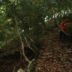
"Bbu" means "a place with a good view from the platform on the mountain" in the Atayal language. From the name, it is clear how the terrain of this hamlet is like. The hamlet is located at the intersection of the left bank of the north Heping River and the Mohen River, at an altitude of about 1,200 meters. The Japanese Occupation Security Road passes below the hamlet, leading to Liuxingshe in the east and Jinyangshe in the west. There is an Education Center for indigenous children and a fort in Kubaboshe. At present, the school playground, the command platform, and the drainage ditch can still be seen in the hamlet.
In the early days, traditional Atayla house was used as the official’s office. Later in the first year of the Showa era (1926), the Japanese built the Kubabo police post using cypress wood. However, there are no traces of the wooden structure of the building any more, only huge stacked stone foundations remain.
- - / -
- - - -
- -
- -/-
- -

