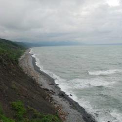
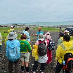
Guanyinbi is located in Mudan Township, Pingtung County, and is on the Hengchun Beinan Historic Trail. The historic trail, which crosses Hengchun Township in Pingtung County and Taitung City in Taitung County, runs from Hengchun via Manzhou, passing through the end of the Central Mountain Range to reach the coast, and then passing through Xuhai and Guanyinbi. Continue walking north along the coast, you will pass by Nantian Hamlet and Anshuo Hamlet, joining other trails that leads to Pingtung, and finally arriving at Taitung City. In the middle of the Japanese occupation, the Hengchun Beinan Historic Trail had long been widened as a designated road for cars. Therefore, the remaining trails that we see today are mostly roads for cars during the Japanese occupation period. Currently the impassable section of the road is in the Guanyinbi area.
paiwan
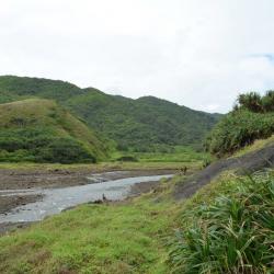
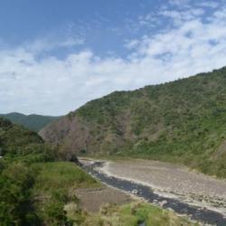
The Tawa River Basin in Daren Township, Taitung County, originated from the valley between Mudanxi Mountain and Taihe Mountain, and finally flows into the Pacific Ocean. The Hengchun Beinan Historic Trail, which crosses Hengchun Township in Pingtung County and Taitung City in Taitung County, runs northward along the coast from Hengchun through Manzhou, joining other trails in Pingtung, and then arriving at Taitung City. In the middle of the Japanese occupation, the Hengchun Beinan Historic Trail had long been widened as a designated road for cars. Therefore, the remaining trails that we see today are mostly roads for cars during the Japanese occupation period. Currently the impassable section of the road is in the Guanyinbi area.
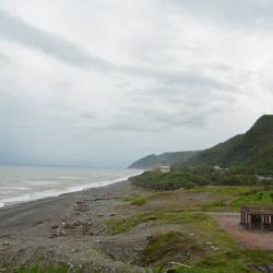
Located in the Nantian Coast of Daren Township, Taitung County, the coastal landscape of the long pebble beach is still intact due to the undeveloped highway. It is one of the few pristine coastlines, rich in Nantian stones, and was named after the neighboring Nantian Village. The Hengchun Beinan Historic Trail passes through the Nantian coast, traveling north along the coast from Hengchun via Manzhou, then joining other trails from Pingtung, and arriving at Taitung City. In the middle of the Japanese occupation, the Hengchun Beinan Historic Trail had long been widened as a designated road for cars. Therefore, the remaining trails that we see today are mostly roads for cars from the Japanese occupation period. Currently the impassable section of the road is in the Guanyinbi area.
Nantian village is located on the right tributary of the upper reaches of Fangshan River in Daren Township, Taitung County. The village was formed by the migration of tribes towards the end of the Japanese occupation. By the early post-war period, 17 households from Donggaoshe moved to the first hamlet in Nantian village. As population grew, the tribesmen from the first hamlet agreed to move to the second hamlet, and Nantian village became a settlement of two hamlets. The name Nantian, which means south fields, was given as it is located at the southern end of Daren Township.
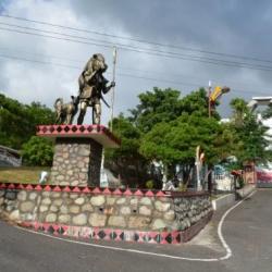
The Hengchun Beinan Historic Trail crosses Hengchun Township in Pingtung County and Taitung City in Taitung County. with a total length of about 98 km. It was an important transportation route between the east and the west of Taiwan during the Japanese occupation, starting from Hengchun in the south and reaching Beinan in the north while passing through Manzhou Township. Today, the Hengchun Beinan Historic Trail is commonly known as the Alangyi Historic Trail. Alangyi is the old name of Anshuo Hamlet of the Paiwan ethnic group. Moreover, most parts of the trail have been excavated into Taiwan Provincial Highway No. 26. The only sections that have not been made into a highway are the sections between Xuhai and Guanyinbi, as well as the section to the junction of Taitung County.
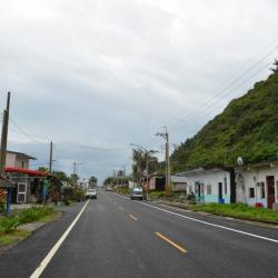
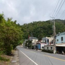
Anshuo Hamlet is located next to Nanhui Road in Daren Township, Taitung County. In the post-war period, the Nationalist Government asphalt-paved what was originally a gravel road of the Fenggang Beinan Historic Trail, covering a total length of 107 km from Taitung to Shouqia.
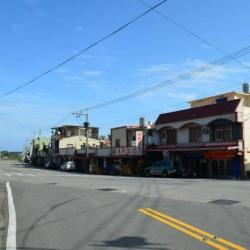
Xinlu Hamlet in Shizi Township, Pingtung County, is located by Nanhui Road on the south bank of Fenggang River, about 3.5 km away from Fenggang. It was originally the traditional territory of Jiaxinlushe, but during the Japanese occupation period, the Governor-General in Taiwan vigorously implemented the group relocation project and forcefully relocated indigenes of Bashimoshe (Lomaq) to the area of Konkya. They were then moved to the current location of the Xinlu hamlet in 1943. At the beginning of the post-war period, the National Government also moved the residents of Karoran hamlet and Chachagun hamlet here, thus forming the current Xinlu hamlet.
Fenggang Beinan Historic Trail was excavated under the policy of excavating mountains to manage indigene during the Qing period. Before then, it was a tribal passage for the local Paiwan tribe. The excavation mainly went along the river from Fenggang towards the northeast, not overlapping with Nanhui Road. The trail goes along the tribal passage, into Mount Qiluzhike, along the ridgeline to Shouqia, and finally reaching Dawu from Rumulu River. Therefore, before the opening of the Fenggang Beinan Hsitoric Trail, residents living in the mountainous areas would go upstream the Fenggang River to trade hunted animal products at the riverbed.
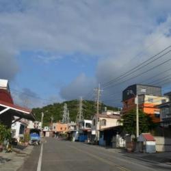
Danlu Hamlet is located on the steep slope on the left bank of Fenggang River, on the north-western mountainside of Nurenshan in Shizi Township, Pingtung County. The hamlet was formed by the migration of indigenous peoples in 1924, who originally lived in Mudanlushe and Jiaxinlushe. During the Japanese occupation period, the Governor-General in Taiwan set up the Mudanlu Police Post next to the present Danlu Elementary School in Upper Danlu Hamlet. In 1943 the tribesmen of the Bashimoshe moved to Lower Danlu Hamlet and became a part of the Mudanlushe. In the post-war period, the National Government referred to Mudan Road as Dan Road in short, and the police post was also moved to the Nanhui Highway, between the upper and lower hamlets.
Shuangliu Hamlet is located on the south bank of the confluence of Neiwen River and Daren River in the upper reaches of Fenggang River in Shizi Township, Pingtung County. It was an important fort on the Fenggang Beinan Historic Trail during the Qing period. The hamlet was formed by the migration of Paiwan people from Jinagalan hamlet in the post-war period.
Beside the Shuangliu Hamlet is the Shuangliu National Forest Recreation Area, which was taken over by the Forestry Bureau in 1965. The main feature of the recreation area is the artificial Taiwan Chinese Ash forest and the rich insect ecology. Follow the upstream of Neiwen River in the park, you can play in the water, watch butterflies, as well as visit the relics of Paiwan slate houses and Shuangliu Waterfall.