Wushe Kashe Historic Trail

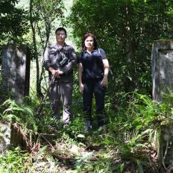
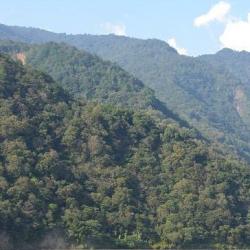
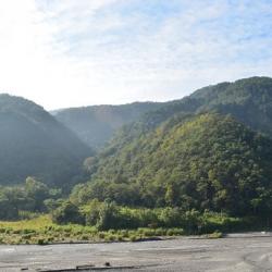
The Wushe Kashe Historic Trail, which runs through Renai Township and Xinyi Township in Nantou County, is about 60 km in length. It starts from Wushe in the north and ends in old Bakulasi village.  It is mainly formed by the connection between the Wandawushe Trail and the Wandakashe Trail, which passed through traditional territories of the Sediq and Bunun tribes.

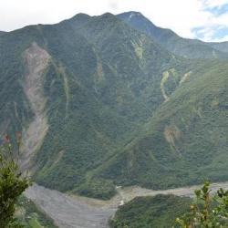
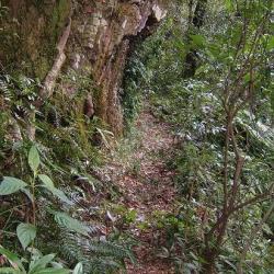
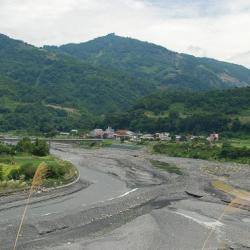
The Wushe Kashe Historic Trail was the first trail that regulated indigenous peoples to be studied, because there were important archaeological sites along the way, and that it was possible to get an understanding of the footprints of prehistoric people. However, the Wushe Kashe Historic Trail that was built along the Zhuoshui River was destroyed by the impact from the Jiji earthquake and the Typhoon Morakot. Today, only a few sections of the trail remain.

  • - / -
  • - - -
  • -
  • - -/-
  • -
Historic Trail located near Liangjiushe

古道地圖

Attractions
Liangjiu Falls
影像為位於良久社下方的良久瀑布,霧社、卡社古道於其上方通過
Liangjiu Falls資訊

The Wushe Kashe Historic Trail that was built during the Japanese colonial period was actually composed of two sections of ancient routes, namely "Wanda Kashe trail" and "Wanda Wushe trail". The Wushe Kashe Historic Trail was the first Lifan road (Indigene management route) to be studied. The trail passes through the traditional territories of the Sediq and Bunun, and has important Qubing archaeological sites along the way. It was the earliest path of the ancestors and therefore, the ruins, settlements, and trails have considerable academic value and indicator significance.

Wujie Reservoir
影像為平靜的武界水庫,位於南投縣仁愛鄉法治村濁水溪上游。
Wujie Reservoir資訊

Wujie Reservoir is located in Renai Township, Nantou County, across from Fazhi Village and Wanfeng Village, which is about 12 kilometers northeast of Sun Moon Lake and adjacent to Wujie hamlet. It was built in the 8th year of Taisho (1919) and opened in the 9th year of the Showa era (1934). The function of Wujie dam is to intercept the stream of the Zhuoshui River and its tributary Wanda River, send water to Sun Moon Lake through a diversion tunnel, then import it into power plants to generate electricity. Due to the large amount of sediment transported by the Zhuoshui River, the Wujie Dam blocks a lot of sand and stones in the upper reaches of the Zhuoshui River in the riverbed above the Wujie Dam, so the Wujie Dam is seriously silted up.

Wanfeng
位於萬豐部落下方的法治一號吊橋遺址
Wanfeng資訊

The Wushe Kashe Historic Trail from the Japanese rule leads to Wanfeng from Wujie. The exits are in Wushe of Renai Township and Bakuras hamlet, an old tribe in Dili Village, Xinyi Township, respectively. The trail along the Zhuoshui River has gone through a rebuild and the trail from north of Wanfeng village to Wushe has been replaced by the current highway. Currently, there are sections of the trail remaining near Inago and the route from Wujie to Bakuras hamlet.

Due to the 1999 Jiji earthquake, the Morakot typhoon, and several heavy rainfalls the trail is broken into pieces. What is now left is some remains of suspension bridges, pillars, and fragments of the trail. At present, there are still relics of the trail on the Wujie Dam and the rock walls beside the dam.
 

Wuliting
Overlooking Mount Zhimao and Zhuoshui River below.
Wuliting資訊

In the 12th year of the Showa era (1937), the Zhimao police post was established. It was stationed on the right bank of Zhuoshui River (now Wuliting Plain), where Danda River and Zhuoshui River  flow together, to monitor the entry of indignous peoples into the mountain. It was to prevent those indigenes that have moved to the plain from coming back. Also, in order to clear up the mountainous area and to relocate the remaining residents, the police post was set up between the relocation place and the original residence. This helped facilitate subsequent relocation matters.

Historic Trail located near Liangjiushe
位在良久社附近的古道現況
Historic Trail located near Liangjiushe資訊

The Wushe Kashe Historic Trail runs through Ren’ai Township and Xinyi Township in Nantou County, with a total length of about 60 km. The trail starts from Wushe in the north and ends in old Bakras Hamlet in the south. It is made up of two routes, the Wanda Wushe trail and Wanda Kashe trail, which pass through the traditional territories of the Sediq and Bunun. In fact, the Wushe Kashe Historic Trail was the first Lifan road (Indigene management route) to be studied, because there are important Qubing archaeological sites along the way, and it is possible to understand the footprints of prehistoric populations, which has considerable academic value and indicator significance.


Zhuoshe Monument
卓社紀念碑即為良久社蕃童教育所的遺址
Zhuoshe Monument資訊

The Zhuoshe Monument in Xinyi Township, Nantou County, is located on the former site of the Education Center for Indigenous Children in Liangjiushe, which was set up by the Government-General of Taiwan during the Japanese occupation. Later in 2003, the Bunun people set up a stone monument at the flagpole stand of the Education Center with the inscribed words "Monument erected in commemoration of the people of Zhuoshe who sought their roots and ancestral home”. The trail is made up of two trails, the Wanda Wushe and Wanda Kashe, which passes through the traditional territories of the Sediq and Bunun. In fact, the Wushe Kashe Historic Trail was the first Lifan road (Indigene management route) to be studied, because there are important Qubing archaeological sites along the way, and it is possible to understand the footprints of prehistoric populations, which has considerable academic value and indicator significance.

Wushe (Musha)
霧社通往高峰的叉路口
Wushe (Musha)資訊

The Wushe Kashe Historic Trail runs through Ren’ai Township and Xinyi Township in Nantou County, with a total length of about 60 km. The trail is made up of two trails, the Wanda Wushe Trail and Wanda Kashe Trail, which passes through the traditional territories of the Sediq and Bunun. In fact, the Wushe Kashe Historic Trail was the first Lifan road (Indigene management route) to be studied, because there are important Qubing archaeological sites along the way, and it is possible to understand the footprints of prehistoric populations, which has considerable academic value and indicator significance.


Wanda Community
作為萬大發電廠員工宿舍的萬大社區
Wanda Community資訊

Wanda Community in Ren'ai Township, Nantou County, is located at the foothills of the northwest of Mount Wanda, 2 km away from the west side where Wanda Stream and Zhuoshui Stream converge. It was originally the land of the Atayal tribe of the Wanda Group. Later in the middle of the Japanese occupation period, due to the construction of the Wanda Reservoir, power plant employees began to move into the area. Now it is the staff dormitory of Wanda Power Plant, and there are also indigenous people living there. The Wushe Kashe Historic Trail that was built during the Japanese occupation also passes through here.

Ching’ai Hamlet
親愛部落一隅
Ching’ai Hamlet資訊

Ching’ai Hamlet is located on the terrace on the south bank of Zhuoshui River in Ren’ai Township, Nantou County. It is inhabited by the Atayal tribe of the Wanda group from Wanda Hamlet . It is geographically bounded by Xiulin Township and Wanrong Township in Hualien County in the east, Xinyi Township in the south, Wujie Hamlet in the southwest, and connected to Nanfeng, Datong, Chunyang, and Jingying hamlets in the north.

In the post-war period, since the Ching’ai Hamlet did not participate in the Wushe incident in 1930, the National Government adopted the meaning of "kin" and "love" and named it Ching’ai (beloved).

Songlin Hamlet
遠眺松林部落和松林橋
Songlin Hamlet資訊

Songlin Hamlet is located on the platform on the south bank of Zhuoshui River in Ren’ai Township, Nantou County, about 3 km west of the Wanda Hamlet. It is named after the many pine trees there. In fact, before the Wushe incident occurred in 1930, Taiwan’s Government-General once moved some Truku people collectively to a place 5 km west of the Wanda Reservoir. However, as infectious disease broke out 74 people from 14 households returned to their original homes. In the post-war period, the National Government completed the construction of the road from Wanda to Puli in facilitating transportation. Since then, the people from Songlin Hamlet moved to the current location.


Qubing Site
曲冰遺址的解說碑文
Qubing Site資訊

Qubing ruin site is located in Ren'ai Township, Nantou County. It got its name from its curving stream and icy water. It was discovered by archaeological excavations in 1981, and thereby exposing the nearby Qubing hamlet. Based on the unearthed foundation stones and stone walls, it is speculated that the area may have had a row of stone houses. Among the relics found, there are stone arrowheads, stone adzes, net pendants, stone axes, pottery pieces, which prove that the early economic activities of the local residents were farming and fishing. The site spanned from the Puli Shuiwa Cave site to the Damalin site, with an estimated time frame between 1700 and 3600 years ago. In addition, from the large number of stone tools unearthed at the site it is speculated that the residents may have adapted to life in the mountains.


Jiemeiyuan Incident
姐妹原一景,古道由此穿過
Jiemeiyuan Incident資訊

Jiemeiyuan (Jiemei Plain) is located in Ren’ai Township, Nantou County. It was the site where the Jiemeiyuan incident occurred in 1903, which was a war between Bunun and Sediq. 

This war came about after the incident in 1902, when the Government-General in Taiwan imposed an economic blockade on the indigenous peoples and completely cut off the Sediq people of the Dektaya group’s access to trade in Puli. Then using the Pingpu and Bunun people to lure the Sediq people to trade in Jiemeiyuan. The Bunun people of the Ganzhuwan group used food and wine to disarm the Sediq people and then made an order to launch an attack. This resulted in the killing of the Sediq tribe. The impact of this incident was far-reaching. First it affected the Sediq ethnic group's submission to Japan, and then it enacted the Wushe incident.


Bakuras Hamlet
巴庫拉斯社現存的石板屋
Bakuras Hamlet資訊

Bakuras Hamlet is located in Xinyi Township, Nantou County with an elevation of about 550 meters. It was mainly formed by the relocation of the Bunun of the Kashe group from Wenwen hamlet and the Jialimo'an hamlet. During the Japanese occupation, the Government-General in Taiwan set up a police post and an education center here, but under the implementation of the group relocation policy, tribal people moved to Dili, Shuanglong and Tan’nan one after another in 1936. Today, from Dili Village along Provincial Highway No. 16 to the elevated platform in front of Heping, there is a fork on the left to reach Bakuras Hamlet. The former site of the police post has now become the Bakurasu Farm. The farm operator has also restored the two slate houses that were in the ruin site.

Inago Police Post
調查人員於Inago社駐在所門前合影(調查人員於イナコ駐在所遺址門前合影)
Inago Police Post資訊

The Inago Police Post is located on the southern bank of Zhuoshui River, about 3 kilometers west of the Wanda Hamlet in Ren’ai Township, Nantou County. The police post was set up by the Government-General in Taiwan in the original Songlin Hamlet during the Japanese occupation.

In fact, before the Wushe incident occurred in 1930, Taiwan’s Government-General once moved some Truku people collectively to a place 5 kilometers west of the Wanda Reservoir. However, as infectious disease broke out 74 people from 14 households returned to their original homes. In the post-war period, the National Government completed the construction of the road from Wanda to Puli in facilitating transportation. Since then, the people from Songlin Hamlet moved to the current location.

No.1 Fazhi Suspension Bridge
位於萬豐部落下方的法治一號吊橋遺址
No.1 Fazhi Suspension Bridge資訊

The No. 1 Fazhi Suspension Bridge in Ren'ai Township, Nantou County is located in the basin surrounded by the peaks of the Central Mountain Range, below Wanfeng hamlet. Today, only the concrete structure of the bridge remains. In fact, this place was the original home of the Bunun people from the Ganzhuwanshe. Other communities that lived there during the Qing period included Lulunshe, Bakuras'she, and Totsukonshe.


Ganzhuowanshe (Old Zhuoshe Hamlet)
河階臺地即為卓社群的舊部落干卓萬社
Ganzhuowanshe (Old Zhuoshe Hamlet)資訊

Ganzhuwanshe is located on the river terrace on the right bank of Zhuoshui River in the upper reaches of Wujie in Ren’ai Township, Nantou County, where the No.1 Fazhi Suspension Bridge is at today. It is at an altitude of 780 meters, and was an old hamlet of the Bunun from the Zhuoshe group. During the Japanese occupation, the Wanda Kashe Historic Trail passed by the old hamlet and in 1913, the Government-General in Taiwan set up the Ganzhuowan Police Post above the hamlet.