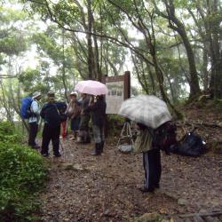
The prefectural boundary between Kaohsiung State (now Kaohsiung City) and Taito Prefecture (now Taitung County) during the Japanese occupation is located 2.6km away from the sign for Jinshuiying National Trail. It is also the tip of the terrain slope because it is uphill from the entry on Dahan Forest Road to the boundary, then it goes all the way downhill. According to the Forestry Bureau information board, when the Governor-General in Taiwan patrolled Jinshuiying Trail from Taito Prefecture during the Japanese occupation, the Officials of Kaohsiung State would greet him at the boundary. Moreover, due to the fog and rain all year round and the landscape of the terrain the trail accumulates water easily. Hence the name ‘Jinshuiying’, which means Soaking Camp.
- - / -
- - - -
- -
- -/-
- -
