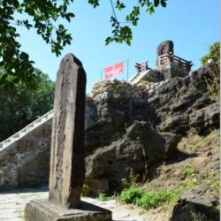
Houdong Mountain, or Monkey Cave Mountain, is what it used to be called before the current name, Shipai Park. It is located on the west side of Hengchun City. In the park, there are two stone steles. One is the monument of “Weapon Preparation” and the other is in memory of those who died fighting the war. The latter was erected after the 3rd Brigade (Ishihara Brigade) of the 4th Infantry Regiment of the Second Division of Japanese Infantry in February of Meiji 28 (1895), which occupied Hengchun and set up its headquarters in Houdong Mountain to prepare for the suppression of the place. The original text states "Meiji twenty-seventh and eighth year, when the brigade was ordered to occupy Hengchun; on October 31st of the twenty-eighth year, got on two ships of Sedoku and Fukui; on November 1st, landed on the south of Checheng; there were about 300 rebels guarding Hengchun. The battle started at eleven o'clock in the morning. The rebels handed over the guns, the most important task was to defend the battle, but they were unable to fight. At two o’clock in the afternoon the city fell. The brigade set up its quarters here, managed the area around. Because of its greatness, it will be passed on to future generations forever.”
Lonckjau Beinan Trail
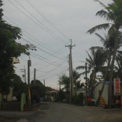
Xuhai Village was formerly known as macaren, also known as butauwan. It is located in the east of Mudan Township, on the eastern slope of the main ridge of the Central Mountains. As the land is high on the west and low on the east, forming a hilly terrain, short rivers such as Liren, Xuhai and Daliu flow from towards the east into the Pacific Ocean. The alluvial lowlands of river banks and estuaries have become the main settlements and arable land for the people. From the end of the Qing Dynasty to the Japanese occupation period, it was designated as a sub-district. It is located on the "Hengchun and Beinan Road in the Qing Dynasty" leading to Taitung in the Hengchun area. Although the developmentof the village was late, the ethnic groups were diverse. The settlement was first established by Pan A-bie, from Seqalu community, who led the people from Manzhou to settle here. There were also Paiwan people, Hakka people, Hokkien people, and people from other provinces. The residents of this village facing the Pacific Ocean are the Amis people who immigrated from Gangzai, Manzhou Township. After the war, an independent village was established, located near the east coast, and named Xuhai as the place where the sun rises.
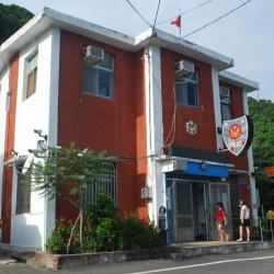
Xuhai Police Station is located in the east of Xuhai, at the intersection of the end of Pingtug 199A Highway and Taiwan Provincial Highway 26. Because it is located on Hengchun Beinan Road, the junction of Hengchun and Taitung, its location is extremely important. In the early days of the Japanese occupation, the Mudan Bay Police Station was established here. It was moved next to Xuhai Elementary School at the end of the Japanese occupation and was re-established after the war at the current location. To the northeast of the police station is the Donghai Tribe. The Donghai Tribe was originally a working dormitory built for fishing convenience. Later, some people settled down and formed a small settlement. The Amis with the surname Pan and the descendants of Pan Abie are the main ones. In 1976, a new pier was built in the north of the tribe, where boats and rafts can dock. Half of the residents are fishers and half are farmers.
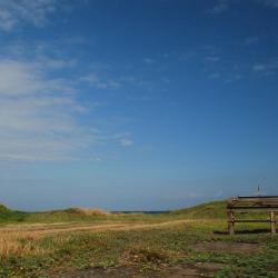
Bayao Bay is a large, triangular sandy beach from the south of Gangzai River to Zhonggang River. It is commonly known as Haishanpu. It is about 3 kilometers in length from north to south, and 2 kilometers wide from east to west. There are continuous tall sand dunes and sloping sand-falls. The dune terrain is well-developed. Due to the long-term accumulation of sand in the estuary and the blowing of the northeast monsoons, the sand continues to move with the northeast monsoon, turning into a large area of special terrain like a desert. The ever-changing sand patterns on the sand are quite beautiful, and together with the dead casuarinas, it becomes a unique scenery. As a tourist attraction in Hengchun Peninsula, sand boarding and jeeps rushing down sand-falls are popular and are loved by many tourists who like some thrill.
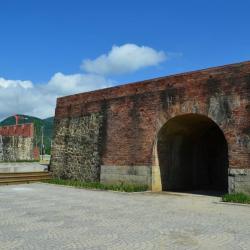
In the past, the East Gate was the only way to Beinan. Under the policy of Kaishan Fufan (Excavate mountains to manage indigenes), Zhou Youji, the first magistrate of Hengchun County, was appointed to officially build Hengchun Beinan Road. From the east gate of Hengchun County, through Shemali and Zhuzhaoshu, along the bank of the port stream. After crossing the watershed, passing through Jiupeng, following the coastline to the north, passing Mudan Bay and Alangyi River, and arriving at Beinan. It was the main route for officials and official documents to and from the front and back mountains in the late Qing Dynasty. At that time, there was a delivery station.
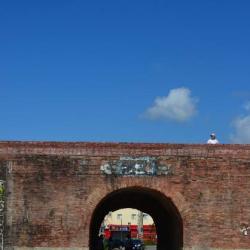
The South Gate of Hengchun old town is also known as "Mingdu Gate". Hengchun is located at the southernmost tip of the Hengchun Peninsula. In the northeast, there are Laofo Mountain, Menmaluo Mountain and other mountains adjacent to Manzhou Township. The name, Hengchun, came about in December 1874, when the Qing viceroy Shen Baozhen came to Taiwan for the Mudanshe incident. He came and saw the crops stay “green and abundant” year-round, and so he named the area Hengchung (always spring). Since then Hengchung replaced the original name, “Longkjouw”.
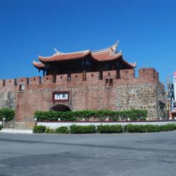
The South Gate of Hengchun old town is also known as "Mingdu Gate". Hengchun is located at the southernmost tip of the Hengchun Peninsula. In the northeast, there are Laofo Mountain, Menmaluo Mountain and other mountains adjacent to Manzhou Township. The name, Hengchun, came about in December 1874, when the Qing viceroy Shen Baozhen came to Taiwan for the Mudanshe incident. He came and saw the crops stay “green and abundant” year-round, and so he named the area Hengchung (always spring). Since then Hengchung replaced the original name, “Longkjouw”.
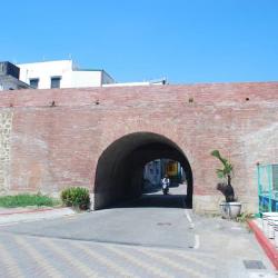
Hengchun is located in the southernmost of Taiwan, on the tip of Hengchun Peninsula, surrounded by the sea on three sides. Although there have been legends of farming and reclamation since the Ming and Zheng Dynasties, there have also been Fujian and Cantonese Han people and even Pingpu ethnic groups settled there. They lived with the local Seqalu group of the Paiwan people and the Hengchung Amis people who came here earlier. However, as late as the Guangxu period of the Qing Dynasty, it was still a remote place.
