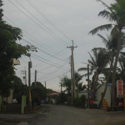
Xuhai Village was formerly known as macaren, also known as butauwan. It is located in the east of Mudan Township, on the eastern slope of the main ridge of the Central Mountains. As the land is high on the west and low on the east, forming a hilly terrain, short rivers such as Liren, Xuhai and Daliu flow from towards the east into the Pacific Ocean. The alluvial lowlands of river banks and estuaries have become the main settlements and arable land for the people. From the end of the Qing Dynasty to the Japanese occupation period, it was designated as a sub-district. It is located on the "Hengchun and Beinan Road in the Qing Dynasty" leading to Taitung in the Hengchun area. Although the developmentof the village was late, the ethnic groups were diverse. The settlement was first established by Pan A-bie, from Seqalu community, who led the people from Manzhou to settle here. There were also Paiwan people, Hakka people, Hokkien people, and people from other provinces. The residents of this village facing the Pacific Ocean are the Amis people who immigrated from Gangzai, Manzhou Township. After the war, an independent village was established, located near the east coast, and named Xuhai as the place where the sun rises.
- - / -
- - - -
- -
- -/-
- -
