Road Excavation and Indigene Management

Da Nan’ao
過去的南澳鄉戶政事務所門柱,現已成為餐廳招牌基座

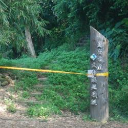
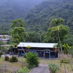
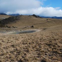
Da Nan’ao is located on the plateau on the left bank of Northern Da Nan’ao River in Nan’ao Township of Yilan County. It is surrounded by mountains and faces the ocean on the east. The Atayal people call the place “Kinan”, meaning a very beautiful environment.  The name, Nan’ao, first appeared in historical documents in 1810. It was called Da Nan’ao because it was located in the south of Su’ao. It was only renamed Nan’ao during the Japanese occupation period. After the establishment of the Nan’ao community in 1932, this name got widely accepted by many.

Today, Nan'ao Village is adjacent to Chaoyang and Nanqiang Erli in Su'ao Township.

Da Nan’ao Traversing Trail
蘇花古道大南澳越嶺段的入口指示

Da Nan’ao Traversing Trail of Nan’ao Township, Yilan County, is located between Su’ao and Hualien Port. It was built by the Government-General in Taiwan during the Japanese occupation in 1916. Due to the needs of developing the eastern area and that the location was closest to the Governor Office, the 12-foot-wide historic walking trail was widened and made into roads for car traffic. The road passes through many indigenous villages and was named Linhai Historic Trail.

Up until today, the Suhua Linhai Historic Trail has undergone many road-widening and adjustments, with old cliff roads replaced by tunnels to prevent danger caused by falling rocks.

Luo Dachun Road Excavation Monument
羅大春開路紀念碑安座於震安宮旁的碑亭內

The Luo Dachun Road Excavation Monument is located inside the pavilion next to Zhennan Temple on Chaoyang Road in Su’ao Township of Yilan County. It is respected by locals as Shipaizigong. Every year on July 29 of the lunar calendar many people come to pay respect here. In fact, the Luo Dachun Road Excavation Monument was originally set up on an historic trail about 300 meters southeast from the current site, facing Hualien. However, due to the excavation of Nan’ao area, the current Chaoyang Road has become an important passage to and from Nan’ao. Gradually, the historic trail got abandoned and got made into a water diversion channel. The remains of the barren tomb beside the historic trail were discovered during the reclamation, and the locals enshrine it with the excavation monument for people to remember.

Gukut Police Post
グークツ駐在所仍保有完整的木構建築,現為民宅

Located in Xiulin Township, Hualien County, the Gukut Police Post is located 300 meters south of the Hezhong Hamlet. It is now a residential house, but still retains a complete wooden structure from the Japanese occupation period. In the past, the Truku people expanded north and established hamlets on the hillside, with the Pacific Ocean in the east and the central mountain range in the west. As the terrain and space resemble a circular pan-bottom, the place was named Gukut, and was the earliest settlement of the Truku people. However, during the Japanese occupation, several hamlets were collectively moved to the present location, and continued with the name “Gukut”.

In the post-war period, Gukut Hamlet was renamed to Heping, and later called Hezhong because it was located in the middle of three communities of Heping Village.

Qingshui Cliff
從臨海崩石坡遠眺清水斷崖和清水隧道

The Qingshui Cliff in Xiulin Township, Hualien County is located on the way between Su’ao and Hualien Port. It was excavated by the Government-General in Taiwan during the Japanese occupation in 1916. Due to the needs of developing the eastern area and that the location was closest to the Governor Office, the 12-foot-wide historic walking trail was widened to make into roads for car traffic. The road passes through many indigenous villages and was named Linhai Historic Trail. Up until today, the Suhua Linhai Historic Trail has undergone many road-widening and adjustments, with old cliff roads replaced by tunnels to prevent danger caused by falling rocks.

Suhua Historic Trail
從石硿子段的蘇花古道遠眺清水斷崖

The Suhua Historic Trail, which runs through Su’ao Township in Yilan County and Hualien City in Hualien County, was first excavated in 1874 (Qing period). The trail starts from Su’ao in the north and ends in Hualien Port in the south, with a total length of about 115 km. During the Japanese occupation in 1916, the Government-General in Taiwan began re-building the road between Su’ao and Hualien Port, which went all the way from Baimi Bridge in Su’ao to Zhuzi Bridge in Hualien Port Street. Later, the 12-foot-wide trail was converted into a road for car traffic that passes through many indigenous villages.

Today, the Yilan section of the Suhua Historic Trail that was excavated during the Qing Dynasty remained the same, while the Suhua Linhai Historic Trail along the coast that was built during the Japanese occupation has undergone many road-widening and adjustments. The old cliff road was even replaced with tunnels to prevent danger caused by falling rocks.

Hualien County Police Station, Xincheng Branch
原為研海支廳廳舍的新城分局

The police station in Xincheng Township, Hualien County was originally the Yanhai branch office that was established by the Government-General in Taiwan during the Japanese occupation.  Today, the fence of the building still remains. After the Taroko War in 1914, Sakuma Samata, the Governor at that time, was deeply admired in Hualien. In commemoration of his achievements, the Government-General in Taiwan merged the Xincheng Branch and the Taroko Branch in 1920 and named it Yanhai after Sakuma.

Later in 1937, there was a restructure of the Hualien area; and the branch offices became counties, while districts were changed to townships. Since then, the Yanhai Branch in Hualien County governed the current Xincheng Township and Xiulin Township. After the war, the National Government restored Yanhai to its old name “Xincheng”.

Dashuiku Pond
大水窟池後方的山腰道路為八通關古道

Dashuiku Pond is a high mountain pond that does not dry up all year round. It is located on the eastern section of the Batongguan Traversing Historic Trail, which was built in the Qing Dynasty period. The water source depends on rainfall and snowmelt. The Bunun people refer to the pond as Oniyap, which means pool. Since the Qing period, this area has always been a traffic hub. Dashuiku Pond was an important drinking water source on the main edge of the Central Mountain Range that provided daily water for the Dashuiku Camp. The water source, as recorded in the "Taiwan Map '' compiled at the end of the Qing Dynasty period or "Taiwan General History'', referred to Dashuiku pond.

Today, a large number of ceramic fragments from the Dehua kiln in Fujian from the Qing period can still be found behind the house in Dashuiku.


Shitou Camp Cherish Character Pavilion
石頭營聖蹟亭的造型特殊,列為縣定文化資產

The Shitou Camp Cherish Character Pavilion, is located in the former camp site for troops during the Quing period in Yuquan Village, Fangliao Township, Pingtung County.  It was built in 1874 and was an important entrance to the Jinshuiying trail on the western side. A year after the camp was built, the then General Zhang Qi-Guan set up a school for indigenous people. A pavilion was also built to incinerate broken books or paper with written characters. This is to respect the heavens and treasure written language, hence the name “Cherish Character Pavilion”. The unique design of the pavilion shows a hexagonal base topped with a house and a horseback roof. 

Today, the Shitou Camp Cherish Character Pavilion is listed as the county’s cultural heritage. 


Ruins of Sidi Camp Site
溪底營盤遺址的解說牌

After the Jinshuiying trail was opened in 1885, Xidi Camp was set up, making a resting stop for officials and business travelers who passed this trail during the Qing period. During the Japanese Occupation, the Governor-General in Taiwan set up the Guzilun Police Post here in 1916, and then a few years later moved it above the ridge. In the late 1960s, the National Government set up an afforestation nursery in Xidi Camp.