Tayal

Wantian Battery Ruins
日治時期設置的丸田砲臺地基

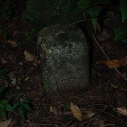
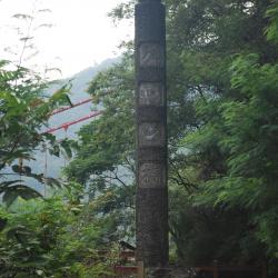
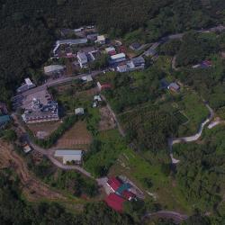
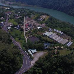
The Wantian Battery, in Tai'an Township of Miaoli County, was set up for the Government-General in Taiwan to monitor the northern Atayal group. The battery was erected on the ridge line or highest point of the mountain overlooking tribal villages in order to intimidate indigenous people.

In the early days of Japanese rule, the governor of Taiwan, Sakuma Samata organized a large-scale crusade to manage the indigenes. In 1911, he suppressed the northern group of Atayal tribe with superior force. Police Officer, Maruda Kiyoshi, was killed during this fight and therefore, the battery was named after him.

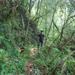
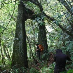
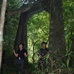
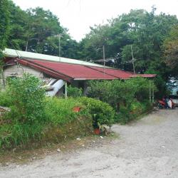
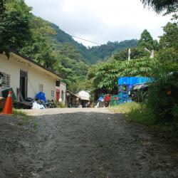
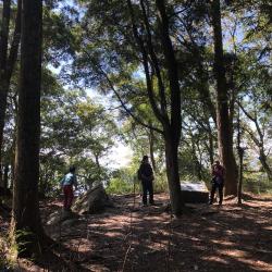
Today, the remains of the Wantian Battery are hidden in the forest of Cryptomeria. The stone road that leads to the battery from Erbensong Police Post was mainly used to transport food and firearms supplies.


Dazheng Police Post
大正駐在所附近的古道路段

The Dazheng Police Post in Datong Township, Yilan County is located near the Mingchi Forest Recreation Area. To get there, go from the Northern Cross-island Highway, cut eastward to Fanfan Creek, then head up the Sanxing Historic Trail in Jiaobanshan, and follow the road to arrive at Dazheng Police Post and Dazheng Bridge. In fact, the Jiaobanshan Sanxing Historic Trail, which traverses the Fuxing District of Taoyuan City and Sanxing Township in Yilan County, was built in 1911 and has a total length of about 125 km. It is the earliest road excavated for Lifan (regulating Indigenes) purposes during the Japanese occupation. A total of 14 police posts were set up along the way, and Dazheng Police Post was one of them.

Today, most sections of the Jiaobanshan Sanxing Historic Trail have been replaced by the Northern Cross-island Highway.

West end of Dazheng Bridge
大正橋西端橋頭,上方還留有一段纜線

The former Dazheng Bridge, located in Datong Township, Yilan County, stood between Dazheng Police Post and Takinoue Police Post. It is an iron cable suspension bridge on the Jiaobanshan Sanxing Historic Trail that was built in 1916.

Today the bridge has been completely destroyed, leaving only the east and the west bridge tower. The end of the bridge is about 20 meters away from the valley. If you want to go to the west end of Dazheng Bridge site, you can cut eastward from the Northern Cross-island Highway near the Mingchi Forest Recreation Area to Fanfan Creek, then head up to the Sanxing Historic Trail of Jiaobanshan and follow the road to reach the Dazheng Police Post and Dazheng Bridge.

East end of Dazheng Bridge
大正橋東端橋頭,上方刻有大正橋的字樣

The former Dazheng Bridge, located in Datong Township, Yilan County, stood between Dazheng Police Post and Takinoue Police Post. It is an iron cable suspension bridge on the Jiaobanshan Sanxing Historic Trail that was built in 1916.

Today the bridge has been completely destroyed, leaving only the east and the west bridge tower. The end of the bridge is about 20 meters away from the valley. If you want to go to the east end of Dazheng Bridge site, you can cut eastward from the Northern Cross-island Highway near the Mingchi Forest Recreation Area to Fanfan Creek, then head up to the Sanxing Historic Trail of Jiaobanshan and follow the road to reach the Dazheng Police Post and Dazheng Bridge. 


Benchmarking Point at Dazheng Police Post
大正駐在所旁的一等水準點59號基石

The benchmarking point No. 59 at Dazheng Police Post in Datong Township, Yilan County is located near the Mingchi Forest Recreation Area. To get there, go from the Northern Cross-island Highway, cut eastward to Fanfan Creek, then up the Sanxing Historic Trail in Jiaobanshan, and follow the road to arrive at Dazheng Police Post and Dazheng Bridge. The Jiaobanshan Sanxing Historic Trail, which traverses the Fuxing District of Taoyuan City and Sanxing Township in Yilan County, was built in 1911 and has a total length of about 125 km. It is the earliest road excavated for Lifan (regulating Indigenes) purposes during the Japanese occupation. A total of 14 police posts were set up along the way, and Dazheng Police Post was one of them.

Today, most sections of the Jiaobanshan Sanxing Historic Trail have been replaced by the Northern Cross-island Highway.

Chiduan (Ikenobata) Police Post
紅色屋頂房舍即為池ノ端駐在所

Chiduan Police Post is located opposite the Mingchi Forest Recreation Area in Datong Township, Yilan County. It is about 200 meters away from the 110-Line Forest Road entrance. It has been converted into a house, but the remains of the ramps and stairs can still be seen. In fact, the Jiaobanshan Sanxing Historic Trail, which traverses the Fuxing District of Taoyuan City and Sanxing Township of Yilan County, was built in 1911 and has a total length of about 125 km. It was the earliest road excavated for Lifan (managing Indigene) during the Japanese occupation. A total of 14 police posts were set up along the way, and Chiduan Police Post was one of them.

Today, most sections of the Jiaobanshan Sanxing Historic Trail have been replaced by the Northern Cross-island Highway, and only the section from Mingchi to Yingshi Village still remains.

Sileng Police Post
大漢守衛站對面房舍即為四稜駐在所遺址

The Sileng Police Post is located opposite the Dahan Guard Station of the Veterans Forest Conservation Management Office in Fuxing District, Taoyuan City. It has been converted into a house, and the remains of the stone staircase slope can still be seen on the nearby road. The Jiaobanshan Sanxing Historic Trail, which traverses the Fuxing District of Taoyuan City and Sanxing Township of Yilan County, was built in 1911 and has a total length of about 125 kilometers. It was the earliest trail to be excavated for Lifan (regulating Indigenes) purposes during the Japanese occupation. A total of 14 police posts were set up along the way and Sileng Police Post was one of them.

Today, most sections of the Jiaobanshan Sanxing Historic Trail have been replaced by the Northern Cross-island Highway, and only the section from Mingchi to Yingshi Village remains, although it has not been used for many years.


Balong Memorial Stele
巴壟紀念柱的正面刻有バロン橋

The Balong Memorial stele is located on the north side of Baling Bridge, in the bushes outside the entrance of Baling No. 1 Tunnel in Fuxing District, Taoyuan City. When the Balong Railway Bridge was completed in 1914, the Civil Engineering Bureau of the Government-General in Taiwan built a commemorative column to commemorate the completion of the bridge. The Baling Railway Bridge is 90 meters long. After the Northern Cross-island Highway was built in the 1960s, the Baling Railway Bridge was demolished and rebuilt into Baling Bridge for car traffic. Later, due to increased traffic, and that the original Baling Bridge was not wide enough, a bigger Baling Bridge was built next to it. The big Baling Bridge was completed and opened to traffic in 2005.

The original Baling Bridge is now a scenic bridge for pedestrians only. The Baling No. 1 and No. 2 tunnels that are at both ends of the bridge are planned to be Atayal Humanities Exhibition Halls.

Kaopo Hamlet
從空中俯瞰高坡部落

The Kaopo Hamlet is located opposite the Yixing Hamlet, on the northern bank of the hillside terrace where Kaopo River and Dahan River converge in the Fuxing District of Taoyuan City,  It is 450 meters above sea level, and the traditional Atayal name for the place is Kaubo, which means fishing gear. It was named after the tool used by the tribesmen to fish in the early years. Kaopo is also known as Kaopuo and Kewupu. In the middle of the Japanese occupation, the people from Lahao hamlet that originally lived in Jianshi Township, Hsinchu County, moved to settle here. Due to the irrigation of the Kaopo canal, it was possible to reclaim the land for growing rice.

Today, due to the declining residents, Kaopo Elementary School merged with Luofu Elementary School in 2013. The original school building is now the headquarters of the Indigenous Peoples Tribal University, a place for people to learn together.

Xiayunping Hamlet
從空中俯瞰霞雲坪部落

The Xiayunping Hamlet is located on the river terrace on the north bank of the Dahan River in the Fuxing District of Taoyuan City, with an elevation of 280 meters above sea level. The traditional Atayal name for the place is Habun, which means to shoot, because the water flows fast like an arrow into Dahan River. There is another saying that Habun means the confluence of rivers as the hamlet was surrounded by streams on three sides and a mountain on the other. The location seemed dangerous but in favor of defense. Thus, in the early days of the Japanese occupation, Atayal people chose to defend against the Japanese here. Later, the Government-General in Taiwan used the Xiayunping Terrace as the location for the group’s relocation policy, and the Atayal tribe began growing rice here. After the Wushe incident in 1931, the Kayouhabunshe was forced to move to this place, also known as the Habunshe.