Tayal

Piyaway
空拍比亞外部落。

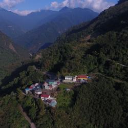
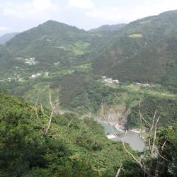
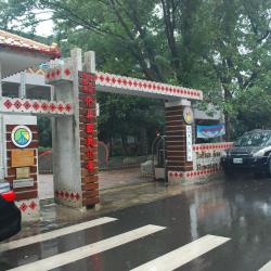
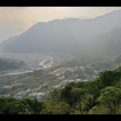
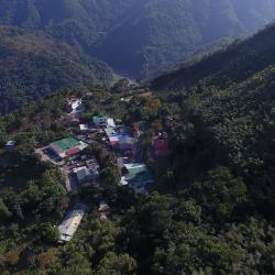
Piyaway is located in Gaoyi village, Fuxing District, Taoyuan City, southeast of Kayilan, at the foot of Baoliku Mountain, at an altitude of more than 500 meters. The residents were from Wudaonengan that migrated here in the 7th year of Qianlong (1742) . The original meaning of Piyaway is a kind of bean, and the place was named after this bean because the land is rich in this bean. Another saying is that it was originally named after a leader, because during the Japanese occupation, the leader resisted the brutality of the Japanese police and was killed. The people of the community were punished for their martyrdom, and called the place Piyaway. However, as a fact the name of this community already existed in the Qing Dynasty, and was called Pi Ye Wai, Bai Awai or Bai Yawei.

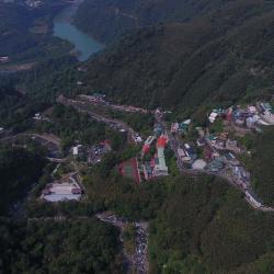
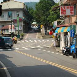
After the completion of the Northern Cross-island Highway, the people from the local plains gradually moved in. Pastor Song Zhengxi of the Presbyterian Church believes that the name "Piyaway" is indecent, and applied to the government to have the name changed to Li’an in 1976. So, it is also called Li'an.

Qehuy
空拍內奎輝

Qehuy is located in Gaoyi village, Fuxing District, Taoyuan City. It is located on the southern slope of Yanshan Ridge in the east of KuihuiMountain, with a height of more than 1,000 meters. Overlooking to the south is Ronhua Creek Valley, and is 3 kilometers eastward of the Northern Cross-island Highway. It is small hamlet with only a dozen households. Qehuy means animal horn in the Atayal language,  and is also called Bnay, meaning orange, and is still the name of the old hamlet. Today, most of the residents have moved north to Kuihui Lame in Fuxing District, and only a few households remain. The people called it Lele. After the completion of the Northern Cross-island Highway, some people moved to Dawan and Kayilan along the highway because Qehuy is located in the deep mountains and the traffic was inconvenient. Currently, there are ten or so households still living there.

Yihsing
從北橫公路眺望大漢溪對岸的義興,部落下方為大漢溪,溪谷右端為義興壩。

Yihsing (Gihin) is located in Yisheng village, Fuxing District, Taoyuan City, about three kilometers south of Xiaowulai, on the platform or slope on the right bank of the middle reaches of Dahan River, about 400 meters above sea level. It sits opposite Gaopo across the Dahan River, and can be reached by crossing the suspension bridge from Beiheng Highway. Also known as Gihin, which means sunshine in the Atayal language. It is said that in the past, people from the Xuewunao (Sbunaw) community came and saw the sunshine, they believed that their descendants would prosper if they lived here. So, they moved to settle here and named the place Gihin. It is also said that Gihin means hillside land, grass, and leech, but none of them can be tested. Today, there are Yihsing No. 1 and Yihsing No. 2, so there are many rice fields, and bamboo and mushrooms are produced on the hillside. After the completion of the Yihsing sand-blocking dam on the Dahan River, the Yihsing Power Plant was constructed using hydraulic power.

Xiayunei (Rahu')
下宇內

Xiayunei (Rahu’), also known as Xiao Wulai, is located in Yisheng village, Fuxing District, Taoyuan City. In the early days, it was called rahu-ulay, which means the lower half in the Atayal language. It was named after the pomelo tree at that time. There was a hot spring in the ulay stream, which was later destroyed. The upper half used to be called gramay, but today it is called ulay. In the early days of the Restoration, the place names in the Fuxing District were all translated in Hokkien. In order to identify Taipei Wulai, it was called Xiaowulai, or it was translated as Yunei, because it was located relatively downstream, so it was called Xiayunei. The Atayal language ulay means waterfall, and some people misunderstand it as hot spring. There is Yisheng Elementary School founded in 1950 in the settlement. During the Japanese occupation period, the Japanese came to manage it, and the settlements in the lower half were residents who originally lived in the upper half.

Jiaobanshan Camphor Storehouse
角板山樟腦收納所之部分建築。

Located next to the Jiaobanshan Residence, the Jiaobanshan Camphor Storehouse was built in Showa 14 (1939). In the period of Japanese rule in the late Qing Dynasty, Taiwan's camphor production accounted for 70% of the world's total production, so it was called the "Camphor Kingdom", and Jiaobanshan was the distribution center for camphor cutting in northern Taiwan. It was to  facilitate smooth transport of the camphor to Daxangkan (now Daxi), then transport it to Taipei by Dahan River, and export it to the rest of the world. In Meiji 34 (1901), the Taiwan Governor's Office Monopoly Bureau was established to include camphor-related affairs. In the 8th year of Taisho (1919), in order to strengthen control and reduce costs, the "Taiwan Camphor Manufacturing Co. Ltd." was established with a government-run and private production method. In the 9th year of the Showa era (1934), the Taiwan Governor's Office disbanded the manufacturing company and changed the manufacture of raw materials and finished products under the control of the Special Sales Bureau. After the Nationalist government moved to Taiwan in 1945, the monopoly system of camphor production was still maintained until 1967.

Jieshou Elementary School (Jiaobanshan Indigenous Children's Education Center)
介壽國小校門,校址位於桃園市復興區澤仁里中正路33號。

In August of Meiji 42 (1909), Jiaobanshan A-grade Indigenous Children's Education Center was established, which was the predecessor of today’s Jieshou Elementary School. In September 1946, the original national language (Japanese) workshop was merged to establish the Jiaoban National School in Jiaoban Township, Hsinchu County. In October 1949, it was renamed Jiaoban National School, Jiaoban Township, Taoyuan County. In 1954, Jiaoban Township was renamed Fuxing Township, and the school name was also changed to Taoyuan County Fuxing Township Jieshou National School. In 1957, it cooperated with the implementation of nine-year compulsory national education and was renamed Jieshou National Elementary School. Jieshou Elementary School is in a remote area. The design of the campus is based on Atayal culture. Due to the special environment, special attention is paid to the integration of multi-ethnic groups and the implementation of multi-cultural views.

Pole of stone lanterns from Jiaobanshan Shrine
桃園市復興區圖書館後方階梯,此階梯並非角板山神社遺跡,但兩側的裝飾石柱是神社遺留的石燈籠構件「竿」(石燈籠燈幢下部的長柱子),上面刻有捐獻者名字。

During the Japanese occupation period, the Jiaobanshan Shrine was built in Jiaobanshanshe, an indigenous community in Daxi County, Hsinchu Prefecture. It was erected on August 15, Showa 13 (1938), and the gods worshiped are the God of Harvest and Prince Kitashirakawa Yoshihisa. The original site is located near the intersection of Zhongzheng Road and Renai Road, Zerenli, Fuxing District, Taoyuan City, near the Fuxing District Library and History and Culture Center. The building structure of the shrine has been demolished after the war, and the only visible remains are the worship path that became the alleyway and four stone lantern poles.

Path leading to Jiaobanshan Shrine
角板山神社參拜道

The slope in the distance was the route leading to Jiaobanshan Shrine during the Japanese occupation. The building on the left side of the slope is the Taoyuan City Fuxing District Library, and on the right is the Fuxing District History and Culture Museum. The Jiaobanshan Shrine was built in Jiaobanshanshe, an indigenous community in Daxi County, Hsinchu Prefecture. It was erected on August 15 in the 13th year of the Showa era (1938), and the deity was dedicated to the God of Harvest and Prince Kitashirakawa Yoshihisa. The original site is located near the intersection of Zhongzheng Road and Renai Road in Zerenli, Fuxing District, Taoyuan City. After the war, the shrine was demolished, and only the "poles" (the long column from the lower part of the stone lantern) of stone lanterns remain, which are now used as decoration beside the stairs. The names of the donors are still visible on the stand.

Bridge on the route between Quan Police Post and Zhen Police Post
泉駐在所通往榛駐在所途中溪溝木橋

The image shows the wooden bridge on the way from the Quan Police Post to the Zhen Police Post, and the creek that is located about 35 minutes way from the Quan Police Post. The Sheipa National Park built a wooden bridge here around 2003. After the wooden bridge, it takes about 30 minutes to reach the Zhen Police Post.

Xianbi Hamlet
影像為麻必浩部落空拍象鼻部落,右方伸入大安溪稜線為千兩山稜線,其稜線後方部落為後方部落為象鼻部落。

Xianbi Hamlet is located at the foot of the mountain on the right bank of Da'an River, on the platform about 500 meters above the sea. Originally named Mepuwal and belonged to the members of the community from the Beishi group of the Atayal Zeolia tribe. Their ancestors were the old Malabang community, which fought against the Japanese in Meiji 36 (1903), and retreated here from Dongxing Village, Dahu Township. The origin of the village name was named after the location, Qianliang Mountain, which looks like an elephant's trunk. In the 13th year of Taisho (1924), the Xianbi Police Post was set up at the commanding height behind the hamlet.