Dashuiku

Attractions along Batongguan Traversing Historic Trail

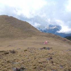
Dashuiku has been a traffic hub since the Qing Dynasty. The Batongguan Historic Trail from the Qing period was completed in the first year of Guangxu (1875). Since then, a camp was set up on the east side of the Dashuiku pond, and today there are remaining ceramic fragments on site that after being studied by archaeologists, they are products of Fujian Dehua kilns during the Xianfeng and Tongzhi reigns of the Qing Dynasty. The Batongguan Traversing Trail was completed in the 10th year of Taisho (1921). The Japanese set up the prefectural boundary on the roadside on the southwest side of the Dashuiku pond, at an altitude of about 3240 meters, and built a pavilion above it for travelers to rest.
In the 1970s, the Forestry Bureau built a tin and iron mountaineering hut in the south of the pond, but it was destroyed by strong winds and snow. Yushan National Park Management Office built a mountain house with solar power supply, rainwater collection tank and simple toilet on the original site, which can accommodate 24 people.

  • - / -
  • - - -
  • -
  • - -/-
  • -
This image is of the high point in the northeast of the Dashuiku pond overlooking the Dashuiku hut and the traversing trail.
This image was taken at a high point in the northeast of the Dashuiku pond. You can see the Dashuiku hut on the left, the Dashuiku pond in the center, the traversing trail and the prefectural boundary above the Dashuiku pond.
古道地圖
沿途景點所在位置
沿途景點所在縣市
花蓮縣
沿途景點所在鄉鎮
卓溪鄉