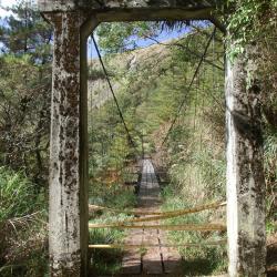
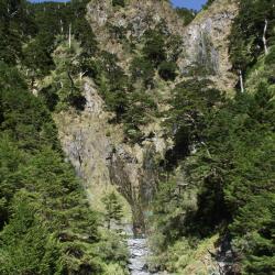
The Upper Guilin Suspension Bridge on the eastern section of Nenggao Traversing Trail is located between the Neggao Saddle and the Cypress Forest Preservation Office, with an altitude of 2,740 meters. Since the eastern section of Nenggao Trail is less used, both important suspension bridges on the way, the Upper Guilin Suspension Bridge and the Guiqi Suspension Bridge, fell into disrepair and became hazardous. In the 6th year of Taisho (1917), the Japanese government opened up the Nenggao Traversing Trail and named it "Hatsune Qilai Crossroad", which is the old Nenggao Traversing Trail. In the 14th year of Taisho (1925), due to the high altitude of the eastern section of the old trail, snow often made it difficult to travel in winter, and the entire Traversging Trail of Hualien Harbor Hall and Nantou Hall was rebuilt, with a total mileage of 76.8 kilometers after completion.
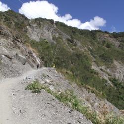
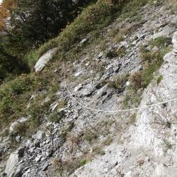
After the war, in order to restore the power system on the island of Taiwan, the Nationalist Government built a number of towers along the Nenggao Traversing route to complete the "East-West Link Transmission Line". In 1998, after the completion of the new east-west transmission line between Mingtan and Fenglin, the old east-west line was gradually replaced until it was officially decommissioned in 2016. At present, the west section of Nenggao Traversing Trail is well maintained due to the demand for the transportation of materials from Tianchi Lodge, and passing of locomotives. The eastern section, on the other hand, has a low utilization rate after the withdrawal of Taipower personnel, and the road conditions are not as good as the western section.
- -/-