Hehuan Traversing Historic Trail

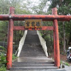
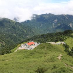
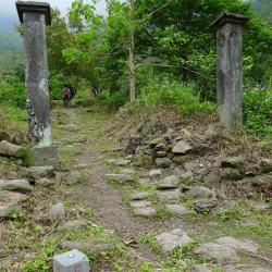
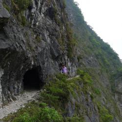
The Hehuan Traversing Historic Trail spans across Ren'ai Township in Nantou County and Xiulin Township in Hualien County. The trail is about 105 km in length, starts from Wushe village in the west and ends in Fushi village in the east. This trail was first built for military purposes by the Government-General in Taiwan during the Japanese occupation to fight the Turuku tribe. After the trail was re-routed and built in 1933, it got turned into a road for regulating the Turuku and Sediq people. This has forced the Turuku people to relocate collectively to another village. This trail was also a gold mining path for gold miners.

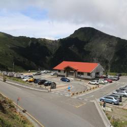
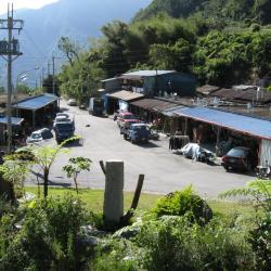
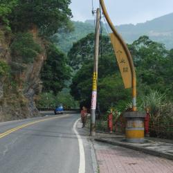
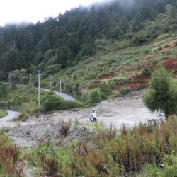
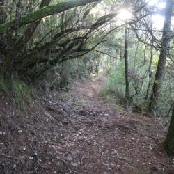
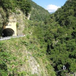
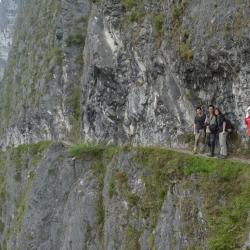
In the early post-war period, the Hehuan Traversing Historic Trail was replaced by the Central Cross-Island Highway after its completion. Currently, most sections of the historic trail are inaccessible, and only some sections have been preserved. Taroko National Park has within its jurisdiction restored the Zhuilu section and Lushui section of the trail.

  • - / -
  • - - -
  • -
  • - -/-
  • -
The Hehuan Traversing Historic Trail between Dayuling and Guanyuan Police Station

古道地圖

Attractions
Wugang Shrine
)霧ケ岡社入口的鳥居,霧ケ岡社戰後被拆除,入口的鳥居上方短柱也是戰後被加上去的。
Wugang Shrine資訊

The Wugang Shrine ruins is located in Jiesho Lane next to the Wushe fire station. Enter the alley and walk for about one or two minutes you will see a red torii gate and stone steps leading to Delong Temple. This torii is the remains of Wugang Shrine. On both sides of the stone-steps there is an abandoned stone lantern, also left from Wugang Shrine. The opening of Wugang Shrine was on December 16, Showa 7 (1932), and the ritual day is October 28th each year. After the war, the shrine was changed to offer sacrifices to Kaitai Shengwang and Fude Zhengshen. In 1958, the government promoted Confucian education and renamed it "Confucius Temple". In 1960, it was renamed "Delong Temple". From the square in front of Delong Temple, you can overlook Wushe Street and Wanda Reservoir. 

Second Office of Taipower Wanda Power Station
台電萬大發電廠第二辦公室
Second Office of Taipower Wanda Power Station 資訊

The second office of the Wanda Power Station of the Taiwan Power Company was originally the Wushe Public School during the Japanese Occupation and the site of the Wushe incident. In the 5th year of Taisho (1916), Japanese people set up Wushe Public School in Wushe area to provide education and placement for Japanese children in Wushe area. On October 27, the 5th year of the Showa era (1930), the Japanese held a sports event here. The staff of the Camphor companyand, the Japanese police officers and officials who were stationed in the headquarters of Nengao County and neighboring areas gathered here. The garrisons were weak in manpower, and was easy to attack and rob weapons and ammunition. Therefore, the six Sediq tribes chose to revolt on this day. After the incident, the Japanese police piled the 138 dead bodies on the playground of the Wushe Public School, and ordered the police to cut firewood and cremate the bodies. It took three days and three nights to complete the cremation.

Mona Rudo Memorial Park
莫那魯道紀念公園
Mona Rudo Memorial Park資訊

On October 27, the 5th year of the Showa era (1930), the Japanese held a sports event here. The staff of the Camphor company, the Japanese police officers and officials who were stationed in the headquarters of Nengao County and neighboring areas gathered here. The garrisons were weak in manpower and were easy to attack and rob weapons and ammunition from. Therefore, the six Sediq tribes chose to revolt on this day, but they were outnumbered and suffered heavy casualties. It is known as the "Wushe Incident" in history. After the incident, Mona Rudo, the leader of the Seediq tribe, shot himself in the dense forest above the cliff above the Mahepo Grottoes. It was not until Showa 8 (1933) that his body was discovered by two hunters from the Sakura community. Nenggao County Police in Nantou Office bound Mona Rudo’s remains with iron wires and put them on public display at the Wude Hall in Puli. Afterward, they were sent to the anatomy room of the Governor’s School of Medicine to be made into bone specimens and then sent to the Department of Anthropology at Taipei Imperial University for classroom research. In 1973, Gao Guang-hua, then mayor of Ren'ai Township (the posthumous son of Jiro Hanaoka who committed suicide in the Wushe incident), and representatives of the clan brought Mona Rudo's remains from the Specimen Exhibition Hall of the Department of Archeology and Anthropology, National Taiwan University, back to Wushe for burial.

The Tomb of Mona Rudo
莫那魯道之墓
The Tomb of Mona Rudo資訊

On October 27, the 5th year of the Showa era (1930), the Japanese held a sports event here. The staff of the Camphor company, the Japanese police officers and officials who were stationed in the headquarters of Nengao County and neighboring areas gathered here. The garrisons were weak in manpower and were easy to attack and rob weapons and ammunition from. Therefore, the six Sediq tribes chose to revolt on this day, but they were outnumbered and suffered heavy casualties. It is known as the "Wushe Incident" in history. After the incident, Mona Rudo, the leader of the Seediq tribe, shot himself in the dense forest above the cliff above the Mahepo Grottoes. It was not until Showa 8 (1933) that his body was discovered by two hunters from the Sakura community. Nenggao County Police in Nantou Office bound Mona Rudo’s remains with iron wires and put them on public display at the Wude Hall in Puli. Afterward, they were sent to the anatomy room of the Governor’s School of Medicine to be made into bone specimens and then sent to the Department of Anthropology at Taipei Imperial University for classroom research. In 1973, Gao Guang-hua, then mayor of Ren'ai Township (the posthumous son of Jiro Hanaoka who committed suicide in the Wushe incident), and representatives of the clan brought Mona Rudo's remains from the Specimen Exhibition Hall of the Department of Archeology and Anthropology, National Taiwan University, back to Wushe for burial.

Qingjing Farm
從立鷹山頂往南空拍清境農場、博愛新村一帶。
Qingjing Farm資訊

Qingjing Farm was established in 1961 and is owned by the Advisory Committee of Retired Officers and Soldiers of the Executive Yuan. During the Qing Dynasty, it was the pasture of the Atayal Wushe group. During the Japanese colonial period, it was changed to a public ranch. After the war, it was taken over by the Nantou County Government and became a Wushe pasture directly managed by the county government, covering an area of ​​280 hectares. In 1960, the Nantou County Government transferred it to the Retirement Association and named it "Jianqing Farm". In the autumn of 1961, the Forestry Bureau transferred the adjacent state-owned 36 forests to the Retirement Association for management. In 1967, it was renamed "Qingjing Farm", which has a meaning of a fairyland with clean fresh air.

Kunyang Rest Stop
從合歡山南峰登山口望昆陽休息站,上方墨綠色山頭為合歡東峰,左側草綠色山頭為合歡主峰,兩峰中間的鞍部為佐久間鞍部(今武嶺)。
Kunyang Rest Stop資訊

The Kunyang Rest Stop is located between Wuling and Yuanfeng, around 30.7K of the Taiwan Provincial Highway 14 of Zhongheng Wushe branch line, and 3,090 meters above sea level. It was where the Hehuanshan Police Post was located during the Japanese occupation.


Walking Trail on the Main Peak of Hehuan Mountain
日治時期,日本政府為討伐太魯閣族人,曾先後組成探險隊進行五次的地形探勘,當時的台灣總督佐久間左馬太曾於大正元年(1912)9月底,隨合歡山探險隊登上合歡主峰山頂,親自觀測周圍的地形環境。現在在合歡山主峰山腰,公路的上方,隱約可見一條與公路平行的小路,這就是太魯閣戰役時日軍所開出的軍用道路,路跡仍清晰,可走上一小段,體會一下日軍當年的討伐之路。
Walking Trail on the Main Peak of Hehuan Mountain資訊

The main peak of Hehuan Mountain is 3,417 meters above sea level, which is the watershed between Liwu River and Zhuoshui River. The mountaineering entry is located at 30.8 km from Taiwan Provincial Highway 14. Since a radar station was built on the Hehuan Main Peak in the early years, the Hehuan Main Peak Trail is actually a road for military vehicles. After the troops withdrew in 2000, the National Park  reorganized this area and transformed old foundations (other than telecommunication base station) into a viewing platform. From the top of the mountain you can see Hehuan Peak, Qilai Peak, Nenggao Mountain, Nanhu Mountain, Central Sharp Mountain, and Yushan Mountain at a glance.

Xibao
西寶國小旁的西寶聚落一景。
Xibao資訊

Xibao is located 161 kilometers away from the Zhongheng Highway. It is a large river terrace. Anthropologists have discovered pottery and stone spinning wheels on the Xibao terrace, which may have been left by humans in the late Neolithic period. About 250 to 300 years ago, after the Truku people settled in the Liwu River valley, they established the Xibao community here. After the Japanese implemented the Lifan policy in 1915, they were forced to move away. After World War II, some returned to the tribe. When the Zhongheng highway began to be excavated, vegetables and fruits were grown on the terraces of Xibao River due to the inconvenient transportation of vegetables in mountainous areas, and Xibao Farm was established. After the highway was opened, the Retirement Association arranged for the veterans to settle here. There is Xibao Elementary School on the terrace. It was originally a school for the children of the Xibao Farm workers, and later it was changed to Forest Primary School. It is the only forest primary school in the country and the only primary school inside the national park.


Renzhiguan
位於霧埔公路大觀橋和仁愛橋之間的人止關
Renzhiguan資訊

Renzhiguan, located between Daguan Bridge and Ren'ai Bridge on Provincial Highway 14, was a gate that was set up during the Qing period to prohibit the Han people from entering the area and to prevent the Han immigrants from having conflicts with the Sediq tribe. However, in the early days of the Japanese occupation, the Governor-General in Taiwan launched a series of large-scale battles against the Sediq tribe in the Wushe area. Both sides suffered heavy losses. Later, the Japanese implemented the strategy of ruling indigenous peoples by their own kind and successfully broke through the defense line. In 1908, police officials were stationed in Wushe, and they devoted all their efforts to build Wushe into a model indigenous society.


Wushe
從空中俯瞰霧社
Wushe 資訊

Wushe, located in Ren'ai Township, Nantou County, sits above the terrace on the west bank of the upper Meixi creek at an altitude of 1,148 meters. It is the intersection of three historic trails: Nenggao Traversing Historic Trail, Hehuan Traversing Historic Trail and Pyanan Historic Trail. It is also the hub of the Aiyong Boundary and has been vigorously constructed by the Governor-General in Taiwan, with administrative agencies, trade companies, hotels, and so on.

In the past, Wushe was not inhabited locally. The Zhuo group of the Bunun tribe called it Ish-Tibuo, which means the northern tribe. During the Qing period, the Han people used Hoklo language to transliterate it to Zhiwushe. Later, it got referred to as Wushe. In the post-war period, the National Government established the township office on Yingtai next to Wushe main street. Today, the residents are mostly Han Chinese.


Liying Police Post
位於立鷹山頂的立鷹駐在所,現為氣象局立鷹中繼站
Liying Police Post資訊

Liying Police Post is located on the top of Mount Liying, above New Bowang Village of Qingjing Farm in Ren’ai Township, Nantou County. It is 2,219 meters above sea level and overlooks the Xueshan Range, the Hehuan peaks, the Qilai peaks and the Shoucheng Dashan. This place was originally the ruins of the Seediq’s Tadaka Hamlet of the Wushe group. During the Japanese occupation, the Governor-General in Taiwan had a fort to suppress the hamlet of the Wushe group. Today, there are forest trails and industrial roads that lead to the top of the mountain.


Zhuifen Police Post
追分駐在所位在現今翠峰派出所對面
Zhuifen Police Post資訊

Zhuifen Police Post of Ren’ai Township, Nantou County is located opposite the current Cuifeng Police Station, which is a popular observatory that overlooks the mountains. During the Japanese Occupation period, Zhuifeng was called Oiwake, which means the divergence point of the road, and just like the name, it was the boundary point acknowledged by the Governor-General in Taiwan and the indigenous tribes. When the Taroko War broke out in 1914, the army would assemble at Zhuifeng Police Post before heading to Hehuanshan as there was a large supply station.

Wuling
從合歡山南峰稜線上遠眺武嶺
Wuling資訊

Wuling is located between the main peak and the east peak of Hehuanshan, on the 31.5 km point of the Provincial Highway 14. It is 3,275 meters above sea level, the highest point of Taiwan Highway, and has a panoramic view of the surrounding mountains. 

During the Japanese occupation, Wuling was called the Hehuanshan Saddle. When the Taroko War broke out in 1914, the then Governor of Taiwan, Sakuma Samata, led troops from Wushe and crossed the saddle to reach the northwestern region of eastern Hehuanshan, and set up a crusade command there. Therefore, Wuling was also called Sakuma Pass at the time. During the Japanese occupation, hikers climbed the main peak of Hehuanshan from here. In the post-war period, due to the excavation of the Central Cross-Island Highway, it was renamed Wuling.


Hehuan Police Post
從高處俯視合歡駐在所一帶的現況
Hehuan Police Post資訊

The Hehuan Police Post is located above the Provincial Highway 14, between Dayuling and Xiaofengkou, at an altitude of 2,782 meters. When the Taroko War broke out in 1914, the then Governor of Taiwan, Sakuma Samata, wanted to use a strong military and police force to defeat the Turuku tribe along the Liwu River. Therefore, Nantou Minister, Ishibashi Tooru, personally led the road excavation team, and opened the road from Puli to Tianxiang. After the war, the road continued to be opened from Puli to Taroko Gorge entrance, which was the original path of the Hehuan Traversing Historic Trail. Later, due to the collective migration of tribes and the steep slope of the original route, the route was modified and completed in 1935. This route was a popular hiking trail at that time.


Hehuan Traversing Historic Trail
從大禹嶺到關原駐在所之間的合歡越嶺古道
Hehuan Traversing Historic Trail資訊

When the Taroko War broke out in 1914, the then Governor of Taiwan, Sakuma Samata, wanted to use a strong military and police force to defeat the Turuku tribe along the Liwu River. Therefore, Nantou Minister, Ishibashi Tooru, personally led the road excavation team, and opened the road from Puli to Tianxiang. After the war, the road continued to be opened from Puli to Taroko Gorge entrance, which was the original path of the Hehuan Traversing Historic Trail. Later, due to the collective migration of tribes and the steep slope of the original route, the route was modified and completed in 1935.

In the post-war period, the Central Cross-Island Highway was opened and replaced the Hehuan Traversing Historic Trail. Coupled with the erosion from typhoons, there are only a few complete road sections that can be walked on today.


Guanyuan Police Post
關原駐在所入口處的的疊石牆
Guanyuan Police Post資訊

The Guanyuan Police Post is located above Guanyuan on the Central Cross-Island Highway, about 2,580 meters above sea level. When the Taroko War broke out, the army sent by the Government-General in Taiwan attacked the Turuku tribe from the east side of Hehuanshan. Guanyuan was the first stop, and when the then Governor of Taiwan, Sakuma Samata, heard that the Turuku tribe had fought here, he named the place after the ancient battleground during the Japanese Sengoku Period, “Sekigahara” (Guanyuan in Chinese character). As a result, the route of Hehuan Traversing Historic Trail was changed in the middle of the Japanese occupation, and the police post was called Guanyuan in honor of the Governor.

In the post-war period, the Central Cross-Island Highway was opened, passing through the small hamlet below Guanyuan Police Post, also known as Guanyuan. The hamlet has a lodge, Hehuan police station, and Guanyuan gas station.


Wenshan Hot Spring
從泰山隧道俯視文山溫泉上方吊橋
Wenshan Hot Spring資訊

Wenshan Hot Spring is located between Tianxiang and Xibao on the Central Cross-Island Highway. It is the only natural Hot Spring in Taroko National Park where water flows out from the crack of a marble rock on Dasha riverbed. It was discovered by Captain Fukami Buheiji during the Taroko War in 1914, and named it Fukami Hot Spring (Chinese character Shen-Shui, meaning deepwater). In the post-war period, the National Government changed its name to Wenshan Hot Spring. The trail on the right side of the south entrance of the Taishan Tunnel used to lead down to the hot spring. However, after a rock fell and injured some tourists in 2005, the trail has been closed since.

Budong Mingwang Temple
位於寧安橋下方的不動明王廟
Budong Mingwang Temple資訊

The Budong Mingwang Temple is located on the 183 km point of the Central Cross-Island Highway, and sits under Ning’an Bridge. There are two bridges parallel to each other on Liwu River. The old red bridge was built when the road was first constructed. It was the longest one-lane bridge in Taiwan at that time. About 50 meters in front of the old bridge, there is a narrow Tianwang Bridge. Under this bridge there is a cave, and inside it is the Budong Mingwang Temple. It is said that it was a Japanese, who mined gold in Liwu River at the end of the Japanese Occupation, that brought the bronze statue of Fudo Myoo (Budong Mingwan or the immovable wisdom king) from Japan. The statue was enshrined here to protect the safety of the mining road construction. In the post-war period, the statue was sent to Xining Temple because there was no one to worship it in Liwu River. In 1951, Taipower rebuilt the statue, brought it back to Liwu and renovated the temple.


Badagang Police Post
巴達岡駐在所遺留的水泥門柱
Badagang Police Post資訊

The Badagang Police Post is located 1 km of the Zhuilu section of the Hehuan Traversing Historic Trail.  The terrain is gentle, but the cliff at the south edge of the mountain falls steeply.

Traditionally, it was a Turuku village of the Badagang group, which the traditional name of this place means makino bamboo. It also has the meaning of striking battlefield. According to records, in the past, the Badagang tribesmen temporarily moved to the lower reaches of Liwu River for refuge due to typhoon destruction. When they returned to their homes, they found that the land had been taken by the people from Jingguan Hamlet. They made spears from bamboos and fought back the land.

During the Japanese occupation, the Governor-General in Taiwan established a healthcare center, education center, and police post here. Later, guest houses, clubs, and dormitories were added in promoting the Taroko National Park project as a resting area between the route of Fushi and Tianxiang.

Zhuilu Cliff
峭壁垂直陡立的錐麓大斷崖
Zhuilu Cliff資訊

Zhuilu Cliff is located on the Zhuilu section of the Hehuan Traversing Historic Trail. It is a steep cliff that was formed by the Liwu River cutting through the ridgeline of the mountain. It is about 1,200 meters long, 600 meters high and is mostly marble rocks. It faces the Fuji Cliff across the Liwu River, which is only around 20 meters away. It can even be called the most magnificent landscape in the Taroko Gorge.

Due to the steep terrain of the Zhuilu section of the historic trail, some sections of the road have collapsed. For safety purposes, only the section from the entrance to the Duan’ya police post (around 3.1 km) is currently open. If walking from the Zhuilu Suspension Bridge, it takes about 90 minutes to reach the most quintessential section of Zhuilu Cliff.

Small tunnel in the middle of Zhuilu Cliff
錐麓大斷崖中間小隧道的外觀
Small tunnel in the middle of Zhuilu Cliff資訊

Zhuilu Cliff is located on the Zhuilu section of the Hehuan Traversing Historic Trail. It is a steep cliff that was formed by the Liwu River cutting through the ridgeline of the mountain. It is about 1,200 meters long, 600 meters high and is mostly marble rocks. It faces the Fuji Cliff across the Liwu River, which is only around 20 meters away. It can even be called the most magnificent landscape in the Taroko Gorge.

When walking along the Zhuilu cliff, you will pass through a small tunnel. Inside the tunnel is a stone-carved Buddha, and the stone wall outside the tunnel is engraved with the words commemorating the excavation team who completed the project in 1915. The excavation project was led by Police Captain Umezawa Masa.

Stone Buddha inside the small tunnel on Zhuilu Cliff
錐麓大斷崖小隧道內的石雕菩薩
Stone Buddha inside the small tunnel on Zhuilu Cliff資訊

Zhuilu Cliff is located on the Zhuilu section of the Hehuan Traversing Historic Trail. It is a steep cliff that was formed by the Liwu River cutting through the ridgeline of the mountain. It is about 1,200 meters long, 600 meters high and is mostly marble rocks. It faces the Fuji Cliff across the Liwu River, which is only around 20 meters away. It can even be called the most magnificent landscape in the Taroko Gorge.

When walking along the Zhuilu cliff, you will pass through a small tunnel. Inside the tunnel is a stone-carved Buddha, and the stone wall outside the tunnel is engraved with the words commemorating the excavation team who completed the project in 1915. The excavation project was led by Police Captain Umezawa Masa.

Duan-ya Police Post
斷崖駐在所
Duan-ya Police Post資訊

The Duan-ya Police Post at the Zhuilu section of the Hehuan Traversing Historic Trail is located on the west side of the Zhuilu Cliff, just where it begins to enter the forest. It was first the Donglu Branch Office. Later in 1922, it was changed to Duan-ya Police Post and was finally abolished in 1934.

Today, hikers who come here will rest on the concrete foundation platform that remained from the police post before turning back.

Monument of the deceased Inspector in Charge Daigoro of Karenko (now Hualien County)
故花蓮港廳巡査班長持館代五郎之碑
Monument of the deceased Inspector in Charge Daigoro of Karenko (now Hualien County)資訊

The Monument of the deceased Inspector in Charge Daigoro of Karenko (now Hualien County), is located at the foot of the Zhuilu section of the Hehuan Traversing Historic Trail, about 50 meters away from the Duan-ya Police Post.

The monument was set up in memory of Inspector in Charge Daigoro of Donglu Checkpoint (later the checkpoint became Duan’ya police post), who was attacked and killed by indigenous people in 1916 while on duty. The monument was originally erected on a wooden pillar but was later converted into a cement tombstone in 1935. As the condition of the road that leads to the police post and the monument is poor, the monument is not open now.