Hapen Historic Trail

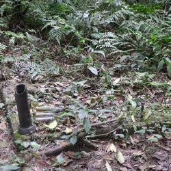
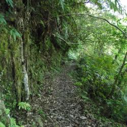
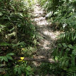
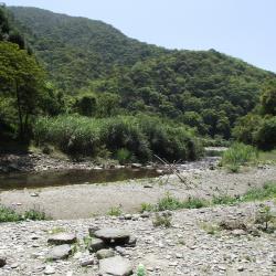
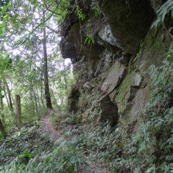
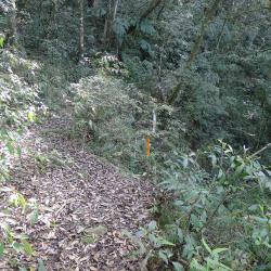
The Hapen Historic Trail, which runs diagonally through Wulai District of New Taipei City and Datong Township in Yilan County, was completed in 1931. The trail starts from Fushan in the west and ends in Lunpi in the east, with a total length of about 24 km. Before this, the trail was a narrow passage that runs from Shenken to Yilan crossing the Aiyong border. The road is narrow and undulate, making it difficult to walk on. However, the Government-General in Taiwan wanted to regulate and relocate the Atayal group to another village and so, the narrow passage was extended, and was used for regulating indigenous people.

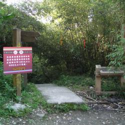
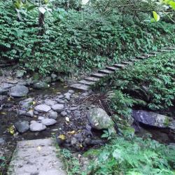
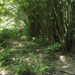
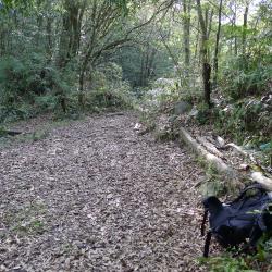
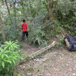
Today, the Hapen Historic Trail is well-preserved and attracts many hikers. It is also an important passage for villages such as Fushan, Lunpi, Xiapen, and other tribes for entering the traditional territories for gathering, fishing, and hunting.

  • - / -
  • - - -
  • -
  • - -/-
  • -
Hapen Historic Trail

古道地圖

Attractions
Fushan Mountaineering Entrance
福山登山口入口指示牌
Fushan Mountaineering Entrance資訊

Hapen Historic Trail starts from Fushanli, Wulai District, New Taipei City in the west, and ends in Lunpi Village, Datong Township, Yilan County in the east. Formerly known as "Shenkeng to Yilan Crossing Aiyong Boarder", when the Japanese government rebuilt thisroad for relocating the indigenous people of the Ka’aowan group from Takasan and Gaoyilan communities in Showa 6 (1931). The original starting point was near Xinxian Village, Wulai District, follow the right bank of Nanshi River to Fushan Village and then turn to the direction of Hapen. Later, due to the excavation of modern roads, the mountaineering entrance was also moved to the Karamoji Industrial Road on the opposite bank of Fushan Village.


Cedar Forest
哈盆越嶺古道途經柳杉林區道路
Cedar Forest資訊

The Hapen Historic Trail, which runs obliquely through Wulai District, New Taipei City, and Datong Township, Yilan County, goes along the right bank of the upper reaches of Nanshi River and around the mountain. The path crosses the tributaries of Nanshi River many times. The road conditions are flat, the shade is dense, and the natural landscape is primitive, which is quite suitable for ecological observation, mountaineering and hiking and other activities.


Polu Creek
哈盆越嶺古道鄰近4.5K~5K溪流-波露溪
Polu Creek資訊

The Hapen Historic Trail, which runs obliquely through Wulai District, New Taipei City, and Datong Township, Yilan County, goes along the right bank of the upper reaches of Nanshi River and around the mountain. The path crosses the tributaries of Nanshi River many times. There are three main locations where you need to wade across the river before arriving at Hapen Camp. The first river crossing is at around 3K of the trail. Polu Creek is also one of the tributaries of the upper reaches of Nanshi River. The stream is clear and shallow, but the roadbed near the stream is lost and very steep. Although there are ropes to assist, you still need to be very cautious.

Upstream of Nanshi River
南勢溪上溯一景
Upstream of Nanshi River資訊

The Hapen Historic Trail, which runs obliquely through Wulai District, New Taipei City, and Datong Township, Yilan County, goes along the right bank of the upper reaches of Nanshi River and around the mountain. The path crosses the tributaries of Nanshi River many times. Once reached the Hapen Camp, continue walking along Nanshi River for an hour until reaching the confluence of the tributaries. Then cut the ridge line, and go around to the saddle between Hongchai Mountain and Zhongling Mountain, and finally arriving at Lunpi.

County Boundary
調查人員於縣界勘查
County Boundary資訊

The Hapen Historic Trail starts from Fushan, and goes all the way around the right bank of Nanshi River. After crossing several tributaries, it arrives at the confluence of Hapen River and Nanshi River. Climb up the ridge between the two streams to reach the east saddle of Peak 934, and then continue to climb to the county boundary between New Taipei City and Yilan County, which is also the highest point of the historic trail, the saddle between Hongchai Mountain and Zhongling Mountain. Then pass Zhongling Police Post and finally arriving at Lunpi.

The county boundary is about 1,050 meters above sea level, and takes about 80 minutes to reach Zhongling Mountain.

Road Signs at Mountaineering Entrance
哈盆越嶺道登山口木牌指示牌
Road Signs at Mountaineering Entrance 資訊

Hapen Historic Trail starts from Fushanli, Wulai District, New Taipei City in the west, and ends in Lunpi Village, Datong Township, Yilan County in the east. It was formerly known as the "Shenkeng to Yilan Crossing Aiyong Boarder", built in built in Meiji 38 (1905). In Showa 6 (1931),  the Police Department of the Taiwan Governor's Office rebuilt the road to relocate the indigenous people of the Ka’aowan group from Takasan and Gaoyilan communities. The road continued to be used after the war until now.

The wooden sign at the entrance indicates the distance from the trailhead to Fushan Elementary School (2.4 kilometers, about 53 minutes walk), and Hapen Campground (9 kilometers, 203 minutes walk).

First creek after entering the trail
哈盆越嶺道登山口附近小溪流
First creek after entering the trail資訊

Hapan Historic Trail starts from Fushanli, Wulai District, New Taipei City in the west, and ends in Lunpi Village, Datong Township, Yilan County in the east. The original starting point was near Xinxian Village, Wulai District, along the right bank of Nanshi River to Fushan Village, and then turned to Hapen direction. Later, due to the excavation of modern roads, the trailhead was also moved to the Karamoji Industrial Road on the opposite bank of Fushan Village.


It was formerly known as the "Shenkeng to Yilan Crossing Aiyong Boarder", built in built in Meiji 38 (1905). In Showa 6 (1931),  the Police Department of the Taiwan Governor's Office rebuilt the road to relocate the indigenous people of the Ka’aowan group from Takasan and Gaoyilan communities. The road continued to be used after the war until now.

Nanshi River
哈盆越嶺古道1.5K俯瞰南勢溪溪谷
Nanshi River資訊

The Hapen Historic Trail starts from Fushan, and along the way to Hapen you can see Nanshi River in the distance. The image shows the view of Nanshi River Valley from around 1.5K of the trail.


Kalamoji Police Station
雨量計所在平臺即為卡拉模基警官駐在所遺址
Kalamoji Police Station資訊

The Kalamoji Police Post is located on the 3.5 km point of the Hapen Historic Trail in Wulai District, New Taipei City. It is the first police post to arrive after walking from the trail entrance. 

The station was an abolished Aiyong Supervision Office during the Japanese occupation. However, to force the Atayal tribe from the Kaowan group in the Taoyuan area to relocate, the Government-General in Taiwan changed it to a police post in 1931.

Today, the Bureau of Meteorology has set up a rain gauge platform on the former site of the Kalamoji police post.


Hapen Police Post
位在哈盆營地後方平臺上的哈盆警官駐在所遺址
Hapen Police Post資訊

The Hapen Police Post, located in Wulai District of New Taipei City, was originally an abolished Aiyong Supervision Office on the Aiyong Boundary between Shenken and Yilan. However, during the Japanese pccupation, the Government-General in Taiwan changed it to a police post in 1931 in order to force the Atayal people of the Kaowan group in the Taoyuan area to relocate collectively.

Today, the site where the police post once stood is located on the rear platform of the Hapen camp. There are piles of stone remaining on the ground, but have been covered by weed and bamboo forests. It takes about 4 hours to walk from the entrance of the Kalamoji Trail.


Zhongling Police Post
中嶺警官駐在所遺址上的水泥地基
Zhongling Police Post資訊

The Zhongling Police Post, located in Datong Township of Yilan County, was established in 1935 and abolished after the war. The ruins of the police post can be reached by a 3-hour walk starting from the Hapen Camp, then crossing the saddle between Mout Zhongling and Mount Hongchai. Alternatively, start from the end of the Lunpi industrial road and it will take around 50 minutes on foot to reach the site.

Today, there are still some concrete foundations and buildings on the ruins of the Zhongling police post, but they have been covered by tree roots and weeds.


Green Scenery of the Trail
哈盆越嶺古道的登山入口附近
Green Scenery of the Trail資訊

The Hapen Historic Trail, which crosses diagonally through Wulai District of New Taipei City and Datong Township of Yilan County, runs along the right bank of the upper reaches of Nanshi River and around the mountains. It is rich in natural habitat and is known as Taiwan Amazon. As the road conditions are flat, the trees are dense, and the natural landscape is pristine, it is a suitable place for ecological observation, mountain hiking and other activities.


Trail on the cliff
位在波露溪和露門溪之間的哈盆越嶺古道,開鑿在峭壁上的路段
Trail on the cliff資訊

The Hapen Historic Trail, which crosses diagonally through Wulai District of New Taipei City and Datong Township of Yilan County, runs along the right bank of the upper reaches of Nanshi River and around the mountains. It is rich in natural habitat and is known as Taiwan Amazon. As the road conditions are flat, the trees are dense, and the natural landscape is pristine, it is a suitable place for ecological observation, mountain hiking and other activities.


The remains of the suspension bridge
露門溪旁的吊橋遺跡,仍可見地上露出的纜線
The remains of the suspension bridge資訊

The Hapen Historic Trail, which crosses diagonally through Wulai District of New Taipei City and Datong Township of Yilan County, runs along the right bank of the upper reaches of Nanshi River and around the mountains. As it was required to cross the Polu River and Lumen River when traveling on this trail, the Government-General in Taiwan built a suspension bridge to facilitate crossing the river. However, the suspension bridges have been destroyed now, and mountaineers must wade across the river. If there is a typhoon or heavy rain, it is safer not to walk the trail.


Hapen River Campsite
坐落南勢溪和哈盆溪匯流之處的哈盆溪營地
Hapen River Campsite資訊

The Hapen Historic Trail, which crosses diagonally through Wulai District of New Taipei City and Datong Township of Yilan County, runs along the right bank of the upper reaches of Nanshi River and around the mountains. It is rich in natural habitat and is known as Taiwan Amazon. As the road conditions are flat, the trees are dense, and the natural landscape is pristine, it is quite suitable for ecological observation, mountain hiking and other activities.

The Hapen River Camp is located below the Hapen police post, on the confluence of Nanshi River and Hapen River. The riverbed is wide and the water is clear, making it the perfect summer camping resort.

East Saddle of 934 Peak
934峰東鞍的平臺
East Saddle of 934 Peak資訊

The Hapen Historic Trail, which crosses diagonally through Wulai District of New Taipei City and Datong Township of Yilan County, starts from Fushan in the west and reaches Lunpi in the east.

The trail runs along the right bank of the upper reaches of Nanshi River and around the mountains. After arriving at the confluence of Nanshi and Hapen River, continue up the Nanshi River valley to reach the estuary of the two rivers. Then the path climbs up the ridgeline between the two rivers to reach the east saddle of Peak 934. Continue climbing up to the saddle between Mount Hongchai and Mount Zhongling to reach the highest point of the Hapen Historic Trail. From there it is a descending road to Zhongling police post, and finally arriving at Lunpi.


Entrace of the former Zhongling Police Post
中嶺警官駐在所入口處的兩根橫木
Entrace of the former Zhongling Police Post資訊

The Zhongling Police Post, located in Datong Township of Yilan County, was established in 1935 and abolished after the war. The ruins of the police station can be reached by a 3-hour walk starting from the Hapen camp. Then cross the saddle between Mount Zhongling and Mount Hongchai. Alternatively, start from the end of the Lunpi industrial road and it will take around 50 minutes on foot to reach the site.

Today, there are still two horizontal logs and a row of stones, as well as cement foundations and buildings at the former site of the Zhongling police station entrance, but they are all covered in weed roots.


Trail on the cliff
中嶺警官駐在所和崙埤山西鞍之間的哈盆越嶺古道路段
Trail on the cliff資訊

The Hapen Historic Trail, which crosses diagonally through Wulai District of New Taipei City and Datong Township of Yilan County, runs along the right bank of the upper reaches of Nanshi River and around the mountain.

The trail passes through the tributaries of Nanshi river several times, and arrives at Happen Camp, where Nanshi River and Hapen River converge. Continuing from the camp, the path began to climb up to the saddle between Mount Hongchai and Mount Zhongling. It then passes around the Zhongling police post, descends to the west saddle of Lunpishan, and finally connects to the industrial road.


Water source between Polu River and Lumen River
波露溪與露門溪之間一處小瀑水源,距離波露溪約1公里
Water source between Polu River and Lumen River資訊

The Hapen Historic Trail, which crosses diagonally through Wulai District of New Taipei City and Datong Township of Yilan County, starts from Fushan in the west and reaches Lunpi in the east.

The trail runs along the right bank of the upper reaches of Nanshi River and around the mountains. After arriving at the confluence of Nanshi and Hapen River, continue up the Nanshi River valley to reach the estuary of the two rivers. Then the path climbs up the ridge line between the two rivers to reach the east saddle of Peak 934. Continue climbing up to the saddle between Mount Hongchai and Mount Zhongling to reach the highest point of the Hapen Historic Trail. From there it is a descending road to Zhongling police post, and finally arriving at Lunpi. As the trail passes through many tributaries along the way, there are many water sources.


Trail on east saddle of 934 Peak
從雙溪口上切到934峰東鞍的哈盆越嶺古道路段
Trail on east saddle of 934 Peak資訊

The Hapen Historic Trail, which crosses diagonally through Wulai District of New Taipei City and Datong Township of Yilan County, starts from Fushan in the west and reaches Lunpi in the east.

The trail runs along the right bank of the upper reaches of Nanshi River and around the mountains. The trail passes through the tributaries of Nanshi river several times. After arriving at the confluence of Nanshi and Hapen River, continue up the Nanshi River valley to reach the estuary of the two rivers. Then the path climbs up the ridge line between the two rivers to reach the east saddle of Peak 934. Continue climbing up to the saddle between Mount Hongchai and Mount Zhongling to reach the highest point of the Hapen Historic Trail. From there it is a descending road to Zhongling police post, and finally arriving at Lunpi.