Fuba Cross-Ridge Historic Trail

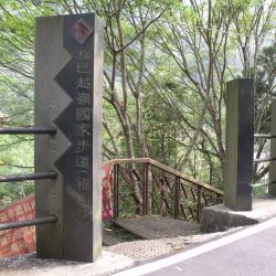
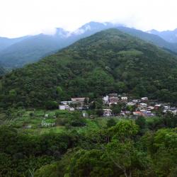
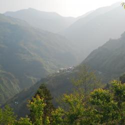
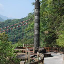
The Fuba Cross-ridge Historic Trail, which runs through Wulai District of New Taipei City and Fuxing District of Taoyuan City, began construction in 1922 and completed the following year. The trail starts from Fushan in the north and reaches Baling in the south. It is about 33 km long and is one of the six historic tribal trails that run from north to south.  

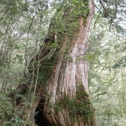
The Fuba Cross-ridge Historic Trail used to be a road for the local Atayal tribes to connect with each other. During the Japanese occupation, the Government-General in Taiwan expanded and extended this trail, which connected indigenous lands in Wenshan County in Taipei Prefecture with Daxi County in Hsinchu Prefecture. This was to better regulate indigenous peoples.  

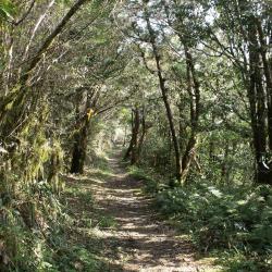
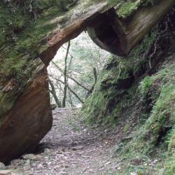
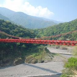
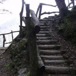
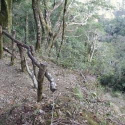
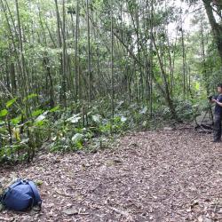
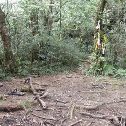
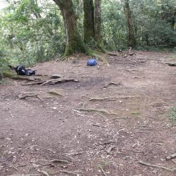
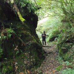
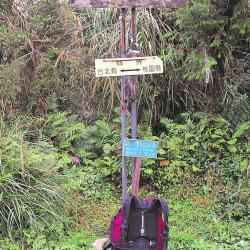
Today, some sections of the Fuba Cross-ridge Historic Trail have been incorporated into the foundation of the Northern Cross-Island Highway. Some sections have also been built as the Fuba Cross-ridge Trail and so the conditions of this trail are well maintained.

  • - / -
  • - - -
  • -
  • - -/-
  • -
Cover photo of Fuba Yueling Ancient Road

古道地圖

Attractions
Fushan Mountaineering Entrance
福山登山口指示牌
Fushan Mountaineering Entrance資訊

Fushan Village is located in Wulai District, New Taipei City. It is the most inland village in Wulai District, and it is also the starting point of the northern end of the Fuba Cross-ridge Historic Trail. The historic trail is a popular route in the mountaineering world. From Wulai Fushan to Balinglala Mountain, the length of the trail is about 17 kilometers, and can be completed in about a day. The protected area is rich in ecological resources. The trailhead is located opposite the residential house on No. 2 Daluolan. The entrance is marked with "Fuba Cross-ridge National Trail". Go down the stairs, pass the Fushan Suspension Bridge, and you are on the historic trail.

Sacred Tree
福巴越嶺古道上聳立參天神木
Sacred Tree資訊

There are many sacred trees scattered along the trail between Lalashan and Guishan Police Post, as well as the Lalashan sacred trees at the Baling Mountaineering Entrance. 

The altitude of this area is between 1,300 and 1,700 meters, and the climate is suitable for the growth of cypress forests. The sacred tree in the image is located between the Guishan Police Post and the Lalashan Police Post.

Lalashan Police Post Entrance
拉拉山駐在所入口景館
Lalashan Police Post Entrance資訊

The Lalashan Police Post was established in the 11th year of Taisho (1922) and abolished in June of the 35th year of the Republic of China (1946). The site is located at 11.5K of Fuba Cross-ridge Historic Trail, about 2 hours' walk from the Sacred Trees area of ​​Lalashan. The site is a wide three-story platform. On the platform, there are abandoned hunting huts, some broken bowls and glass bottles left over from the Japanese occupation period. Many stacked stone walls can also be found around. There is a slope at the entrance of the site, which is overgrown with weeds. The image is a view taken from the historic trail to the entrance slope.


Trail near the County Boundary
縣界附近的古道狀況
Trail near the County Boundary資訊

The Fuba Cross-ridge Historic Trail is also a trail for climbing Lalashan and Guishan. If you have spare energy, you can make a detour and climb to the top of these mountains along the way. The climbing entrance of Lalashan is located near the county boundary, and takes around 1 hour one way. The climbing entrance of Guishan is located at the Guishan Police Post, and the climbing time is about 25 minutes.

Gigantic Fallen Tree
拉拉山神木區到檜山駐在所之間,可見巨大倒木隧道
Gigantic Fallen Tree資訊

There are many sacred trees along the way from the sacred tree area of ​​Lalashan to the Guishan Police Post, and there are also many huge fallen trees. Since large fallen trees are not easy to be removed, it is often seen that the giant trees lying on the road are sawn open to form a passage. The huge fallen log in this image is located near 15K of the trail.

Baling Bridge
遠眺巴陵橋一景
Baling Bridge資訊

The predecessor of the Northern Cross-island Highway was Jiaobanshan Sanxing Guard Road during the Japanese colonial period. In October of the third year of Taisho (1914), the Japanese built the Balong Suspension Bridge at 47 kilometers away from today's Northern Cross-island Highway. Fuba Cross-ridge Historic Trail connects with Jiaobanshan Sanxing Road here. During the construction of the Northern Cross-island Highway in the 1960s, the Balong Bridge was demolished and rebuilt as "Baling Bridge".

Detouring Wooden Stairs
林務局架設高繞木梯,協助徒步者繞過崩壁
Detouring Wooden Stairs資訊

The starting point of the Fuba Cross-ridge Historic Trail is in Fushanli, Wulai District, New Taipei City, and the finishing point is in Baling, Taoyuan City. It was one of the important transportation passage between New Taipei City Wulai District and Taoyuan Fuxing District druring the Japanese rule. In recent years, it has been planned and built by the Forestry Bureau as a section of the "Chiatianshan National Trail System". The entire path runs through the Lalashan the Chitianshan Natural Reserves. There are many giant red cypress trees along the route, which is also an important habitat environment for wildlife. After entering the Fuba Cross-ridge Historic Trail from the mountaineering entrance of the Sacred Trees District of Lalashan, walk for about 10 minutes, you will encounter a collapsed wall. Since this section of the trail has collapsed, the Forestry Bureau erected wooden stairs to bypass the collapsed section. This detour, Gaorao Road, can be passed in about 5 minutes.


Gaorao Road
高繞路一景
Gaorao Road資訊

The starting point of the Fuba Cross-ridge Historic Trail is in Fushanli, Wulai District, New Taipei City, and the finishing point is in Baling, Taoyuan City. It was one of the important transportation passage between New Taipei City Wulai District and Taoyuan Fuxing District druring the Japanese rule. In recent years, it has been planned and built by the Forestry Bureau as a section of the "Chiatianshan National Trail System". The entire path runs through the Lalashan the Chitianshan Natural Reserves. There are many giant red cypress trees along the route, which is also an important habitat environment for wildlife. After entering the Fuba Cross-ridge Historic Trail from the mountaineering entrance of the Sacred Trees District of Lalashan, walk for about 10 minutes, you will encounter a collapsed wall. Since this section of the trail has collapsed, the Forestry Bureau erected wooden stairs to bypass the collapsed section. This detour, Gaorao Road, can be passed in about 5 minutes.


Fushan Hamlet
從高處遠眺福山部落
Fushan Hamlet資訊

The Fushan Hamlet is located in the upper reaches of Nanshi River in Wulai District, New Taipei City. It was the earliest hamlet established by the Atayal people in Wulai District during the Qing period. They were the Talanan and Limao-an tribes.

Later, due to the increased population, the tribes began migrating to the lower reaches of Nanshi River. Through social changes, the people living in Fushan hamlet further established the Tunlu, Limao’an, Karamuki and Daluolan hamlets.

During the Japanese occupation, the Governor-General in Taiwan set up the Limao’an Police Post in Limao’an hamlet. After that, the Mitsui Gomei Company took the land and forced the people to move. In the post-war period, the National Government delineated the administrative area and merged the hamlets into Fushan village.


Kara Hamlet
從高處遠眺卡拉部落
Kara Hamlet資訊

The Kara Hamlet is located 3 km northeast of Shangbaling in Fuxing District, Taoyuan City, on the hillside on the south bank of Daguan River. It sits 900 meters above sea level, and the traditional Atayal name is Qara, which means separate or branch.

In the past, two brothers had to separate due to insufficient hunting grounds. The eldest brother and his family stayed in today’s Baling Hamlet, while the younger brother took their family and arrived at the old tribe, which is on the hill opposite to the current Kara Hamlet.

Many years ago, due to typhoons the people moved to Kara hamlet for the safety of their homes and traffic reasons. It is a hamlet of around 20 households, mainly living in the vicinity of the boat-shaped church.

Chaken Police Post
僅存一片竹林的茶墾警官駐在所遺址
Chaken Police Post資訊

The Chaken Police Post in Wulai District, New Taipei City is located on the 3.5 km point of the Fuba Cross-ridge Historic Trail. It was built in 1911 for the officers managing indigenous people during the Japanese occupation, and was abolished by the National Government in the post-war period.

Today, you can reach the site on foot and it takes around an hour from the entrance of the Fuba Cross-ridge Historic Trail. In the past, there was a monument for monk Aiyonglin and Liu Shi on site. Nowadays there is only a flat land of bamboo forests.

Guishan Police Post
檜山警官駐在所遺址均被雜草樹木遮蔽
Guishan Police Post資訊

The Guishan Police Post is located in Wulai District, New Taipei City, at 8.5 km on the Fuba Cross-ridge Historic Trail. It is the midpoint of the entire trail and the entrance to Guishan. It sits about 1,300 meters above sea level, and was set up in 1922 by the Government-General in Taiwan during the Japanese occupation.

Today, what is left from the Guishan police post is its wide platform, surrounded by stacked stone walls and artificial forests on the platform. The former site is covered by weeds and trees. When coming from Fushan, pass the site and you can see many giant trees along the path. Continue walking and you will find yourself in a well-known group of sacred trees in Lalashan.

Lalashan Police Post
拉拉山警官駐在所遺址仍留有日治時期的生活遺物
Lalashan Police Post資訊

The Lalashan Police Post  is located on the 11.5 km point of the Fuba Cross-ridge Historic Trail entrance, at the end of the ridge of Lalashan in Fuxing District, Taoyuan City. It sits about 1,500 meters above sea level and was built in 1922 by the Government-General in Taiwan during the Japanese occupation. It was not until the post-war period that it was abolished by the National Government.

Today, the police post ruin still maintains a wide three-story platform, surrounded by stacked stone walls, and stone stairs at the entrance. On the platform, there are still pieces of porcelain bowls and glass bottles from the Japanese Occupation period. It takes about 2 hours on foot to reach the site from the sacred trees of Lalashan.


Biashan Police Post
水泥平臺上的民宅即為比亞山警官駐在所遺址
Biashan Police Post資訊

The Biashan Police Post in the Fuxing District of Taoyuan City sits about 1,325 meters above sea level. It has a good view of Mount Baling and Upper Baling. The police post was set up in 1922 by the Government-General in Taiwan during the Japanese occupation. It was not until the post-war period that it was abolished by the National Government.

If you go from Baling to Lalashan Nature Reserve, before reaching the Lalashan Management Station of the Forestry Bureau there will be a concrete platform and several houses on the side of the road. This is the former site of Biashan police post.


Balingshan Police Post
現今巴陵派出所的前身即為巴陵山警官駐在所
Balingshan Police Post資訊

The former Balingshan Police Post is located in the Fuxing District of Taoyuan City. It is located at the intersection of Baling Road and sits about 1,150 meters above sea level. It was established in 1922 by the Government-General in Taiwan during the Japanese occupation.

It is now the Baling Police Station of the Daxi Branch. There are parking lots, a lookout deck, restaurants, and shops. Walk up the fork road next to the police station for 10 minutes to reach Baling Elementary School and Baling Fort.


Baling Fort
巴陵砲臺
Baling Fort資訊

The former site of the Baling Fort and the military camp in the Fuxing District of Taoyuan City is located on the top of Balingshan, about 1,230 meters above sea level. It can be reached by a 10-minute walk up the fork road next to the Baling Police Station. It is also known as the Malun Fortress.

During the Japanese occupation, in order to control the Kara Valley in the north, Taman Valley and Sanguang Valley in the south, and the Yeheng Valley and Dahan Valley in the west, the Government-General in Taiwan set up forts on the higher ground. However, in 2018, the Fuxing District Office of Taoyuan City set up the Baling Tower on the site of the Baling Fort, which has lightning protection, broadcasting and sightseeing functions.


Lengjiao Police Post
位在拉拉山遊客中心對面的稜角警官駐在所遺址
Lengjiao Police Post資訊

The Lengjiao Police Post was located on the open space at the entrance of the Baling Historic Trail Ecological Park in the Fuxing District of Taoyuan City. It sat opposite the present Lalashan Visitor Center, about 580 meters above sea level.

It was abolished by the National Government in the post-war period, and now there is no trace of it anymore. However, the Baling Historic Trail Ecological Park has built walkways and a rope bridge from the Baling Bridge to the Lalashan Visitor Center, and set up a butterfly pavilion, a beetle museum, a broad-leaved forest museum, and a geological museum. You can enjoy the scenery by going down the trail to the lookout deck and enjoy a panoramic view of the two old and new Baling Bridges as well as overlooking Dahan River.

Balong Suspension Bridge
巴壟鐵線橋遺跡的紀念石柱
Balong Suspension Bridge資訊

The Balong Suspension Bridge in the Fuxing District of Taoyuan City is located on the 47 km point of the Provincial Highway 7 and was completed in 1914. It was the junction of the Fuba Historic Trail and the Jiaobanshan Sanxing Guard Road during the Japanese occupation. The Sanxing Guard Road is the predecessor of the current Northern Cross-Island Highway.

In the post-war period, the National Government built the Northern Cross-Island Highway, demolished the Balong Bridge and built the (old) Baling Bridge.

Today, in the small park next to the tunnel entrance, the memorial stone pillar of the Balong Bridge still stands, with “Balong Bridge” carved on the front, and the year it was built engraved on the back. Later, due to traffic congestion, the Ministry of Transport built a new Baling Bridge at the lower reaches of the Baling Bridge.


Guishan Police Post Platform
檜山警官駐在所平臺遺址均被雜草樹木遮蔽
Guishan Police Post Platform資訊

The former site of Guishan Police Post is located on the 8.5 km point of the Fuba Cross-ridge Historic Trail in Wulai District, New Taipei City.  It is the midpoint of the entire trail and the entrance to Guishan. It sits about 1,300 meters above sea level, and was set up in 1922 by the Government-General in Taiwan during the Japanese occupation.

Today, what is left from the Guishan police post is its wide platform, surrounded by stacked stone walls and artificial forests. The site is covered in weeds and trees. When coming from Fushan, pass the site and you can see many giant trees along the path. Continue walking and you will find yourself in a well-known group of sacred trees in Lalashan.

Fuba Cross-ridge Historic Trail
鑿穿巨石而過的福巴越嶺古道
Fuba Cross-ridge Historic Trail資訊

The Fuba Cross-ridge Historic Trail, which runs through Wulai District in New Taipei City and Fuxing District in Taoyuan City, was used to connect Wenshan County in Taipei Prefecture and Daxi County in Hsinchu Prefecture during the Japanese occupation.

In recent years, it was reconstructed by the Forestry Bureau as one of the sections of the Chatianshan National Trail System. The trail is about 17 km long and takes about one day to hike. The whole route runs through the Lalashan Reserve and the Chatianshan Reserve. There are many giant red cypress trees along the path, and is also an important habitat for wild animals.


County Boundary
福巴越嶺古道所經過的縣界鞍部
County Boundary 資訊

The Fuba Cross-ridge Historic Trail, which runs through Wulai District in New Taipei City and Fuxing District in Taoyuan City, was used to connect Wenshan County in Taipei Prefecture and Daxi County in Hsinchu Prefecture during the Japanese Occupation period.

In recent years, it was reconstructed by the Forestry Bureau as one of the sections of the Chatianshan National Trail System. The trail is about 17 km long and takes about one day to hike. The county boundary is located at the junction of New Taipei City and Yilan County, where a weather station was set up by the Meteorological Bureau.