Dajia River Historic Trail

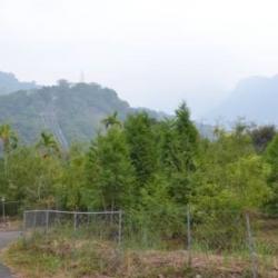
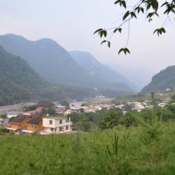
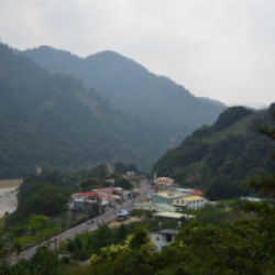
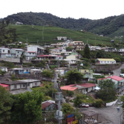
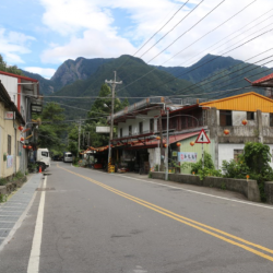
Located in the Heping District of Taichung City, the Dajia River Historic Trail was built in 1922. The trail starts from Songhe in the west and ends in Lishan in the east. It is about 62 km long and mainly passes through the traditional territories of the Atayal people.

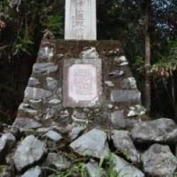
According to records, the predecessor of the Dajia River Historic Trail was originally the patrol passage of the Baileng Aiyong Boarder. When the Government-General in Taiwan implemented a five-year plan for managing indigenous peoples, trials like this were excavated, extended and police patrol posts were set up along the trail.


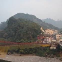
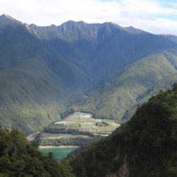
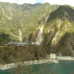
This trail was then connected to the Pyanan Historic Trail in the north that formed an important passage to Nenggao County of Taichung at that time. Many mountaineering investigation teams used this trail to climb Xueshan (formerly known as Mount Sylvia). Today, most sections of the Dajia River Historic Trail overlap with the Central Cross-island Highway and have been replaced by it.

  • - / -
  • - - -
  • -
  • - -/-
  • -
Overlooking the Jiayang alluvial fan and the Jiayang hamlet from above

古道地圖

Attractions
Heping
影像為今臺中市和平區。
Heping資訊

The original name of Heping is "Shaolaiping", which is a narrow river terrace on the right bank of Dajia River. The name came about after the "Shaolaishe" community moved here. Shaolaishe originally lived scattered in the northwestern part of Dongmao Mountain and the foothills on the west bank of Dongmao River. Later, due to a lack of cultivated land, the people moved to Misara. 

In the 39th year of Meiji, due to the ruling requirement, people were moved to the current place of residence. At the beginning of the move, there were 6 households with 23 people; In the 5th year of Showa (1930), two communities (Baimao and Baimao Aleng) were merged Nansei community. After the war, the Heping Township Office was moved here from Boai, and the name "Heping" gradually replaced the old Xiaolaiping. Heping is the administrative center of the district, where most of the agencies in the district are concentrated, such as the township representative assembly, police station, fire brigade, household registration office, peasant association, junior high school, library, and so on.
 

Tianlun Baileng Suspension Bridge
影像為天輪發電廠通往白冷的吊橋。
Tianlun Baileng Suspension Bridge資訊

This suspension bridge that leads to the Baileng Police Post can be seen from the 1/50,000th topographic map of the  Japanese rule during the Showa period. The bridge was the predecessor of the monitoring route of Baileng Aiyong Border, which was excavated on February 23, Meiji 44 (1911). The route began from the Beileng Supervision Office, going up the Dajia River and arriving at the シウワンタイム, with a total length of about 4 miles (about 16 kilometers). In the 3rd year of Taisho (1914), because the original old defile was very narrow, Taichung Office planned to widen the road from Dongshijiao to Baxianshan to facilitate the logging business. It was finally excavated by the Forestry Bureau of the Governor's Office of Taiwan, but the road still ended in Jiurai (now Songhe, Heping District, Taichung City).

Yabis
影像為雅比斯部落
Yabis資訊

The hamlet is on the east side of the Nanshi hamlet, on the high ancient river terrace on the right bank of the Dajia River. The terrain is high and flat, and prehistoric stone tools can be collected from the surface of farmland. The residents came from Songhe hamlet after the 72 floods in 2004. In addition to the Atayal, the residents also include Hokkien, Hakka, Amis, and other ethnic groups. 

The Typhoons Mindulle and Aere in July and August 2004 hit Songhe hamlet, causing all 78 households to collapse. The county government and the office urgently placed the affected households in the Indigenous Arts Center. Because some areas of the Songhe Hamlet were listed as dangerous areas and could not be rebuilt, the government allocated 0.9 hectares of the land of the Indigenous Arts Center and had the Red Cross build 40 houses to resettle the Songhe victims.
 

Dajia River Power Plant
影像為雅比斯部落
Dajia River Power Plant資訊

The Tianlun Branch of the Dajia Power Plant is the administrative and remote control center of each power plant in the Dajiaxi River Basin. Due to the steep slope of the Dajia River and many passes, in Showa 17 (1942), the Land and Resources Bureau of the Taiwan Governor's Office formulated the "Dajia River Development Project" and planned to build a weir on the upper reaches of the Dajia River to store water for development and to meet the goals of providing water for agricultural irrigation and industrial water usage through power generation and flood regulation.  Among them, Taiwan Electric Power Co., Ltd. set up 6 power generation fortifications downstream of the barrier for generating power. The other facilities, such as transportation, are the responsibility of the land bureau. However, the plan was interrupted by the defeat of Japan. After the war, the nationalist government followed the Japanese plan, and this power development plan was still centered on Dajian, with 6 power plants including Dajian, Qingshan, Guguan, Tianlun, Maan, and Shigang.

Baileng
影像為白冷駐在所遺址,目前為肖楠苗圃
Baileng資訊

This Baileng Police Post can be seen from the 1/50,000th topographic map of the  Japanese rule during the Showa period. It was the predecessor of the Supervisory Office on the Baileng Aiyong Boarder, where there is a patrol defile, which was excavated on February 23, Meiji 44 (1911). The route starts from the Beileng Supervisory Office, going up the Dajia River and arriving at the シウワンタイム, with a total length of about 4 miles (about 16 kilometers). In the 3rd year of Taisho (1914), because the original old defile was very narrow, Taichung Office planned to widen the road from Dongshijiao to Baxianshan to facilitate the logging business. It was finally excavated by the Forestry Bureau of the Governor's Office of Taiwan, but the road still ended at Kurasu (now Songhe, Heping District, Taichung City).

Hrung
影像為台灣基督長老教會哈崙台教會,設立於1953年
Hrung資訊

The Atayal people of Hrung originated from the Ruiyan hamlet (qalangMsthbwan) in Renai Township, Nantou County, and then migrated to the Tebirun River (gong Tebirun) and the Baigou Mountain, and established qalangPesyux hamlet, where Dajia River meets the tributary Piyasan River (gong Piyasan). Later, the people moved to Qingshan (ulayrim). According to the elder’s memory, in the 1920s, when he lived in the qalangPesyux hamlet, he was invaded by the Wushe Seediq tribe and moved to qalangPyasan. In the 1930s, he moved to qalangHrung. During the Japanese occupation period, the education center taught the people to wrestle and sumo. In the annual sumo competition, the Hrung and Songhe hamlets once had players that got five and three consecutive victories and won the overall championship for the team. In the history of local self-government after the war, the number of households in Hrung and Songhe hamlets was small, only 50 or 60 households. 

Basianshan
影像為八仙山八景記念碑,昭和2年(1927)8月,臺灣日日新報社舉辦透過民眾投票方式,選出「臺灣八景十二勝」另加「二別格」。其中八仙山入選為臺灣八景。
Basianshan資訊

Basianshan was named in October of Meiji 43 (1912), when Uichiro, Uchida Koshiro and others came here to fight against the indigenous peoples. Since the height of the mountain was 7998 Japanese feet and was almost 8,000 feet, it was named "Eight Thousand Mountains" (Hatsusensan). This is homophonic for "Eight Immortals Mountain" (Basianshan). Basianshan and its surrounding mountainous areas are rich in forest resources and became one of the three largest forest farms in Taiwan during the Japanese colonial period. The logging of the forests began in November of the 4th year of Taisho (1915). In the 5th year of Taisho (1916), the Forestry Bureau of the Taiwan Governor set up a Basianshan branch office in Jiabaotai that ministered to various businesses. Afterward, after various transfers, in Showa 17 (1942), Taiwan Takushu Co., Ltd. was transferred to become a government-business joint venture. After the war, the logging business continued in this field, and the production volume exceeded the sum of the Japanese occupation period by the mid-1950s. In 1963, the forest farm stopped production. In 1978, it was established as the "Basianshan Forest Recreation Area", covering the 99th-102nd, 108-111 forest classes of the Basianshan business area, and became a well-known tourist spot in central Taiwan.

Tianfu Bridge
由天冷望向新社區福興里,聚落左側小路為昔日八仙山林場的林用鐵道,可通往八仙山
Tianfu Bridge資訊

The image of a new community, Fuxing village, was taken from Tianleng. The path on the left side of the settlement is the forest railway that was used in the former Basianshan Forest Farm, leading to Basianshan. 

Baxianshan Forest Farm was one of the three major forest farms in Taiwan during the Japanese occupation.  The logging of the forests began in November of the 4th year of Taisho (1915). In the 5th year of Taisho (1916), the Forestry Bureau of the Taiwan Governor set up a Basianshan branch office in Jiabaotai that ministered to various businesses. Afterward, after various transfers, in Showa 17 (1942), Taiwan Takushu Co., Ltd. was transferred to become a government-business joint venture. After the war, the logging business continued in this field, and the production volume exceeded the sum of the Japanese occupation period by the mid-1950s. In 1963, the forest farm stopped production. At present, Basianshan is under the Dongshi Forest Area Management Office of the Forestry Bureau.
 

Songhe Hamlet
從高處遠眺松鶴部落
Songhe Hamlet資訊

Songhe Hamlet is located on the fan terrace on the left bank of Dajia River in Heping District, Taichung City. In the early days of Japanese rule, the tribes of the Tbulanshe and Sirakushe migrated and settled here, formerly known as Jiuliangqi. The forest alley in Songhe hamlet was the railway of the Baxianshan Forest Farm, one of the three largest forest farms in Taiwan during the Japanese occupation. At the beginning of the operation, all loggers were hired from Japan. Since 1930, due to changes in related laws and regulations, the forest farm gradually accepted Taiwanese, which attracted many laborers.

Today, there are still many Japanese-style houses remaining in the alleys of the Songhe Hamlet Forest Farm, which are forest farm staff dormitories.


Bailu
從高處俯瞰白鹿
Bailu資訊

Bailu is located on the right bank of Dajia River in Heping District, Taichung City, about 2 kilometers southwest of Baileng. It is a train station for the Baxianshan Forestry Railway built during the Japanese occupation period. The Japanese name for Bailu is Hakushika, and is the first station to arrive in the indigene territory after passing through Mazhukeng Station. In the early days of Japanese rule, the Governor-General in Taiwan started the logging business in this area after having transported the first batch of timber from Baxian Mountain in 1915. Baxianshan Forest Farm was one of the three largest forest farms in Taiwan during the Japanese occupation. At the beginning of the operation, all loggers were hired from Japan. Since 1930, due to changes in related laws and regulations, the forest farm gradually accepted Taiwanese, which attracted many laborers.

Lileng Hamlet
裡冷社區活動中心即為裡冷駐在所舊址
Lileng Hamlet資訊

Lileng Hamlet is located on the western fan terrace where the Dajia River and Lileng River meet in the Heping District of Taichung City.  The Atayal traditional name for the place is Qalang Lilang. People of Lileng Hamlet originally lived in Hongxiang Hamlet in Renai Township, Nantou County. However, in the early days of the Japanese occupation, with the push of the Aiyong border in Dajia River, the Governor-General in Taiwan set up the Lileng Police Post there, and collectively moved the people to the vicinity of the police post. This formed the Lileishe or the Lilanshe, which is the present Lilen Hamlet.


Guguan
谷關派出所
Guguan資訊

Guguan is located in Heping District, Taichung City. When the Governor-General in Taiwan began to excavate a road to Lishan in the middle of the Japanese occupation period, the Meiji Police Post, which is the current Guguan Police Dormitory, was set up the same time the Dajia River Historic Trail was completed in 1923. Dajia River Historic Trail, which connects to the Beiyanan Historic Trail in the north, was an important indigene road that leads to Nenggao County in Taichung during the Japanese occupation. In 1967, the Guguan Police Station was established. Although the building was originally built during the Japanese occupation, it was located at a different site from the Meiji Police Post.


Nanshi Hamlet
南勢部落一隅
Nanshi Hamlet資訊

The Nanshi Hamlet is located on the flat terrace, right of Dajia riverbank, at the southern foothills of Chuyunshan in Heping District, Taichung City. The people of Nanshi Hamlet originally lived in Baimaoshe near the Baimaoxishan ridge and Alengshe in the northern valley of the Alengshan. However, in the early days of Japanese rule, with the establishment of the Aiyong Border in Baimaoshan ridge, the people of Baimaoshe and Alengshe migrated downwards to live in the lower reaches of Baimao River. In 1927, they moved with the people from nearby hamlets to the present location and named it Nanshi Hamlet. Since the residents of the Nanshi Hamlet mainly came from Baimaoshe and Alengshe, the hamlet was also known as the new Baimao.


Xin Jiayang
從高處遠眺新佳陽部落
Xin Jiayang資訊

Xin Jiayang is located 5 km northeast of Deji Reservoir in Heping District, Taichung City. After the completion of the reservoir project, the rising water level flooded the original Jiayang Hamlet. Therefore, a new settlement was formed. In the post-war period, the Nationalist Government prepared for the construction of the Central Cross-Island Highway. The Executive Yuan, the Taiwan Provincial Government, the Taichung County Government, the Taiwan Electric Power Company and other units set up a special team to be responsible for the drafting, review and implementation of Xin Jiayang Village construction plan. The construction was completed in 1968 with indigenous residential houses, unit staff dormitories and public facilities.

Jiayangtai
從空中俯瞰佳陽沖積扇和佳陽部落
Jiayangtai資訊

Jiayangtai is located on the terrace, right of the Dajia Riverbank in Heping District, Taichung City, and was the original residing place for the Atayal people of Jiayangshe. However, in the post-war period, when the Nationalist Government built the Deji Reservoir in response to the completion of the reservoir project,  the rising water level flooded the original Jiayang Hamlet. Therefore, Xin (new) Jiayang was built 5 km northeast of Deji Reservoir. During the preparations for the construction of the Central Cross-Island Highway, The Executive Yuan, the Taiwan Provincial Government, the Taichung County Government, the Taiwan Electric Power Company and other units set up a special team to be responsible for the drafting, review and implementation of Xin Jiayang Village construction plan. The construction was completed in 1968 with indigenous residential houses, unit staff dormitories and public facilities.


Dapan
達盤一帶的工地宿舍板房
Dapan資訊

Dapan is located in Heping District, Taichung City, about 1,450 meters above sea level. After the completion of the Dajia River Historic Trail in the middle of the Japanese occupation, the Dapan Police Post was set up there. While the then Governor-General in Taiwan, Hasegawa Kiyoshi, patrolled the indigenous territories and dropped by to inspect the Dajia power development project in 1941, he once looked to the planned site of the Dajian Electric Power Fortification from Dapan. During the Japanese occupation, the Dapan suspension bridge was erected.  It was the longest suspension bridge on the Dajia River Historic Trail that connected Dapan and Dajian. In the post-war period, the suspension bridge was damaged and converted into a composite bridge. Since then it has undergone many reconstructions. In 2010, the current Dapan Bridge was rebuilt and opened to traffic. The bridge now leads to Deji and Jiayang.


Jiayang Hamlet
佳陽部落街景
Jiayang Hamlet資訊

Jiayang Hamlet is located on the Jiayang Alluvial Fan on the right bank of Dajia River in Heping District, Taichung City. The Atayal people of Jiayangshe originally lived here. However, when the National Government built the Deji Reservoir after the war, the rising water level flooded the original Jiayang Hamlet. Therefore, a new settlement was formed, located 5 km northeast of Deji Reservoir. During the preparation of building the Central Cross-Island Highway, the Executive Yuan, the Taiwan Provincial Government, the Taichung County Government, the Taiwan Electric Power Company and other units set up a special team to be responsible for the drafting, review and implementation of Xin Jiayang Village construction plan. The construction was completed in 1968 and there were indigenous residential houses, unit staff dormitories and public facilities.


Deji Reservoir
臺電公司大甲溪發電廠德基分廠,前方水壩為德基壩
Deji Reservoir資訊

The Deji Reservoir is located on the upper reaches of Dajia River in Heping District, Taichung City, with steep slopes and many passes. At the end of the Japanese occupation, the Governor-General in Taiwan planned the development of the Dajia River. The plan was to build a weir in the upper reaches of Dajia River to store water for generating electricity, agricultural irrigation and industrial water use. However, the plan was interrupted due to the defeat of Japan. In the post-war period, the Nationalist Government followed the plan of the Governor-General, and the power development plan was still based in Dajian, with six power plants including Dajian, Qingshan, Guguan, Tianlun, Maan, and Shigang. In 1973, Deji Dam started to store water, forming a big lake in the shape of a goose egg. In the following year, the plant officially generated electricity.