Beikeng Creek Historic Trail

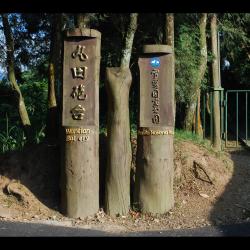
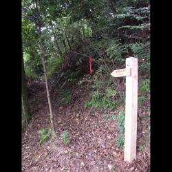
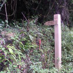
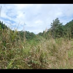
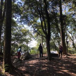
The Beikeng Creek Historic Trail, which runs through Wufeng Township in Hsinchu County and Tai'an Township in Miaoli County, was built in 1923. It starts from Tiancuntai in the north and reaches Erbensong in the south. It is about 74 km in length and is one of the six indigenous historic trails that run from north to south.

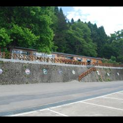
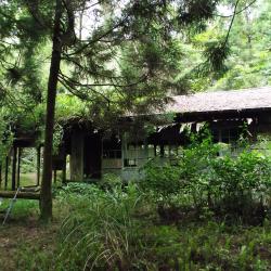
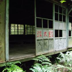
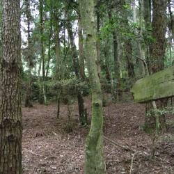
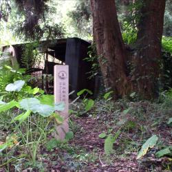
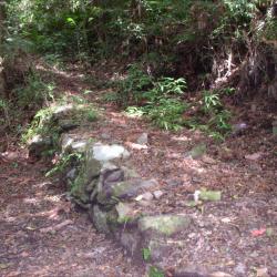
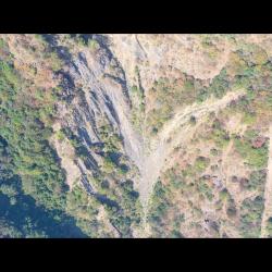
One section of this trail connects to the southern section of the Syakaro Historic Trail, forming a network of passages for monitoring  indigenous peoples. To this day, most sections of the Beikeng Creek Historic Trail are inside the Shei-Pa National Park. Although there are still traces of several police posts left from the Japanese occupation, some sections of the trail have been abandoned or collapsed, which is not suitable for hiking.

  • - / -
  • - - -
  • -
  • - -/-
  • -
北坑溪古道封面照
北坑溪古道封面照
北坑溪古道封面照

古道地圖

Attractions
Tiangou Hamlet
影像為俯拍天狗部落
Tiangou Hamlet資訊

The Tiangou hamlet is located in the 3rd to 6th alley of Meiyuan Village, Tai'an Township, Miaoli County, in the northeast of Da'an, and on the terrace on the right bank of the Da'an River.  The Atayal people call it Saulau (or Vai-annuh, Mai-annuh), which means soil that can be dyed, sa means to dye, and ulau means land. It’s got the name because there are earth-colored, earth-yellow and red soils in the local area and were used as a source of dyeing pigments. It is also also called Vai-annuh, which means flat in the local Atayal language.  The people originally lived in the Jinwei mountain area on the east side of the current location. During the Japanese occupation period, in the Taisho period, due to the implementation of the group relocation plan, they were moved to the current place to live. As the ridgeline looks like a crouchingdog and because of its high terrain, it was give the name, Tiangou. From the mid-1930s to 1937, some members of the Yehmagong comunity were moved to the Tiamgou settlement by the Japanese.

Guanwu Lodge
影像為伐林時代的林務局觀霧宿舍,原為日治時期モギリ(茂義利)駐在所的舊址,現為一排米黃色的建築,分別為林務局工作站、觀霧山莊,提供遊客住宿及餐飲服務。
Guanwu Lodge資訊

Maoyili (Japanese: Mogili) Police Post is located in the 8th alley of Meiyuan Village, Taian Township, Miaoli County. Mogili means a high hill in Atayal language. It was named Mogili because it is located at the junction of Miaoli and Wufeng Township, and it was a watershed with high terrain.  In the 12th year of Taisho (1923), the Maoyili Police Post was established. After the war, the Forestry Bureau was engaged in logging and afforestation. Because it is located on the ridge line of the Luchang Mountain at an altitude of 2,200 meters, when the northeast monsoon comes in winter, it often leads to thick fog. Therefore, it was called Guanwu (viewing fog). Originally a state-owned forest land, the Forestry Bureau has set up a workstation, a guest house, a material transportation management station, and later set up a Guanwu National Forest Recreation Area. Since the site is located in the Sheipa National Park, it also has a National Park Visitor Center.

Xianbi Police Post
影像前方的水泥建築物為林務局的護管所
Xianbi Police Post資訊

Located on the southern edge of Qianliang Mountain, at an altitude of about 750 meters, the platform behind the shelter is the foundation of the Xianbi Police Post from the Japanese occupation period. The police post was established in the 13th year of Taisho (1924), and until today, there are fragments of utensils, guns and ammunition depots from the Japanese occupation period on the ground.

Meiyuan Hamlet
梅園部落
Meiyuan Hamlet資訊

The Meiyuan hamlet is located in Meiyuan Village, on the right bank of Da’an River, at the southwest foothills of Jinwei Mountain, on a platform about 500 meters above sea level. The name of the tribe is Maylubung, which was named after the pool that draws drinking water for the tribe. Therefore, there is a pond on the land. The place is small and the terrain is low. After the war, due to the local planting of a large number of plum trees, the National Government named it Meiyuan (plum garden), which is the current name. In August 1963, Typhoon Geleri struck, and the flood washed away most of the tribe's farmland. Therefore, some tribes moved to settle in Heping Township of Taichung County, yet many people returned to settle here.

Da'an River Meixian Bridge
影像前方橋樑為連結梅園村及象鼻村的梅象橋
Da'an River Meixian Bridge資訊

The bridge in the image is the Meixian Bridge that connects Meiyuan Village on the left and Xianbi Village on the right. It is about 700 meters above sea level and is at the junction of Taichung City and Miaoli County. The Da’an River Basin gradually forms a canyon from the upstream of Meixian Bridge, where the Xuejian Hot Spring is located at 18.5 kilometers upstream. Xuejian Hot Spring is on an altitude of about 1,020 meters, and the one-way journey takes about 9 hours. Xuejian Hot Spring a geothermal spring. The hot water and steam are in a high pressure state, and pass through the fissures of the stratum to the surface, forming the Xuejian Hot Spring.

Da'an Hamlet
影像為空拍大安溪左岸的大安部落
Da'an Hamlet資訊

The Da'an hamlet belongs to Xiangbi Village, Tai'an Township, Miaoli County. It is located on the left bank of Da'an River, at the north foothills of Ma'an Mountain, on a platform about 500 meters above sea level. The residents of the Da'an hamlet are composed of residents from the Beishi Group and the Jialapai Group of the Atayal tribe. Residents from the Beishi Group are remaining survivors from rebelling against the Japanese in 1910, who were induced by the official government to move here. The Residents from the Jialapai Group were moved across the Da'an River after the Wushe incident.

Xianbi Hamlet
影像為麻必浩部落空拍象鼻部落,右方伸入大安溪稜線為千兩山稜線,其稜線後方部落為後方部落為象鼻部落。
Xianbi Hamlet資訊

Xianbi Hamlet is located at the foot of the mountain on the right bank of Da'an River, on the platform about 500 meters above the sea. Originally named Mepuwal and belonged to the members of the community from the Beishi group of the Atayal Zeolia tribe. Their ancestors were the old Malabang community, which fought against the Japanese in Meiji 36 (1903), and retreated here from Dongxing Village, Dahu Township. The origin of the village name was named after the location, Qianliang Mountain, which looks like an elephant's trunk. In the 13th year of Taisho (1924), the Xianbi Police Post was set up at the commanding height behind the hamlet.

Bridge on the route between Quan Police Post and Zhen Police Post
泉駐在所通往榛駐在所途中溪溝木橋
Bridge on the route between Quan Police Post and Zhen Police Post資訊

The image shows the wooden bridge on the way from the Quan Police Post to the Zhen Police Post, and the creek that is located about 35 minutes way from the Quan Police Post. The Sheipa National Park built a wooden bridge here around 2003. After the wooden bridge, it takes about 30 minutes to reach the Zhen Police Post.

Overlooking Wantian Battery
從天狗部落遠眺東方稜線上的丸田砲臺
Overlooking Wantian Battery資訊

The Wantian Battery in Tai’an Township of Miaoli County is located on the river terrace south-facing from Erbensong Police Post. It is about 1,310 meters above sea level, and was set up to monitor the northern Atayal group during the Japanese occupation. The battery was erected on the ridge line or high point of the mountain overlooking tribal villages in order to frighten indigenous people.

In the early days of Japanese rule, the Governor of Taiwan, Sakuma Samata organized a large-scale crusade to manage the indigenes. In 1911, he suppressed the northern group of Atayal tribe with superior force. Police Officer Maruda Kiyoshi was killed during this fight and therefore, the battery was named after him. Today, the remains of the Wantian Battery are hidden in the forest of Cryptomeria.

Wantian Battery Entrance
丸田砲臺步道的入口處
Wantian Battery Entrance資訊

The Wantian Battery Trail entrance, in Tai’an Township of Miaoli County, is located on the 15 km point of Simaxian Forest Road and is about 1,310 meters above sea level. The trail was set up to monitor the northern Atayal group during the Japanese occupation. The battery was erected on the ridge line or high point of the mountain overlooking tribal villages in order to intimidate indigenous people.

In the early days of Japanese rule, the Governor of Taiwan, Sakuma Samata organized a large-scale crusade to manage the indigenes. In 1911, he suppressed the northern group of Atayal tribe with superior force. Police Officer, Maruda Kiyoshi, was killed during this fight and therefore, the battery was named after him. Today, the remains of the Wantian Battery are hidden in the forest of Cryptomeria.


Beikeng Police Post (Side)
北坑駐在所遺址上的木造工寮,為戰後林務局所設置的
Beikeng Police Post (Side)資訊

The Beikeng Police Post, in Tai’an Township of Miaoli County, was established in 1923. It is located on the 14.6 km point of the Beikeng Creek Historic Trail and is about 1,640 meters above sea level. The traditional Atayal name for the place is Simayen, which means floor-like lawn.

The Beikeng Police Post was originally the administrative center of the Beikeng Creek Historic Trail. There was an education center, Wude Hall, medical facility, places for trades, guns and ammunition depot and so on, of which the buildings still remain on the trail today.

To get there, enter from the Simaxian Forest Road in the Xuejian Recreation Area, climb up the Simaxian Forest Road to an altitude of about 2,000 meters, and then descend about 360 meters to arrive at the station.

Beikeng Police Post (Front)
Tayal,泰雅族,理蕃設施,駐在所
Beikeng Police Post (Front)資訊

The Beikeng Police Post, in Tai’an Township of Miaoli County, was established in 1923. It is located on the 14.6 km point of the Beikeng Creek Historic Trail and is about 1,640 meters above sea level. The traditional Atayal name for the place is Simayen, which means floor-like lawn.

The Beikeng Police Post was originally the administrative center of the Beikeng Creek Historic Trail. There was an education center, Wude Hall, medical facility, places for trades, guns and ammunition depot and so on, of which the buildings still remain on the trail today.

To get there, enter from the Simaxian Forest Road in the Xuejian Recreation Area, climb up the Simaxian Forest Road to an altitude of about 2,000 meters, and then descend about 360 meters to arrive at the station.


Beikeng Police Post
北坑駐在所遺址上的木造工寮,刻畫著到此一遊印記
Beikeng Police Post資訊

The Beikeng Police Post, in Tai’an Township of Miaoli County, was established in 1923. It is located on the 14.6 km point of the Beikeng Creek Historic Trail and is about 1,640 meters above sea level. The traditional Atayal name for the place is Simayen, which means floor-like lawn.

The Beikeng Police Post was originally the administrative center of the Beikeng Creek Historic Trail. There was an education center, Wude Hall, medical facility, places for trades, guns and ammunition depot and so on, of which the buildings still remain on the trail today.

To get theret, enter from the Simaxian Forest Road in the Xuejian Recreation Area, climb up the Simaxian Forest Road to an altitude of about 2,000 meters, and then descend about 360 meters to arrive at the station.


Sign posting for Beikeng Police Post
北坑溪古道由觀霧入山14.6公里處所設立的北坑駐在所指標
Sign posting for Beikeng Police Post資訊

The Beikeng Police Post, in Tai’an Township of Miaoli County, was established in 1923. It is located on the 14.6 km point of the Beikeng Creek Historic Trail and is about 1,640 meters above sea level. The traditional Atayal name for the place is Simayen, which means floor-like lawn.

The Beikeng Police Post was originally the administrative center of the Beikeng Creek Historic Trail. There was an education center, Wude Hall, medical facility, places for trades, guns and ammunition depot and so on, of which the buildings still remain on the trail today.

Around 2003, Xuepa National Park renovated the historic trail section from Guanwu to Erbensong, but due to natural disasters, the entire section was still difficult to pass through and was abandoned. Only a few parts of the trail remain.


Song’an Police Station
2003年松安派出所尚未拆除的水泥建築
Song’an Police Station資訊

The Song’an Police Station, in Tai’an Township of Miaoli County, was originally the Erbensong Police Post during the Japanese occupation, built in 1911. In Japanese, Erbensong refers to a place with two pine trees. The traditional Atayal name for the place is Pihun, which means door. Both have the meaning of entering Beikeng Creek.

The Erbensong Police Post was set up with the purpose of monitoring the northern group of the Atayal tribe in the Da’an River Basin during the Japanese rule. However, there have been fierce attacks by the Atayal tribe. In the post-war period, the National Government changed its names to Erbensong Police Station and Song'an Police Station.

When the Jiji earthquake occurred in 1999, police officers were moved to Meiyuan Police Station, which has now been converted into Erbensong Visitor Center.

Rixiang Police Post
2003年松安派出所尚未拆除的水泥建築
Rixiang Police Post資訊

The Rixiang Police Post, in Tai'an Township of Miaoli County, is located at the southeastern foot of Mount Jinwei, east to Xishuishan ridgeline, on the northeastern side of Erbensong, and at an altitude of about 1,410 meters. It was set up in 1923, and was named Rixiang, which means facing the sun, because where the police post stood faces the east. The traditional Atayal name for the place is Ulau-ladin, which refers to the soil being as hard as wood.

To this day, there is still an abandoned industrial building where the Rixiang Police Post used to stand. The ruins of the station can be found behind the building. The Shei-Pa National Park has set up a signpost of the Police Post.


Shu Police Post
曙駐在所下方的古道,道路地基的石砌駁坎整齊
Shu Police Post資訊

Shu Police Post, in Tai'an Township of Miaoli County, is located at the northeastern foot of Beikeng Mountain, northeast of Erbensong, and at an altitude of about 1,730 meters. It was built in 1923.

The origin of the name, Shu (meaning dawn), is unknown but may be related to the landscape and the rising sun. However, the traditional Atayal name is Mai-leliuk, which means a place where many leliuk trees grow. Leliuk is a hard woody tree of the Fagaceae family. The tree trunk can be used as a hoe handle and ship beams. The fruits are often eaten by flying squirrels, muntjacs, squirrels, and black bears. Therefore, in the past, it was common to see black bears in this area.

Zheng Police Post
通往榛駐在所的入口處指標
Zheng Police Post資訊

Zheng Police Post, in Tai'an Township of Miaoli County, is located at the 2 km point on the west side of Mount Zheng, facing Mount Zheng across the Beikeng Valley. It is about 1,930 meters above sea level, and was built in 1924.

The origin of the name, Zheng, may be related to the forest of Asian Hazle that grow in the area. The traditional Atayal name for the place is Ginapan-papak. Papak means the ear, and Ginapan-papak means the shaved ear.

During the Japanese occupation, the guards stationed at Zheng Police Post and his family members set up charcoal kilns to burn charcoal to keep warm in cold winters. The remains of the charcoal kilns are still visible today.


Quan Police Post
通往泉駐在所的入口處指標
Quan Police Post資訊

Quan Police Post, in Tai’an Township of Miaoli County, is located at the south-east foot of the Luchang Dashan, on the north-east side of Erbensong, and at an altitude of about 1,800 meters. It was built in 1923 and subsequently abolished in 1927 because of the change in the area under surveillance by the guards. The original surveillance area was changed to the responsibility of Lushan Police Post and Zheng Police Post.

Today, to get to the Quan Police Post, enter from Guanwu on the Beikeng Creek Historic Trail, and at about 4.6km point of the trail you can see the entrance to the Quan Police Post.

Overlooking the saddle, the former site of Zhongjian Police Post
從茅草叢中遙望中間駐在所的鞍部
Overlooking the saddle, the former site of Zhongjian Police Post 資訊

Zhongjian Police Post, in Tai’an Township of Miaoli County, is located at the northern foot of Mount Zheng, on the north-east side of Erbensong, and at an altitude of about 2,050 meters. It was built in 1923, between Mao’yili Police Post and Zheng Police Post. The origin of the name came from the last name of a police officer from the Hsinchu State Police Department.

During the Japanese occupation, there was afforestation of precious tree species such as cypress and formosan conifer. Today, the remains of the station are hard to find due to afforestation.

Qiugang Police Post
前方平緩的稜線即為萩岡駐在所位置
Qiugang Police Post資訊

Qiugang Police Post, in Tai'an Township of Miaoli County, is located at the south-east foot of Jinwei Mountain, east of Erbensong, and at an altitude of about 1,420 meters. It was built in 1923, about 90 meters away from Beikeng Creek Historic Trail.

The origin of the name, Qiugang, means a mountain covered with reeds. The traditional Atayal name is Lalang, which means a place where calamus grows. Because of the luxuriant Lalang grass, the Atayal people use it as herbs in traditional rituals to cure diseases.


Erbengsong Trench Ruins
二本松駐在所通往丸田砲臺的古道路段
Erbengsong Trench Ruins資訊

The Erbensong trench ruins in Tai'an Township of Miaoli County is located on the river terrace platform on the southern slope of the Erbensong Police Post, about 1,350 meters above sea level. It was designed to facilitate the Wantian Battery in combat and to prevent from indigenes attacks. There is a piled stone road built next to the Erbensong trench, which is the road that connected Wantian Battery to Erbensong Police Post during the Japanese occupation. The road was mainly used for transporting grains and firearm supplies, so that the Government-General in Taiwan could monitor the northern Atayal group through the firepower of the battery.

Today, the remains of the trench are about 550 meters long, and the Sheipa National Park has renovated it into a hiking trail, surrounded by artificial forests.


Wantian Battery Ruins
日治時期設置的丸田砲臺地基
Wantian Battery Ruins資訊

The Wantian Battery, in Tai'an Township of Miaoli County, was set up for the Government-General in Taiwan to monitor the northern Atayal group. The battery was erected on the ridge line or highest point of the mountain overlooking tribal villages in order to intimidate indigenous people.

In the early days of Japanese rule, the governor of Taiwan, Sakuma Samata organized a large-scale crusade to manage the indigenes. In 1911, he suppressed the northern group of Atayal tribe with superior force. Police Officer, Maruda Kiyoshi, was killed during this fight and therefore, the battery was named after him.

Today, the remains of the Wantian Battery are hidden in the forest of Cryptomeria. The stone road that leads to the battery from Erbensong Police Post was mainly used to transport food and firearms supplies.


Erbensong Visitor Centre
二本松解說站的丸田砲臺文史紀念館
Erbensong Visitor Centre資訊

The Erbensong Visitor Center is located in Tai'an Township, Miaoli County. The building was initially a police post, built in 1911 by the Government-General in Taiwan, to monitor the northern group of Atayal tribe in the Da’an River basin. Erbensong in Japanese refers to a place with two pine trees. The traditional Atayal name of the place is Pihun, which means gate.

During the Japanese occupation, the police post was subjected to fierce attacks by the Atayal. In the post-war period, the National Government changed the names to Erbensong Police Station and Song'an Police Station. When the Jiji earthquake occurred in 1999, police officers were relocated to Meiyuan Police Station. Hence, the building has now been converted into Erbensong Visitor Center to provide visitors with environmental education service and tourist information.

Xuejian Police Post
調查人員於雪見駐在所的臺地前方合影
Xuejian Police Post資訊

The Erbensong Visitor Center is located in Tai'an Township, Miaoli County. The building was initially a police post, built in 1911 by the Government-General in Taiwan, to monitor the northern group of Atayal tribe in the Da’an River basin. Erbensong in Japanese refers to a place with two pine trees. The traditional Atayal name of the place is Pihun, which means gate.

During the Japanese occupation, the police post was subjected to fierce attacks by the Atayal. In the post-war period, the National Government changed the names to Erbensong Police Station and Song'an Police Station. When the Jiji earthquake occurred in 1999, police officers were relocated to Meiyuan Police Station. Hence, the building has now been converted into Erbensong Visitor Center to provide visitors with environmental education service and tourist information.

Qiugang Cliff
從空中俯瞰萩岡斷崖
Qiugang Cliff資訊

The Qiugang Cliff is located between Erbensong and Qiugang on the Beikeng Creek Historic Trail. It is about 3 kilometers away from the Erbensong hiking entrance, with a total length of 300 meters of gravel road. The road is divided into two parts. First, the long-distance cliff is composed of gravel slopes, about 200 meters in length, and it can be seen that the Beikeng River and Nankeng River converge to form the Da’an River. The second part is the formation of cliffs.

Around 2003, the historic trail section of Erbensong was recovered by the Xuepa National Park. However, due to natural disasters, the entire section is still closed. The Qiugang Cliff, known as the top ten scenic spots of Beikeng Creek Historic Trail, is  also hard to get close to.

Shu’anbu
曙鞍部即為北坑山和鹿場大山稜線的最低鞍
Shu’anbu資訊

Shu’anbu is located at the lowest saddle on the ridge line of Mount Beikeng and Luchang Dashan, about 2,000 meters above sea level. It is a small flat land but was the transportation hub between Shangdao Hot Spring, Luchang Dashan, Luchang, Shu, Beikeng and other transportation hubs during the Japanese occupation. In the past, there used to be huts for people to rest.

Today, Shu’anbu is covered in overgrown miscanthus, making it difficult to look out at the scenery. Also, no items left from the Japanese occupation period have been found. The section of the historic trail leading to Sishui Police Post has been seldom used and the road conditions are not suitable for hiking.