Batongguan Traversing Historic Trail

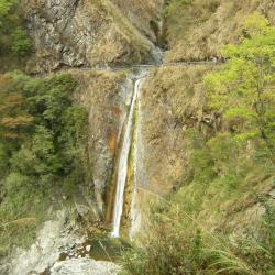
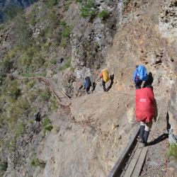
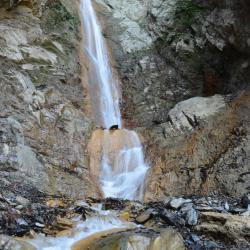
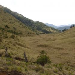
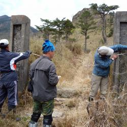
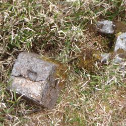
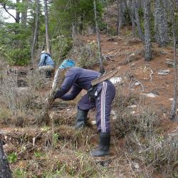
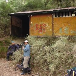
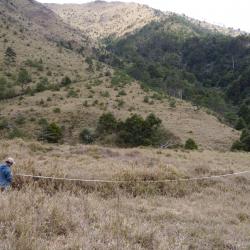
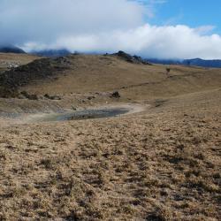
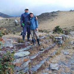
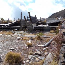
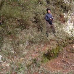
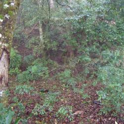
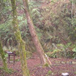
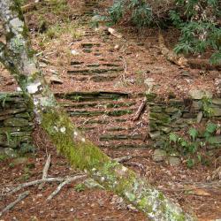
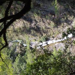
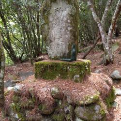
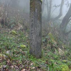
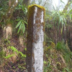
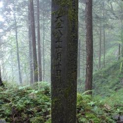
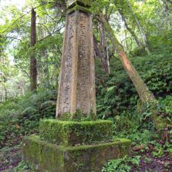
Batongguan Traversing Historic Trail, which runs diagonally through Xinyi Township in Nantou County, and Zhuoxi Township and Yuli Township in Hualien County, was first excavated in 1919 and completed the following year. It runs from Dongpu in the west and ends in Yuli in the east, with a total length of about 120 km. This trail and the Batogguan Historic Trail, which was constructed during the Qing Dynasty under the Fufan policy (Indigene Management) are two very different trails, although some sections intersect each other.  In the early days of the Japanese occupation, the Batongguan Historic Trail was repaired and made the main pathway between the east and the west until the completion of the Batongguan Traversing Historic Trail.

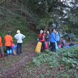
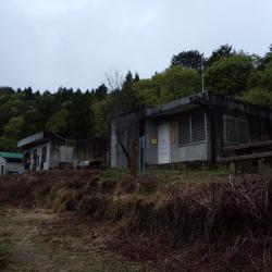
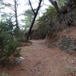
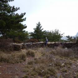
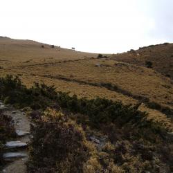
Today, the Batongguan Historic Trail is completely destroyed while the Batongguan Traversing Historic Trail has been restored. It takes about a week to hike through the trail.

  • - / -
  • - - -
  • -
  • - -/-
  • -
Batongguan Plains
Batongguan Plains
Batongguan Plains
Batongguan excavated monument
Monument of Kashibana Incident
Monument
Monument
Monument
Monument of War Land
Monument to the Land of the War
Huabanuo Police Box
Huabanuo Police Box
Huabanuo Police Box
Monument of the Martyrs
Huabanuo Police Box
Huabanuo Police Box
Huabanuo Police Box
Huabanuo Police Box
Huabanuo Police Box
Huabanuo Police Box
Huabanuo Police Box
Huabanuo Police Box
Huabanuo Police Box
Monument of the Martyrs
Dafeng Police Box
Dafeng Police Box
Dafeng Police Box
Dafeng Hut
Dafeng Hut
Dafeng Hut
Lakula Police Box
Lakula Police Box
Lakula Police Box
TugePolice Box
TugePolice Box
TugePolice Box
Lakula Police Box
Lakula Police Box
Lakula Police Box
Lakula Police Box
Lakula Police Box
Lakula Police Box
Lakula Police Box
Lakula Police Box
Lakula Police Box
TugePolice Box
TugePolice Box
TugePolice Box
TugePolice Box
TugePolice Box
TugePolice Box
Tadafen Police Box
Tadafen Police Box
Tadafen Police Box
Tadafen Police Box
Tadafen Police Box
Tadafen Police Box
Research team measuring the site of KoudaiBatongguan Camp
The foundation of Batongguan Police Box used to sit on the Batongguan plains.
Batongguan Plains
Batongguan Plains
Batongguan Plains
Stone walls, timber and iron pipes left over from Dashuiku Police Box and Dashuiku huts.
Dashuiku Pond
Dashuiku Pond
Dashuiku Pond
The path behind Dashuiku pond on the hill is the Batongguan Traversing Historic Trail
Researchers taking a picture on the steps of County Boundary Site
Stone walls and timber left over from Dashuiku Police Box and Dashuiku huts
Monument of the Death of Police Officers
Researcher standing on the Batongguan Traversing Historic Trail that leads to Miyasan Police Box
Foundation of where Miyasan Police Box used to be.
Stone wall ruins from Dashuiku Police Box
Monument of the Death of Police Officers
Monument of Officer
Monument of Officer
Monument of Officer
Monument of the Death of Police Officers
Tadafen Police Box
Tadafen Police Box
Tadafen Police Box

古道地圖

Attractions
Yunlong Falls
影像為遠望雲龍瀑布及穿越其上的八通關古道。
Yunlong Falls資訊

The Yunlong Falls is located in Xingyi Township, Nantou County, and is a tributary of Chengyoulan River and the upper stream of Lakulaku River. At an altitude of about 1,640 meters, it belongs to the Zhuoshui River Basin. The waterfall hangs on the rock wall next to the Batongguan historic trail, making it the most spectacular waterfall on the trail.

Coming from Dongpu you will pass the Fu-tzu cliff or the cliff of "Father Does Not Know Son". Due to the dangerous terrain and falling rocks, even when the father travels with the son together, they will not be able to take care of each other, hence the name.

Lele Mountain Hut (Lakulaku Police Post)
影像為今日的樂樂山屋。
Lele Mountain Hut (Lakulaku Police Post)資訊

The Lele Mountain Hut is located at an altitude of about 1,696 meters, and is around 5.8 kilometers away from Dongpu and around 12.1 kilometers eastward from Batongguan. The hut was built on the foundation where the Lakulaku police post used to be during the Japanese occupation period. The Bunun called the area Oritu, meaning "mountain loquat" in the Bunun language, referring to the place with growing mountain loquats. There were no indigenous settlements near the police post, and since the Japanese planted cherry blossoms there, each year in April a cherry blossom festival is held there. A trail leading to Lele Hot Spring at the bottom of the Chenyoulan River is opened.RakuRaku in Bunun means hot spring. Today, fragments of wine bottles and dishes from the Japanese era can be found on site.

Passage between Yinu Falls and Lele Mountain Hut
乙女瀑布至樂樂山屋途中
Passage between Yinu Falls and Lele Mountain Hut資訊

The image shows a section of the Batongguan historic trail  that is about 10 minutes away from the Yinu Falls that leads to the Lele Mountain Hut. Although the Yinu Falls is only 500 meters away from the Lele Mountain Hut (former Lakulaku Police Post), the road condition is dangerous. The path is around one meter wide, and while there are iron chains and ropes on the mountain wall to assist tourists in hiking, Taiwan’s frequent earthquakes often loosen the rocks, causing landslides during heavy rain, which damages the plank roads.  Due to the difficult maintenance of roads in the mountains, the Yushan National Park Management Office has established a safe detour route at the rear ridgeline of Lele Mountain Hut so that hikers can avoid crossing this dangerous area.

Yinu Falls
今日玉山國家公園管理處於溪谷上架設一座造型單純、線條簡潔的鋼橋,可在橋上欣賞乙女瀑布的風貌。影像為對關駐在所往樂樂山屋的方向,鋼橋橫越乙女瀑布溪谷。
Yinu Falls資訊

The Yinu Falls is located in Xinyi Township, Nantou County, with an altitude of about 1,750 meters. It is about 6.3 kilometers from the Dongpu Mountain entrance to the falls. The roads are often collapsed, so you can choose to go the detour route behind Lele Mountain Hut. The Yinu Falls is about 4 kilometers away from Duiguan police post.
The formation of Yinu Falls is due to the different degrees of resistance to weathering of each geological and lithological property, resulting in differential erosions. Similar to Yunlong Falls that hangs off the cliff wall, the Yinu falls is divided into several sections and winds down into Chenyoulan River. Yinu, or Otome in Japanese means girl in Japanese. It was given this name because the water falls gently and gracefully like a girl.

Duiguan Police Post
對關駐在所
Duiguan Police Post資訊

Duiguan police post is about 10.3 kilometers from the Dongpu Mountain Pass, at an altitude of around 2,100 meters. It is a flat ground with a wide field of vision. The Bunun people call this area Taikan, which means "the corner of the road", and the Japanese transliterated it into Chinese characters. Below the Duiguan police post is a magnificient canyon terrain of the Chenyoulan Valley.  While the upper stream valley is flat and vast, which is an important geographical demarcation point for Duiguan. The Yushan National Park Management Office has placed an explanation board here, introducing the several police posts stationed along the Batongguan Traversing Historic Trail during the Japanese occupation period, one of which is Duiguan which is used as an important resting stop for hikers.

Guangao Workstation
影像為觀高工作站,位於觀高坪下方,在巒大林管處郡大林道66公里處。
Guangao Workstation資訊

The Guangao Workstation is located below Guangaoping, some 66 kilometers away from Luanda Forest Management Office on Junda Forest Road. While it was first established for logging businesses and that trucks could travel the whole 83 kilometers long Junda Forest Road, today logging is forbidden and the passable passage is only 32 kilometers long as subsequent sections have not been repaired. 

The Guangao Workstation, which originally belonged to the forestry system, has become the Guangao Conservation Research Station of the Yushan National Park Management Office.
The ridgeline behind the Guangao Conservation Research Station is Guangaoping, which is called Hahaguo by the Bunun people, which means "low concave land", because it is a flat and broad saddle between Mount Batongguan and Mount Guangao. 

In August 2009, Typhoon Morakot caused a serious collapse in the western section of the Batongguan Traversing Historic Trail. There were 4 collapsed spots on the road between Guangao and Batongguan. The Guangao workstation sank due to the collapse, and the building structure has been tilted and cracked. Hence, it is no longer suitable for mountaineers to stay over. On September 15, 2010, Yushan National Park Management Office announced that it is prohibited to use.

Guangao Police Post
影像為觀高駐在所下方的平臺,地表可發現日治時期酒瓶與茶壺等生活遺留。
Guangao Police Post資訊

The Bunun people call Guangao Hahaguo, which means "low concave land" because it is a flat and broad saddle between Mount Batongguan and Mount Guangao. Guangao is connected to Dongpu in the north, the tribes along Daxi County in the northeast, and Batongguan in the south. During the Japanese occupation period, the two routes of "Central Line Road" and "Batongguan Traversing Historic Trail" intersect at Guangao, making it an important geographic location for military and for transportation purposes.

According to the data of Showa 11 (1936), there was 13 staff in the Guangao police post, and there were well-equipped houses and sentries.

Batongguan Plains
八通關草原
Batongguan Plains資訊

Batongguan plain was a place where the historic trail of Japan and of Qing Dynasty intersects. The Bunun people call this place BaBahrasno, which means "river" because on the south side of the Batongguan plain, there was a small tributary of the Yanong River passing through it. When the "Central Road" was built in the Qing Dynasty, Pantonukua, which is the Cou language for referring Yushan, was used to call this place, and the transliteration was Batongguan. The Japanese continue to use it to this day.

During the Japanese Occupation period, the Batongguan police post was not located on the same foundation as the Batongguan Campsite in the Qing Dynasty period, but about 120 meters north of the Qing campsite.
Due to the dangerous terrain and that Batongguan has a good outlook,  there were police officers stationed there with trenches, observation decks, and shooting ranges during the Japanese occupation period. There was a wrestling field in front of the station. Every autumn a wrestling competition is held between the police posts, and there are two rows of rammed earth walls about 1.2 meters high.

Gate posts of Batongguan Police Post
影像為調查人員測量八通關駐在所正門的門柱。
Gate posts of Batongguan Police Post資訊

The Bunun people call this place BaBahrasno, which means "river" because on the southern side of the Batongguan plain, there was a small tributary of the Yanong River passing through it. When the "Central Road" was built during the Qing Dynasty, this place was used ot be called Pantonukua, which is the Cou language for Yushan. This was later transliterated to Batongguan, and the path is being use to this day.

Due to the dangerous terrain and that Batongguan has a good outlook,  there were police officers stationed there with trenches, observation decks, and shooting ranges during the Japanese occupation period. There was a wrestling field in front of the station. Every autumn a wrestling competition is held between the police posts, and there are two rows of rammed earth walls about 1.2 meters high. Batongguan plain was a place where the historic trail of Japan and of Qing Dynasty intersects.

Pillar holes at the entrance of Batongguan Police Post
影像為八通關駐在所玄關的柱洞,及當時建築物留下的相關遺構。日治時期八通關駐在所,與淸代八通關營盤址,並非在同一個地基,而是在淸營盤北邊約120公尺處。
Pillar holes at the entrance of Batongguan Police Post資訊

The Bunun people call this place BaBahrasno, which means "river" because on the southern side of the Batongguan plain, there was a small tributary of the Yanong River passing through it. When the "Central Road" was built during the Qing Dynasty, this place was used ot be called Pantonukua, which is the Cou language for Yushan. This was later transliterated to Batongguan, and the path is being use to this day.

Due to the dangerous terrain and that Batongguan has a good outlook,  there were police officers stationed there with trenches, observation decks, and shooting ranges during the Japanese occupation period. There was a wrestling field in front of the station. Every autumn a wrestling competition is held between the police posts, and there are two rows of rammed earth walls about 1.2 meters high. Batongguan plain was a place where the historic trail of Japan and of Qing Dynasty intersects.

Historic trail stairs of the Qing period
影像為調查人員於八通關山前峰南稜所找到的石階,約有20多階2.4公尺的石階,成弧形修築,十分壯觀,階梯上鋪滿二葉松針,保存狀況良好,清八通關古道大多沿稜而行,與日治時期越嶺道沿山腰繞,有所差異,影像調查人員以山刀清除古道階梯上方的植物。
Historic trail stairs of the Qing period資訊

The Batongguan trail of the Qing period begins from the Batongguan campsite of the Qing period, crossing the upper reaches of the Laonong River, along the southern edge of the front peak of the Batongguan to the northern edge of Mount Zhizhu, where it intersected with the traversing historic trail from the Japanese occupation period. Continue climbing along the edge and you will reach the Dujuan saddle.

Banaik Mountain Shelter
巴奈伊克山屋
Banaik Mountain Shelter資訊

The Banaik Refuge Mountain Shelter is located about 100 meters away from the Barnaik police post that was built during the Japanese occupation period. Due to the insignificance of its geographical location, the Banaik police post was abolished at the end of the Japanese occupation period. The origin of the location’s name is unknown.

Zhizhushan Police Post
駐在所的前門與後門,均有夯土牆,影像為躑躅山駐在所後方駁坎現況,高約1.2公尺,長約18公尺,採用人字形砌法,地表也鋪滿二葉松針。
Zhizhushan Police Post資訊

This image shows the current state of the barrier behind what used to be the Zhizhushan police post,  about 1.2 meters high and 18 meters long.
The front door and the back door of the police post have rammed earth walls with layered stones and the ground is covered with pine needles.

Dujuan Police Post
This image shows the current state of the barrier behind what used to be the Zhizhushan police post,  about 1.2 meters high and 18 meters long. The front door and the back door of the police post have rammed earth walls with layered stones and the ground is covered with pine needles. Many living utensils such as wine bottles left over at that time can be found around the area.
Dujuan Police Post資訊

The Zhizhushan Police Post (Dujuan Camp) is located between the Xiuguluan Police Post and the South Police Post, about 3,150 meters above sea level. The police post was named after the flower Rhododendron that was abundant in the area. Hence, some call the police post the Rhododendron camp (Dujuan Camp). The Batongguan Traversing Historic Trail from the Japanese occupation period was located about 30 meters below the post, and so it is not the current mountaineering road that passes the post. During the Japanese occupation period, there were iron wires between the traversing historic trail and the post, which illustrates how indigenous peoples were prevented from entering the area at that time. Today, many living utensils from the past, such as wine bottles, can be found around the station.

Dashuiku
影像為大水窟池東北方的高處俯瞰大水窟山屋與日越嶺道。
Dashuiku資訊

Dashuiku has been a traffic hub since the Qing Dynasty. The Batongguan Historic Trail from the Qing period was completed in the first year of Guangxu (1875). Since then, a camp was set up on the east side of the Dashuiku pond, and today there are remaining ceramic fragments on site that after being studied by archaeologists, they are products of Fujian Dehua kilns during the Xianfeng and Tongzhi reigns of the Qing Dynasty. The Batongguan Traversing Trail was completed in the 10th year of Taisho (1921). The Japanese set up the prefectural boundary on the roadside on the southwest side of the Dashuiku pond, at an altitude of about 3240 meters, and built a pavilion above it for travelers to rest.
In the 1970s, the Forestry Bureau built a tin and iron mountaineering hut in the south of the pond, but it was destroyed by strong winds and snow. Yushan National Park Management Office built a mountain house with solar power supply, rainwater collection tank and simple toilet on the original site, which can accommodate 24 people.

Central Gold Mine Hut
中央金礦山屋
Central Gold Mine Hut資訊

Belonging to the Yushan National Park, the Central Gold Mine Hut is located in Xinyi Township, Nantou County, at an altitude of 2823 meters and about 4 kilometers away from Xiugu plain. The hut is made of steel, two levels with 20 beds, solar panels for providing night lighting, simple toilets next to it, and is equipped with picnic tables and chairs, etc. The water source came from the clear stream next to the fork road from the hut to the Dujuan campsite. The Central Gold Mine Hut was built on the foundation of the former Xiuguluan police post from the Japanese occupation period. It got its name from Mount Xiuguluan, and was known for gold mining during the Japanese occupation.

Minami Police Post
影像為調查人員以捲尺測量南駐在所遺留的疊石圍牆長度。
Minami Police Post資訊

The Minami Police Post is located between the Zhizhushan Police Post and the prefectural boundary, with an altitude of about 3,225 meters. Unlike today, where one could pass through the police post, at that time, the traversing trail bypassed the outer wall of the post. 

This image shows the stacked stone wall and rammed earth wall left on the Minami Police Post. The scope of the police post is approximately trapezoidal, about 40 meters long and about 35 meters wide, while the beveled stone wall is about 44 meters. There are remains of porcelain fragments, wine bottles and other containers to be seen on site.

Dashuiku Surrounding
大水窟附近
Dashuiku Surrounding資訊

The far ridgeline in the picture is Dashuiku, which is located in south of Mount Dashuiku, south of Mount Jianshan, and north of Mount Jianshan and North-faced Mountain, on the main ridge of the Central Mountain Range. 

Nearby is a bamboo grassland with a good outlook and a natural pond. The Qing soldiers were once stationed here in the Qing period and named the camp Shuiku. Today, the pottery fragments left by the life of the people at that time can be found on site. Furthermore, this area was the prefectural boundary for Taichung and Hualien during the Japanese occupation period, and a checkpoint was set up. Currently, there are still traces of the stacked stone foundation. There are also semi-circular iron pipes on site, which were left from the Japanese occupation period when the water source of the Dashuiku was drawn from the pond in the north.

Dashuiku Hut
大水窟山屋
Dashuiku Hut資訊

The far ridgeline in the picture is Dashuiku, which is located in south of Mount Dashuiku, south of Mount Jianshan, and north of Mount Jianshan and North-faced Mountain, on the main ridge of the Central Mountain Range. 

Nearby is a bamboo grassland with a good outlook and a natural pond. The Qing soldiers were once stationed here in the Qing period and named the camp Shuiku. Today, the pottery fragments left by the life of the people at that time can be found on site. Furthermore, this area was the prefectural boundary for Taichung and Hualien during the Japanese occupation period, and a checkpoint was set up. Currently, there are still traces of the stacked stone foundation. There are also semi-circular iron pipes on site, which were left from the Japanese occupation period when the water source of the Dashuiku was drawn from the pond in the north.

Batongguan Police Post
坐落八通關草原上的八通關駐在所地基
Batongguan Police Post資訊

The Batongguan (Pattonkuan) Police Post is located on the vast Batongguan grassland between the Yushan Mountain Range and the Central Mountain Range. It is the junction for Batongguan Traversing Historic Trail from the Japanese era and Xingkao Mountain Trail. Due to the dangerous terrain and excellent outlook, the Governor-General in Taiwan set up a police post there, as well as facilities such as trenches, shooting ranges, and observation decks. Every autumn, a wrestling contest was also held here for every police post on the Batongguan Trail. As a result, the Batongguan Police Post became the best reception place, with spacious and comfortable premises. To this day, telephone line obstructions and life relics can still be found on the site.

Former Site of Batongguan Camp from the Qing period
調查人員測量清代八通關營盤址
Former Site of Batongguan Camp from the Qing period資訊

The Batongguan campsite built during the Qing period and the Batongguan Police Post set up during the Japanese occupation are not on the same foundation. The two are 120 meters apart, and the altitude is about 2,745 meters. The origin of the place name “Batongguan” is the transliteration of Pantonukua, which Tsou people refer Yushan (Mount Jade) to. At present, there are still two bases surrounded by rammed earthen walls at the Batongguan campsite from the Qing period.


Dashuiku Pond
大水窟池後方的山腰道路為八通關古道
Dashuiku Pond資訊

Dashuiku Pond is a high mountain pond that does not dry up all year round. It is located on the eastern section of the Batongguan Traversing Historic Trail, which was built in the Qing Dynasty period. The water source depends on rainfall and snowmelt. The Bunun people refer to the pond as Oniyap, which means pool. Since the Qing period, this area has always been a traffic hub. Dashuiku Pond was an important drinking water source on the main edge of the Central Mountain Range that provided daily water for the Dashuiku Camp. The water source, as recorded in the "Taiwan Map '' compiled at the end of the Qing Dynasty period or "Taiwan General History'', referred to Dashuiku pond.

Today, a large number of ceramic fragments from the Dehua kiln in Fujian from the Qing period can still be found behind the house in Dashuiku.


Former Site of the Prefectural Boundary
調查人員於州廳界遺址的臺階上合影
Former Site of the Prefectural Boundary 資訊

The former site of the Prefectural Boundary is located on the Batongguan Traversing Historic Trail of the Japanese Occupation period. It is mainly located on the southwestern side of the Dashuiku Pond at an altitude of about 3,240 meters.  It is a stone foundation with four 4.3 meters wide steps.  The stairs were the dividing line between Taichu State (now Taichung City) and Karenkou Prefecture (now Hualien County) during the Japanese occupation. In the past, the Governor-General in Taiwan once built a pavilion on the foundation to provide a resting place for travelers, and erected a wooden boundary marker in front of it. After the war, the Forestry Bureau built an iron hut in the 1970s that was later destroyed by strong winds and snow.

Today, the Yushan National Park Management Office rebuilt a hut with solar power and a rainwater tank on the original site.


Dashuiku Police Post
大水窟駐在所的石牆與大水窟山屋的木構建材,遺址有引水鐵管
Dashuiku Police Post資訊

The Dashuiku Police Post is located on the flat shoulder on the east side of Mount Nandashuiku, at an altitude of 3,150 meters.  It was established in 1920 and was the highest police post on the Batongguan Traversing Historic Trail during the Japanese occupation. November to April is the period when the mountains are covered with snow. Therefore, life at the Dashuiku Police Post faced various difficulties, such as the sudden temperature drop that caused the drinking water to freeze and daily water needed to be collected from Maiasang Police Post, which is several kilometers away. There were even times when all staff needed to be evacuated to Maiasang Police Post due to freezing weather. In the 1980s, the Yushan National Park Management Office built the Dashuiku mountain hut next to the former site of Dashuiku Police Post, but it was destroyed by a typhoon in 1999.


Maiasang Police Post
調查人員在八通關越嶺古道通往米亞桑駐在所的階道上
Maiasang Police Post資訊

Maiasang Police Post is located in the valley beside Batongguan Traversing Historic Trail on the north branch of the southeastern ridge of Mount Nandashuiku, about  2,650 meters above sea level. It was built in 1920 and the name Maiasang means ancestral home in the Bunun language. Maiasan Police Post situated in an alpine climate, mostly shrouded in white fog. The snowfall period is between November and February. At times when there was heavy snowfall, the guards at Daishuiku Police Post, which is stationed several kilometers away, will retreat to Maiasang Police Post, where there is a ravine water source nearby.

Today, the foundation where Maiasang Police Post was stationed is overgrown with Taiwan red pine, and only a few building structures and relics remain.

Monument of the Death of Police Officer Sura and Asen of Karenkou Prefecture
故花蓮港廳警手スラ、アセン戰死之地紀念碑
Monument of the Death of Police Officer Sura and Asen of Karenkou Prefecture資訊

The Monument of the Death of Police Officer Sura and Ansen of Karenkou Prefecture (now Hualien County) is located beside the Batongguan Traversing Historic Trail. It is about 100 meters away from the Sasarabi Police Post, and about 1 km away from Dumas Police Post in the east.

The reinforced concrete obelisk-shaped monument was set up by the Governor-General in Taiwan to commemorate two police officers, Sura and Asen, who were killed in an attack on February 17, 1921. The two officers were ordered to patrol and transport supplies to the Dafeng Police Post, and on return to Dumas Police Post in the afternoon, they were killed while patrolling nearby.


Monument of the Death of Inspector Miyano, Oshima and Government Official Kasau of Karenkou Prefecture
故花蓮港廳巡查宮野七兵衛、大島三男、官役人夫カシアウ戰死之地紀念碑
Monument of the Death of Inspector Miyano, Oshima and Government Official Kasau of Karenkou Prefecture資訊

The Monument of the Death of Inspector Miyano, Oshima and Government Official Kasau of Karenkou Prefecture is located beside the Batongguan Traversing Historic Trail, about 1,900 meters above sea level, south of Pengke Police Post, and about 1.8 km away from Eshira Police Post. Originally, there were three wooden pillars erected to commemorate two officers and one government official who were ambushed and killed during their duty on March 16, 1921. It was later converted into one reinforced concrete obelisk-shaped monument in the mid-Japanese occupation period in the 1930s.


Monument of the Death of Sergeant Niki Sanjuro of Karenkou Prefecture
故花蓮港廳巡查部長仁木三十郎戰死之地紀念碑
Monument of the Death of Sergeant Niki Sanjuro of Karenkou Prefecture資訊

The Monument of the Death of Sergeant Niki Sanjuro of Karenkou Prefecture is located on the side of the ridge valley by the Batongguan Traversing Historic Trail, about 1,770 meters above sea level, on the south side of the first Eshira railway bridge, which is about 10 minutes away from Eshira Police Post.

Originally, there were two pillars erected, one was to commemorate the death of Sergeant Niki and the other for Police Officer Lai Minghe, who were killed by gun ambush in the dense forest on October 23, 1920. They were on duty supervising the second phase of the construction of Batongguan Traversing Historic Trail. Later, it was converted into one reinforced concrete obelisk-shaped monument in the mid-Japanese occupation in the 1930s, but the inscription only bears the name of Niki Sanjuro.


Tatahun Police Post
塔達芬駐在所平臺上散落的酒瓶
Tatahun Police Post資訊

Tatahun Police Post is located on the mountainside beside the Batongguan Traversing Historic Trail, about 1,550 meters above sea level. “Hun” means a lot of moisture in the Bunun language. Tatahun Police Post was built on a small piece of land surrounded by a 1.2-meter-high gillnet for protection. There were stone ridges in the front, east asian cherry and oliver’s maple trees planted on the foundation platform. The office building is in the center with the official residence on the left. The police post was abandoned in 1934 and today, the site is completely buried in miscanthus.


Tonkatsu (Tuge) Police Post
土葛駐在所地基平臺上設立的解說牌
Tonkatsu (Tuge) Police Post資訊

The Tonkatsu (Tuge) Police Post is located 20 minutes walk from the collapsed cliff of Tuge on Batongguan Traversing Historic Trail. The collapse was caused by the erosion from the confluence of Rakuraku and Tatahun Rivers. Therefore, Tonkatsu (Tuge) Police Post is surrounded by cliffs. The police post was built in 1922 and has a 90 cm thick stone-stacked fence on the south-western side. It was abolished in 1944 and to this day, the stone slabs that were used for the flower garden remain there.


Rakura Police Post
通往拉古拉駐在所的階梯
Rakura Police Post資訊

The Rakura Police Post is located near the Rakura Bridge on the Batongguan Traversing Historic Trail, at an altitude of about 1,355 meters. It was established in 1920 and abolished in 1944. To get there, walk past the collapsed cliff of Tuge and Rakura Bridge, continue for about 15 minutes, and you will enter a forest of Taiwan red pines. From there, you will see the signpost for the Rakura Police Post stationed by the Yushan National Park Management Office on the side of the road. The police post was once described as a forest resort with a laid-back atmosphere in the "Eastern Taiwan Outlook", which was published during the Japanese occupation. 


Dafeng Police Post
自大分山屋後方俯視大分駐在所的平臺
Dafeng Police Post資訊

The Dafeng Police Post is located near the Monument of Dafeng Incident. It was established in 1911 and was one of the earliest police posts established during the Japanese occupation. However, the building was burned down during the Dafeng Incident in 1915. In 1920,  the Governor-General in Taiwan rebuilt the police post in a new location by the mountainside with a Wude Hall, armory room, official dormitories, offices, and an exchange place. In the post-war period, the police post was once used by the Forestry Bureau, and some Bunun people who originally lived in Dafeng also returned to settle down.

Today, the Yushan National Park Management Office built a steel-framed iron-clad Dafen mountain hut on the former site of the police post in order to provide accommodation for researchers and hikers.

Monument of the Martyrs
殉職者之碑的正面,刻著殉職者之碑字樣
Monument of the Martyrs資訊

The Monument of the Martyrs is located about 1,250 meters above sea level at the Dafeng entrance, where the police officers held welcome and farewell ceremonies. To get here, walk past the Dafeng Railway Bridge and walk up a sloping path on the Batongguan Traversing Historic Trail. Entering from this point is the Dafeng district. The Monument of the Martyrs is made of natural stone with a pebble base. According to the shape, materials and inscriptions of the stele, it is speculated that this stele mainly commemorates the victims of the Dafeng incident, although the inscription behind it is not very clear.

Huabanuo Police Post
調查人員於ワバノ駐在所(華巴諾駐在所)正門合影
Huabanuo Police Post資訊

Huabanuo Police Post is located on the ridge line south-west of the Dafeng Police Post, about 1,930 meters above sea level. It was built in 1920, and was the final stop on the Huabanuo branch of the Batongguan Traversing Historic Trail. The outlook from there is excellent and the terrain is dangerous, making the location a strategic point. Therefore, the Governor-General in Taiwan set up three different types of cannons there. The firing range of these cannons covered almost all of the neighboring Bunun tribes. In addition, the building of the police post was designed and constructed according to the Japanese-style modular square method, using standardized building materials. Since it was built on the ridge line, there was no water available. Water must be drawn from an outside water source through water pipes of a thousand meters long.


Monument of the Death of Police Officer Rinowusan of Karenkou Prefecture
故花蓮港廳警手リノウサン戰死之地紀念碑
Monument of the Death of Police Officer Rinowusan of Karenkou Prefecture資訊

The Monument of the Death of Police Officer Rinowusan of Karenkou Prefecture is located beside the Batongguan Traversing Historic Trail, about 50 meters north of the Shisanli Police Post, about 1,730 meters above sea level. It was originally a wooden obelisk, and later converted into a reinforced concrete obelisk-shaped monument. It is to remember Rinowusan, a policeman from the Xinkang Police Post, who was killed and beheaded on October 31, 1920. However, due to his lower rank, there were no relevant records of his life and events. His death on his duties was also not recorded in the "Taiwan Police Remains Records" that was compiled during the Japanese occupation.


Monument of the Death of Inspector Koyama and Goto, Police Officer Baratsu of Karenkou Prefecture
故花蓮港廳巡査小山惟精、後藤又五郎、警手バラッ戰死之地紀念碑
Monument of the Death of Inspector Koyama and Goto, Police Officer Baratsu of Karenkou Prefecture資訊

The Monument of the Death of Inspector Koyama and Goto, and Police Officer Baratsu of Karenkou Prefecture is located on the mountainside by the Batongguan Traversing Historic Trail, about 50 meters north from Ying Bridge (No. 7 Bridge). There were originally two wooden pillars commemorating the two inspectors who were killed in an ambush on April 11, 1922. The indigenous police officer who died in the same incident was not listed. Therefore, when the pillars were replaced with a reinforced concrete obelisk in the 1930s,  the names of the three victims were placed side by side.


Monument of the Death of Inspector Nojiri and Boundary Guards of Karenkou Prefecture
故花蓮港廳巡查野尻光一、隘勇ルスカウ、ババイ、潘阿生、潘阿武、潘納仔戰死之地紀念碑
Monument of the Death of Inspector Nojiri and Boundary Guards of Karenkou Prefecture資訊

The The Monument of the Death of Inspector Nojiri and Boundary Guards Ruskau, Babai, Pan A-shen, Pan A-wu, and Pan Na-zi of Karenkou Prefecture is located on the mountainside of Batongguan Traversing Historic Trail, on an altitude of 1,315 meters, 15 minutes away from Midori Police Post. This monument is an obelisk built of reinforced concrete. It mainly commemorates Inspector Nojiri and five Boundary Guards who were killed in an ambush on October 10, 1919 during the excavation and construction of the Batongguan Trail.


Monument of Kashibana Incident
カシバナ事件(喀西帕南事件)殉職者紀念碑
Monument of Kashibana Incident資訊

The Monument of the Kashibana Incident is located on the mountainside of the Batongguan Traversing Historic Trail, about 15 minutes south of the Huangma Police Post. This reinforced concrete obelisk shaped monument was built in 1931 to mainly remember the 10 patrols and police officers from the Kashibana Police Post, who lost their lives during the Kashibana incident on May 12, 1915.

Batongguan Excavation Monument
八通關開鑿紀念碑
Batongguan Excavation Monument資訊

The Batongguan Excavation Monument at the Nan'an Visitor Center of the Yushan National Park was originally set up in front of the Yuli Shrine when the completion ceremony of the eastern section of the Batongguan Traversing Historic Trail was held on January 22, 1921. However, in the post-war period, the monument was moved and left at the Zhengoushi Bridge due to the widening of the road. Finally it was found by Yang Nanjun, an expert on Taiwan ancient roads, in 1988 and was sent to the Nan'an Police Squad for safekeeping.

Today, the Batongguan Excavation Monument still contains specific details of the excavation project, such as date, mileage, funding, team members, employees, deaths and injuries.