Antong Traversing Historic Trail

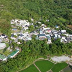
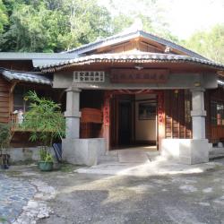
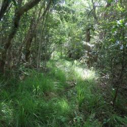
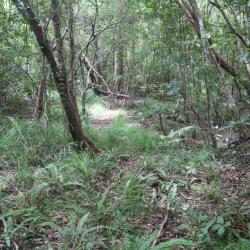
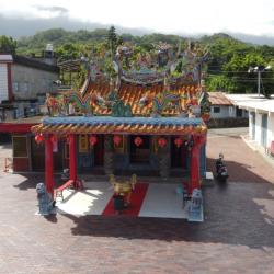
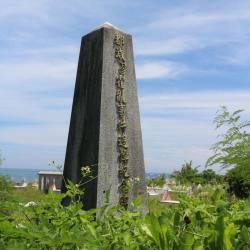
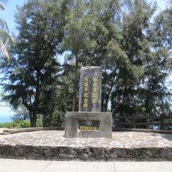
The Antong Traversing Historic Trail was built in 1875.  This trail spans from Yuli Township, Hualien County in the west to Changbin Township, Taitung County in the east. It is about 14 km long and is an important tunnel crossing that crosses the coastal mountains to arrive at Nanzhuhu village.  During the Qing period, the commander-in-chief of the Qing court, Wu Guangliang, opened up this trail and began to garrison at the junction of mountains and seas. Goods were transported from the sea to the mountains and then down to Yuli. According to reports, there were thousands of Qing troops stationed here.  Although the journey on Antong Traversing Historic Trail is not long, and there are no buildings such as police posts on the way, there are still historical traces of the Pingpu and Amis groups to be seen.

  • - / -
  • - - -
  • -
  • - -/-
  • -
cover photo
cover photo
cover photo
View from above of Yuli town center and Yuli Bridge in the east.
View from above: the entrance of Yu-Chang Highway from Antong into the Coastal Mountains
Antong Hot Spring Hotel was originally a public bath during the Japanese Occupation period.
The inside of the hotel still retains the wooden structure from the Japanese Occupation period.
Overlooking the mountain ridge between Antongyueh Shan and Wumaozi Shan from Yuchang Highway.
The east section of Antong Traversing Historic Trail on the ridgeline of 380m above sea level.
Stone steps in the east section of Antong Traversing Historic Trail.
Stone steps on the slope in east section of Antong Traversing Historic Trail.
The sugar refinery that was located in the east section of the Antong Traversing Historic Trail is now left without any traces.
從空中俯瞰南竹湖部落
從空中俯瞰南竹湖部落
從空中俯瞰南竹湖部落
Ningcheng Temple
Ningcheng Temple
Ningcheng Temple
The inscription on the outer wall of Ningcheng Temple describes the development and evolution.
Birds’ eye view of Pasongan Hamlet
Birds’ eye view of Ningpu Village
Pavilion of Cholera Incident Memorial Monument
Inscription on Cholera Incident Memorial Monument
The names of the victims from cholera incident are recorded on the memorial monument
Cholera Incident Memorial Monument
Entrance to Cholera Incident Memorial Monument that is locatec inside the Chongan public cemetery
Monument to the Centenary of Teaching in Eastern Taiwan, located in the Shiyusan (Stone Umbrella) recreation area in Chenggong Township
Monument to the Centenary of Teaching in Eastern Taiwan
Memorial Monument to the Centenary of Church Establishment in Eastern Taiwan
Chengguangao Tianhou Temple is the oldest Tianhou Temple in eastern Taiwan
The site of the Guanghengfa Company in front of the Chengguangao Cultural Landscape

古道地圖

Attractions
Antong Hamlet
從空拍機望向安通部落空拍一景
Antong Hamlet資訊

The original name of Antong hamlet was Hongyu or Wengsuo, which comes from the Amis word Ancoh, and means "the smell of urine". The name came about when the Amis people first moved here and the smell of sulphur is like a child’s urine. During the Qing Dynasty, the Han people came here to reclaim the land, and their phonetic translations were Wengsuo and Hongyu. Antong hamlet was first established in a place called Tailaan at the mouth of the Antong River. In the 6th year of Taisho (1917), the houses were demolished for the construction of the Eastern Railway. After the completion of the railway, the settlement was moved to the current location and renamed Antong. Most of the tribal residents are Ciwidian and Pacidal clans from Shuilian and Rarangus clan from Taitung. The origin of the tribe is different from that of the Harawan tribe, because although there is only a mountain between the two tribes, they have little contact with each other. Before the 1980s, there were often fights over land.

Zhuhu
空拍竹湖國小一帶,此處屬於竹湖社區的一部分
Zhuhu資訊

Zhuhu is a settlement of the Pingpu ethnic group (other Austronesians in Taiwan), distributed along the Provincial Highway 11. This place was originally the Xiaozhuhu community of the Amis people (also called Zhuhu-she while the Amis call it Taman-she, which means "darkness" and is transliterated as "Danman-she") and the former site of Sabie-she (Amis people called it Mornos-she). The original tribe lived in the "Luliaogou" area on the hillside to the west of the current site. Later, the Amis moved to Dasaobie (now Yongfu) in the north and Nanzhuhu in the south, and the local area was inhabited by the Pingpu peoples. As the bamboo forest around the original site was luxuriant and shaped like a lake, the Han people called it the "Bamboo Lake" (Zhuhu) community. At present, there are only about 20 households in Zhuhu, and the Pingpu peoples account for about half of the population. The rest are Hakkas and Hokkien who immigrated to the nearby hills and mountains during the Japanese occupation, and moved here after World War II.

Xiakan
空拍下崁社區,下崁為阿美族南竹湖部落之一部分。
Xiakan資訊

The area around ​​Luliaogou above the hillside on the west side of Zhuhu is known as Zhuhu community. The Luliaogou area was originally the site of the Zhuhu-she and the Sabie-she of the Amis people. In the late Qing Dynasty, due to a land dispute with the local Pingpu peoples that almost turned into a fight, the Pingpu peoples cursed that there were ghosts in the area and will cause disasters. The Amis people were deeply afraid of the theory that ghosts would disturb the people, so they migrated to the south and north of the area one after another. Among them, the one going south is today's Nanzhuhu, and the one moving north is the left bank of Dade River. The Ami people of Nanzhuhu called the community bakaraatsu (the name of a kind of crab) because the early Zhuhu-she was surrounded by paddy fields, and there was a small crab called bakaraatsu inhabiting the paddy fields. After the war, due to the division of the tribe, it was divided into upper and lower communities. The upper "Nanzhuhu" is adjacent to alley 17-20 of  Zhuhu hamlet 17-20, and residents are mainly Catholic and Presbyterian. The lower part, also called "Xiakan", is alley 15-16 of Zhuhu hamlet, and most of them are true Jesus believers.

North Wushibi
從空拍機望向北烏石鼻部落空拍一景
North Wushibi資訊

The Provincial Highway 11 passes through North Wushibi Settlement, an Amis tribe located between Ningpu and South Wushibi. North Wushibi is located on the south side of the Ningpu Creek mouth. It is the "Wushibi Community" of the Amis people, and is called ciradayai in Amis. Radai in Amis means orange jasmine (commonly known as Qilixiang). It was named after this tree because there were many growing nearby. In the past, Amis men, women and children used the radai for their teeth as there is a custom of burning charcoal to blacken teeth. The Han people named it "Wushibi" (black rock nose) because there is a black rock promontory protruding out of the sea in the southeast of the settlement that looks like a human nose protruding outwards. The ancestors of the Wushibi community moved from the Hualien Port Office Ganana community at the end of the Qing Dynasty. At the beginning, they lived with the people of "Danman-she" in the foothill area above the Danman Bridge on the west side of Nanwushibi community. The settlement was only moved to the current site during the Japanese occupation .

South Wushibi
南烏石鼻部落空拍一景
South Wushibi資訊

The Provincial Highway 11 passes through the settlements on the east coast. From the picture, the nearest small settlement is South Wushibi, the middle is North Wushibi, and the farthest is Ningpu, Guangrong and other places. South Wushibi is located by the submergent coastline on the north side of Wushibi, backed by mountains and faces the sea. It is symmetrical with North Wushibi and named South Wushibi, and belongs to the 14th alley of Ningpu Village. There are only about 10 households in the settlement, including familynames of Zhong and Xie from Pingtung, Huang from Changhua, and Pan from Yilan. The Kebalan people moved here after the "87 Flood" in 1959. Residents make a living by fishing with most catches being snapper and lobster, which are mainly supplied to local seafood restaurants. If they catch large fish, they will be sent to Chenggong Fishing Port for auction.

Danman
胆曼部落空拍一景
Danman資訊

Danman, an Amis tribe, is located on the south coast of Wushibi. There were sayings that its ancestors migrated southward in the 12th year of Guangxu (1886) because they could not bear the oppression of the high mountains in the north of Hualien Port Office, or because of the small cultivated land, or because they were defeated in the battle with the Qing soldiers. 

When their ancestors arrived here, it was a dark night so they named the settlement tonman, which means night in Amis language. This was translated into Danman-she in Chinese. There is another theory that there is a deep ditch at the southern end of the settlement. The bottom of the ditch is covered with thatch, and it looks dark even during the daytime. “Dark” in the Amis language is toman or ta'man, so ta'man is the name of the settlement. Around the 34th to 35th year of Meiji (1901-1900), the tribe moved south from the Dingzailuoshe (Dingziloushe, Pacidal) of the Hualien Harbor Office in search of arable land. At the beginning, they lived with the Wushibishe in present-day Nanwu. In the foothill area above the Danman Bridge on the west side of the stone nose, people moved down to live on the coast in the early days of the Japanese occupation, and moved to the current site when the coastal highway was built.

Yiwan Chapel - Taiwan Presbyterian Chapel
台灣基督教長老教會大門入口
Yiwan Chapel - Taiwan Presbyterian Chapel資訊

The Taiwan Presbyterian Church was introduced to the Yiwan hamlet in 1950. Zhu Lanmei and others were converted from other religions. At that time, preacher Chen Zhifeng and Pastor Lin Chuanming also assisted the church in evangelizing. Due to the increasing number of believers, the believers built the chapel and completed construction in June 1953. In June 1974, the original church was destroyed by a typhoon. Designed by Lai Mingde, a member of the clan, the believers worked together to build a new church. The front of the church was built in the form of a small European country chapel. The white exterior wall is the main visual base, and the roof has the style of Gothic architecture. And there are cross and angel carvings on the tip of the roof and on both sides of the gate. Its shape is like a small European church as seen on Christmas cards, so it is called a “geeting card church”. In 2003, it was designated as a "Historic Building" by the Taitung County Government.


Yushui Bridge Hamlet
玉水橋空拍一景
Yushui Bridge Hamlet資訊

This image shows the coastline around Yushui Bridge from north to south. The small settlement in the middle is Yushui Bridge hamlet, and the promontory on the upper right protruding out of the sea is Sanxiantai. The Yushui Bridg Hamlet is located about 700 meters south of Shiyusan. It belongs to Zhongxiaoli, Chenggong Town. Because it is located on the south side of Yushuiqiao, it is named Yushuiqiao. It is an Amis settlement formed after the war. The Amis call this place fadoachan or larachan, which is formed by the Amis who moved from Dulan and Jialulan in Donghe Township, Danman in Changbin Township, Guanshan Township, and Chong'an and Jiaping in Chenggong Township after the war. The fairly new settlement currently has about 36 households, all of which are Amis except for two Han households. Although this settlement has a short history and a small population, it has held harvest festivals every year in recent years.

Yuli
從空中俯瞰玉里市區,東接玉里大橋
Yuli資訊

Yuli Township is located in the south-central section of Hualien County. It became a village in 1875 and was called Pu-Shi-Ge during the Qing period. There are many saying how the name originated. First, Pusiko is how Bunun people describe dust and sand that they saw flying above Xiuguluan riverbank. Secondly, Paheko is how Amis people describe ferns because the riverbank plain was covered with ferns. Third saying was when General Wu Guangliang opened the road in 1875, he saw pure white jade all over Xiuguluan river and named the place Pu Shi Ge, namely the unpolished gem pavilion.

At the end of the Qing period, Pushige village was already a military powerhouse and a Han settlement, with an area equivalent to the current urban Yuli.

Entrance of Yu-Chang Highway
從空中俯瞰玉長公路從安通進入海岸山脈的入口
Entrance of Yu-Chang Highway資訊

The Yu-Chang Highway, which runs through Hualien County and Taitung County, was excavated in 1875. The highway stretches mainly along the Antong Valley and deep into the coastal mountains. After passing through a tunnel, it then follows the road between the Lujiao Creek and Ningpu Creek that leads to Ningpu Village in Changbin Township.

The construction of the Yu-Chang Highway was actually based on the Antong Traversing Historic Trail. At that time (Qing period), General Wu Guangliang, who was stationed in Yuli, led the soldiers to excavate Pushige Chengguang’ao passage. This became the outer port of the middle section of the Huadong Rift Valley on the other side of the Coastal Mountains. During the Japanese occupation, the Government-General in Taiwan renamed the place Hongzuo Traversing Trail. Later, when the route was changed from Antong to Zhuhu, the trail was renamed to Antong Traversing Trail.

Antong Hot Spring Hotel
安通溫泉大旅社原為日治時期的公共浴池
Antong Hot Spring Hotel資訊

Antong Hot Spring is located on the north bank of Antong River in Yuli Township, Hualien County. Natural hot spring was discovered in 1904 by a Japanese, who went up the mountain to gather camphor. In the middle of the Japanese occupation, the Government-General in Taiwan built a police hostel here and set up public baths, which gradually developed into a hot spring resort. In the post-war period, the private industry bought and operated it in 1974 and changed its name to Antong Hot Spring Hotel.

To this day, the building itself still retains part of the wooden bungalows that were built in the Japanese Occupation period. The Japanese sliding doors and tatami floors are well preserved. In 2014, the Executive Yuan Cultural and Construction Council announced it as an important historical building.


Wumaozi Mountain Ridge
從玉長公路上遠眺安通越山和烏帽子山之間的稜線
Wumaozi Mountain Ridge資訊

The Yu-Chang Highway, which runs through Hualien County and Taitung County, was excavated in 1875. The highway stretches mainly along the Antong Valley and deep into the coastal mountains. After passing through a tunnel, it then follows the road between the Lujiao Creek and Ningpu Creek that leads to Ningpu Village in Changbin Township. The construction of the Yu-Chang Highway was actually based on the Antong Traversing Historic Trail. At that time (Qing period), General Wu Guangliang, who was stationed in Yuli, led the soldiers to excavate Pushige Chengguang’ao passae. This became the outer port of the middle section of the Huadong Rift Valley on the other side of the Coastal Mountains.

During the Japanese occupation period, the Government-General in Taiwan revised the legislation and changed the route to go from Antong to Zhuhu. In the post-war period, the Nationalist Government built a road from Yuli to Changbin, and chose the same route as the Antong Traversing Historic Trail. This road was completed and opened to traffic in 2007.


Historic Trail
位於海拔380公尺稜線上的安通越嶺古道東段
Historic Trail資訊

The Yu-Chang Highway, which runs through Hualien County and Taitung County, was excavated in 1875. The highway stretches mainly along the Antong Valley and deep into the coastal mountains. After passing through a tunnel, it then follows the road between the Lujiao Creek and Ningpu Creek that leads to Ningpu Village in Changbin Township. The construction of the Yu-Chang Highway was actually based on the Antong Traversing Historic Trail. At that time (Qing period), General Wu Guangliang, who was stationed in Yuli, led the soldiers to excavate Pushige Chengguang’ao passae. This became the outer port of the middle section of the Huadong Rift Valley on the other side of the Coastal Mountains.

During the Japanese occupation period, the Government-General in Taiwan revised the legislation and changed the route to go from Antong to Zhuhu. In the post-war period, the Nationalist Government built a road from Yuli to Changbin, and chose the same route as the Antong Traversing Historic Trail. This road was completed and opened to traffic in 2007.


Sugar Refinery
安通越嶺古道東段製糖所位置,現已無任何痕跡
Sugar Refinery資訊

The Yu-Chang Highway, which runs through Hualien County and Taitung County, was excavated in 1875. The highway stretches mainly along the Antong Valley and deep into the coastal mountains. After passing through a tunnel, it then follows the road between the Lujiao Creek and Ningpu Creek that leads to Ningpu Village in Changbin Township. The construction of the Yu-Chang Highway was actually based on the Antong Traversing Historic Trail. At that time (Qing period), General Wu Guangliang, who was stationed in Yuli, led the soldiers to excavate Pushige Chengguang’ao passae. This became the outer port of the middle section of the Huadong Rift Valley on the other side of the Coastal Mountains.

During the Japanese occupation period, the Government-General in Taiwan revised the legislation and changed the route to go from Antong to Zhuhu. In the post-war period, the Nationalist Government built a road from Yuli to Changbin, and chose the same route as the Antong Traversing Historic Trail. This road was completed and opened to traffic in 2007.


Nanzuhu (Pakara’ac) Hamlet
從空中俯瞰南竹湖部落
Nanzuhu (Pakara’ac) Hamlet資訊

The Nanzhuhu Hamlet is located in Changbin Township, Taitung County. It was formerly known as Bakaraatsu, named after the white crabs that lived in nearby paddy fields. Amis people used to live in the hillside west of what is the current Zuhu village. However, at the end of the Qing period, there was a land dispute with the local Pingpu people, and they were cursed that if they lived here for a long time, there would be disasters. The Amis people of the local Zhuhu group and the Saobie group were deeply frightened of ghosts, and so they moved to the south and north. South is now the Nanzhuhu Hamlet, while north is the Yongfu hamlet that sits at the higher plateau on the left bank of Dade River. In the post-war period, the Nanzhuhu Hamlet was split into Nanzhuhu on the top and Xiakan on the bottom.

Ningcheng Temple
從空中俯瞰寧城宮
Ningcheng Temple資訊

Ningcheng Temple, whose full name is Sanshan (Three Mountain) King Dutai Kaiji Ancestral Temple, is located in Ningpu Village, Changbin Township, Taitung County. It was the earliest Sanshan King Temple to be established in the east coast area. Ningcheng Temple was built a long time ago. It is presumed that it came with the early immigrants or the garrison during the Guangxu period of the Qing Dynasty.

During the Japanese occupation, the Ningcheng Temple, which was made with coral stones, was ordered to be abandoned. Local residents then moved the god and secretly worshiped under the big tree in the mountain. In the early post-war period, local residents first built thatched temples, and then initiated a proposal to build a temple, which is now the Ningcheng Temple. Every year, a festival is held to celebrate the birthday of Sanshan King.

Pasongan Hamlet
從空中俯瞰白桑安部落
Pasongan Hamlet資訊

The Pasongan Hamlet is located between Kinaloka Creek and Pengzicun Creek in Changbin Township, Taitung County. It is rumored to have been established by the Amis tribe who emigrated from Dagangkou Hamlet in Fengbin Township, Hualien County in 1884. As the arable land was small at the time, and that the Amis people were long term oppressed by other indigenous groups from the mountainous area, they moved all the way to the south. In addition, they have been defeated by the Qing army. There is another saying that the Pasongan Hamlet was formed by Amis people of the Wushibi group that came out on its own in 1888. The original site of the hamlet is on the platform on the west side of the current site. The traditional name is Cafongai or Chiganadai, which means big stone, as it was named after two prehistoric boulders that were there. During the Japanese occupation, the hamlet was moved here for management convenience.

Ningpu Village
從空中俯瞰寧埔村
Ningpu Village資訊

Ningpu Village sits on the south bank of the Ningpu River entrance in Changbin Township, Taitung County. It was built by the Kaliwan people of Kavalan tribe who migrated to Hualien. The prehistoric boulder erected on the mountain has two protrusions, resembling a female breast, hence the name Shiru (stone breast) was given. Later it was translated as Shiningpu. Coming to the Japanese occupation period, the Government-General in Taiwan renamed it to Ningpu. In the early days of Japanese occupation, there were 7 Kaliwan households and 33 people in Ningpu Village. Later, Fulao and Hakka immigrants moved here and as bananas were planted on the hills nearby, the banana drying factory was set up at the south intersection of Ningpu Village. In the post-war period, the residents switched to planting lemongrass, which flourished for a while.

Cholera Incident Memorial Monument
位於重安公墓區內的霍亂事件追悼紀念碑入口
Cholera Incident Memorial Monument資訊

The Cholera Incident Memorial Monument is located in the cemetery area of ​​the Chong’an Hamlet in Chenggong Township, Taitung County. This cholera incident occurred in 1946, when a man from the Yiwan Hamlet fell ill after eating seaweed that he had collected. He was sent back to Chong’an Hamlet, however, the disease spread quickly. It was found after inspection that it was an infectious disease of cholera. At that time there was a shortage of medicine because the war had just ended. The patients were quarantined in the hamlet but could only receive basic treatment. The dead were sent to the beach for incineration. No tombstones were set up and no names were registered. Decades later, the families of the victims were determined to find out the truth. The town office took the initiative to assist in the investigation and finally established a memorial in 2006 to detail the incident.

Monument to the Centenary of Teaching in Eastern Taiwan
位於成功鎮石雨傘遊憩區內的東臺灣設教百週年紀念碑
Monument to the Centenary of Teaching in Eastern Taiwan資訊

The Memorial Monument to the Centenary of Church Establishment in Eastern Taiwan is located in the Shiyusan Recreation Area in Chenggong Township, Taitung County. The monument mainly tells the story of the introduction of the Presbyterian Church to eastern Taiwan. At the end of the Qing period, Zhang Yuanchun, a follower from Aligang in Pingtung County, moved to Shiyusan and used holy water to heal Shiyusan chief’s asthma. He then established the Xun-Guang-Ao Church that was later known as the Shiyusan (Stone Umbrella) Church, and opened up the missionary history in eastern Taiwan.

At the end of the Japanese occupation, the Government-General in Taiwan vigorously promoted the imperialism movement, and so church services became secret gatherings. Later, the Xingang Church was established and took on the followers of the Shiyusan Church, and a monument was established in 1997 to commemorate it.

Chengguang'ao Tianhou Temple
成廣澳天后宮是東部歷史最悠久的天后宮
Chengguang'ao Tianhou Temple資訊

Chengguang’ao Tianhou Temple is located in the Xiaogang area where the Han people first landed on the east coast in Chenggong Township, Taitung County. It was built in 1874 and is the oldest Tianhou Temple in the east. According to documentary records, Chengguang’ao Tianhou Temple was originally a hand-carved wooden structure. The Mazu statue that is enshrined in the temple was brought in from Lugang Tianhou Temple by Liu Jinlai, who was assigned to Houshan as general manager. Legend has it that the Mazu statue was once rejected by the indigenous people and the Japanese, and once lived in a stone cave by the Keelung Sea. It was only in the post-war period that it was invited back to Xiaogang for worship.


Chengguangao Cultural Landscape
成廣澳文化地景前的廣恆發商號遺址
Chengguangao Cultural Landscape資訊

Chengguang’ao Cultural Landscape Park is located in Chenggong Township, Taitung County. It was originally the site of the Guanghengfa Company. Through the existing brick arch arcade-style pavilions and columns, one could see that the gateposts, carvings and styles were rare in the eastern part of Taiwan for that time.

Guanghengfa Company was founded in around 1916. It was built from scratch by Wen Taikun, a Hakka who emigrated to Neipu, Pingtung, and was the largest grocery store in the east coast area at that time. The goods were mainly imported through the Chengguang’ao port and was said to be a large-scale business in the early period. In the mid-Japanese occupation period, Wen Taikun was already the richest man in Xingangzhuang. During World War II, it was told that the Guanghengfa Company was once regarded as a bombing target by the US military because of its prominent position.